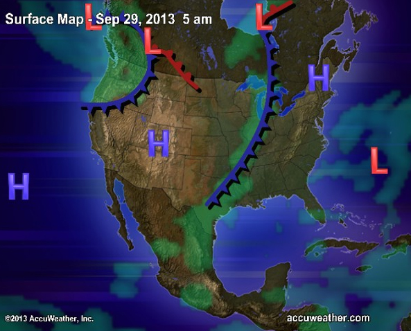
There's a cold front to our west and a large area of low pressure with instability to the southeast, both of which are moving directly towards us. So why won't we get any precip in the metro area tomorrow?
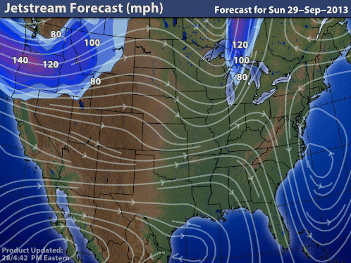
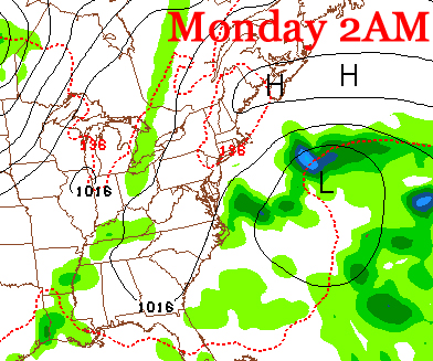
First let's look at what those systems look like at the moment, and look at the jet stream to find how how they're moving:
First let's look at what those systems look like at the moment, and look at the jet stream to find how how they're moving:
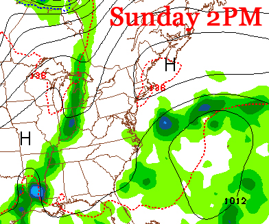
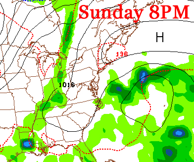
You can see in the first picture another factor in play: the area of high pressure sandwiched between the two areas of precip. This is our barrier, and because of the jet stream funneling in northeasterly winds, it won't budge.
In fact, you can see above that every 6 hours, the cold front dissipates more and more due to the large influx of higher pressure air, and the low pressure is forced to stay away from land because of the westerly winds at the southern part or the high pressure system (and jet). The models have been struggling for the past few days on where the system would be moving with a 20% chance of rain for Monday in the forecast for quite some time, but now we can say for sure that we're in the clear.
Other than our part of the country, tropical depression 11 formed in the Atlantic and will most likely become TS Lorenzo but won't affect land. A quiet hurricane season is a good one. And a quiet and sunny week is what we get to look forward to.
-Mike Merin
Other than our part of the country, tropical depression 11 formed in the Atlantic and will most likely become TS Lorenzo but won't affect land. A quiet hurricane season is a good one. And a quiet and sunny week is what we get to look forward to.
-Mike Merin

 RSS Feed
