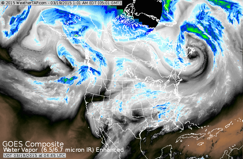
Strong jet and disturbance moving across Tennessee Valley will cause a swath of snow from Central Appalachians to So. New England Friday. It could drop 2"-4"....from Philadelphia to NYC. Less amounts to the north...and a chilly rain to the south.
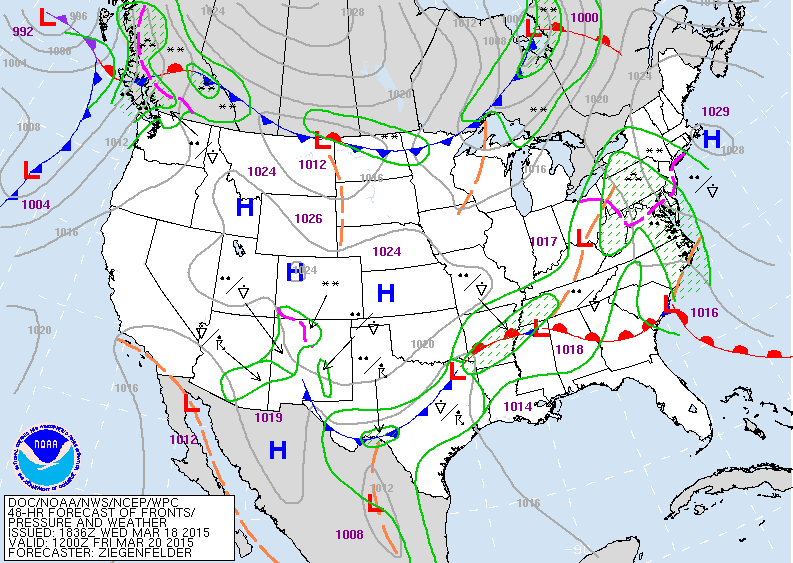
Map above is for Friday morning. Low in Ohio Valley moves east with the snow as mentioned above. The wave train in the south stays south. Cold front in the North drops south to keep the Eastern half of the Nation submerged in cold air as Spring comes in Friday evening.
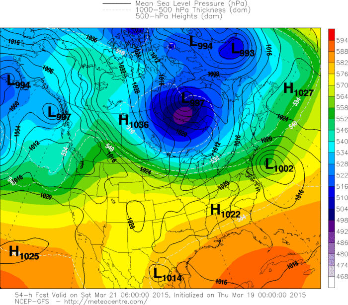
GFS Model above for Friday evening which look similar to The Euro Model. The storm is just far enough south and east to give NYC and southern most New England marginally heavy snow of 4" or even a bit more. Should a burst of heavy snow take place...would not be surprised to see some 5"- or 6" amounts. So much for Spring. All good things come to people who wait...and wait. Be safe.

 RSS Feed
