
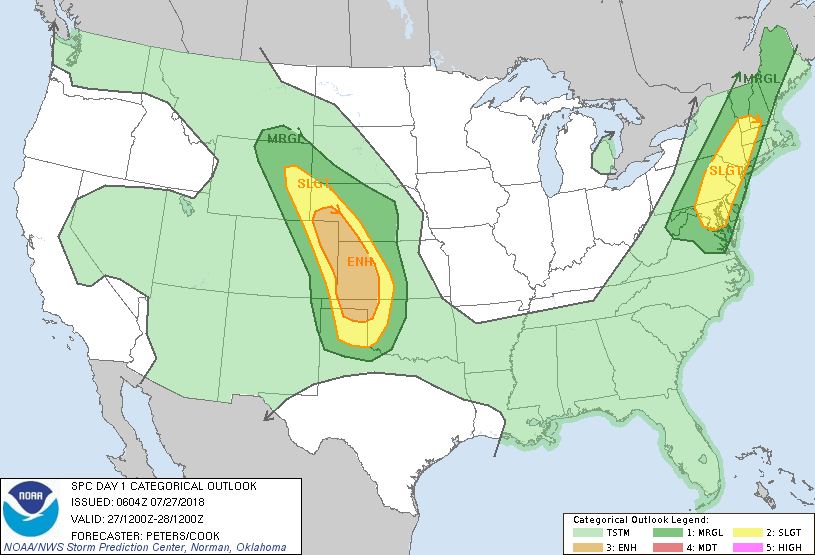
Satellite + radar shows next cold front moving into Northeast today with thunderstorms that may become severe. Looks a bit slower...so wet weather for the start of the weekend then clearing there. Elsewhere - not much change...heat West _ Sw - Storms Rockies and Plains...tropics quiet. Below - today's outlook for severe - dark green - yellow- tan.
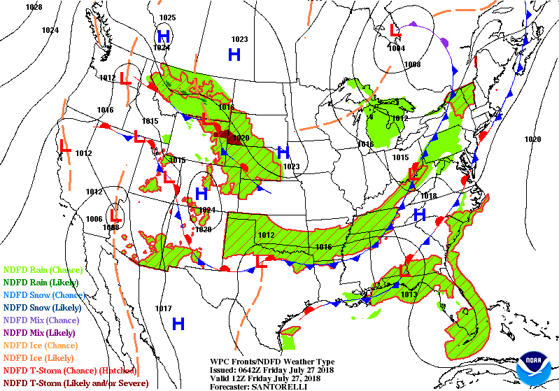
Below - animated maps for the next couple of days followed by amount of rainfall for the next 5-7 days.
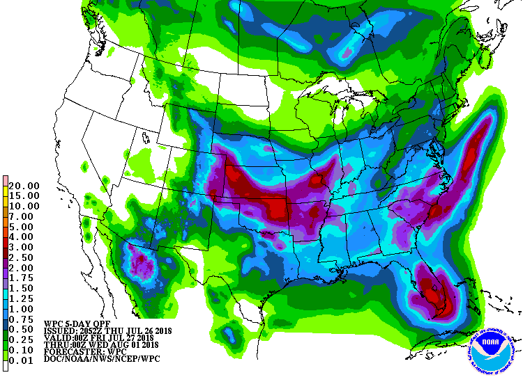
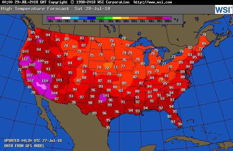
Pattern will resort to hot and humid weather next week...with frequent wetness again for East Coast. Lastly - below - high temperatures expected for Saturday. Be safe...enjoy the weekend.

 RSS Feed
