
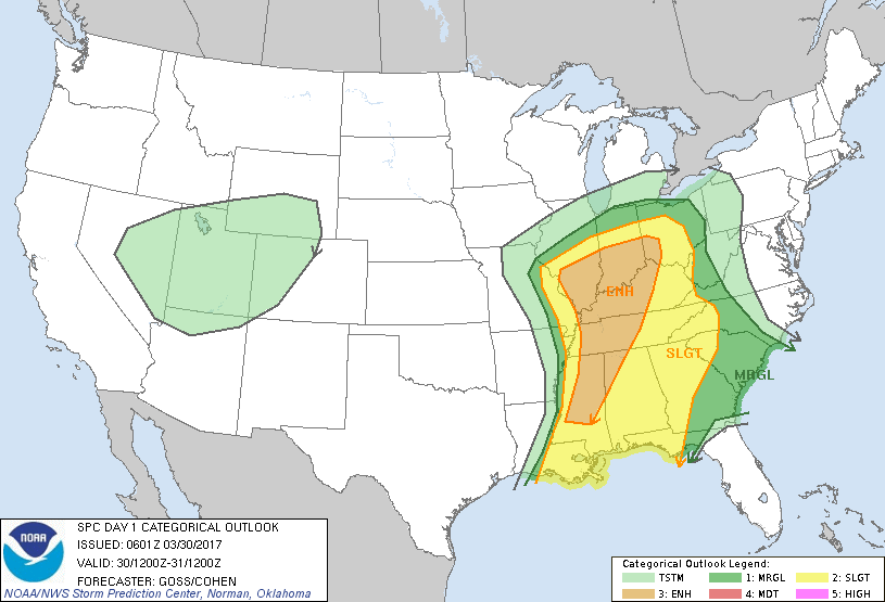
Satellite Radar - shows an intense Spring/WInter Storm in Plains moving east to the east coast Friday into Saturday. This storm will have everything but the kitchen sink. Below...the threat of severe thunderstorms and tornadoes today and tonight in highlighted areas.
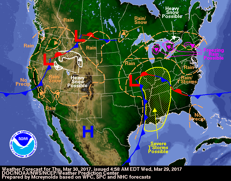
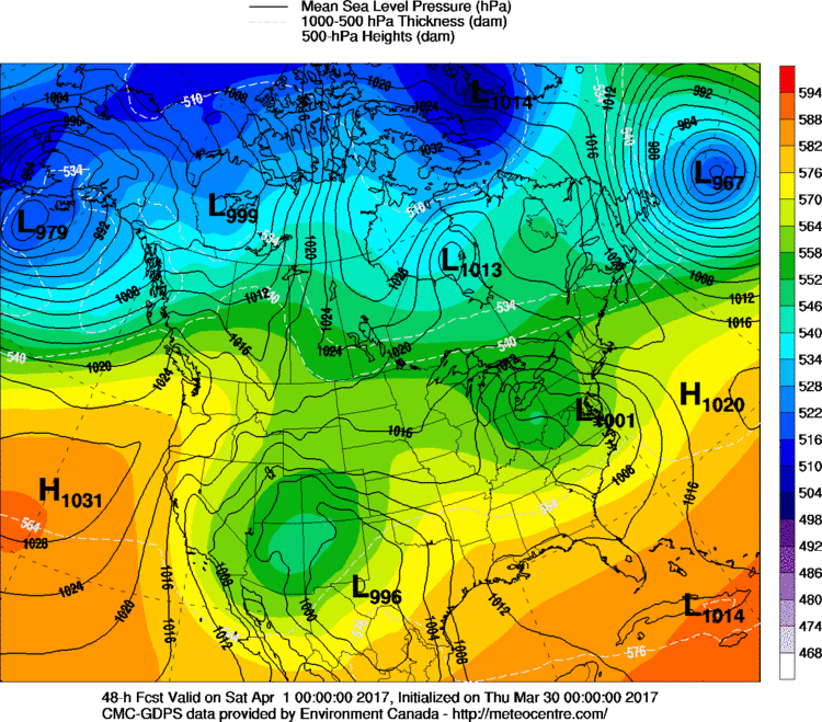
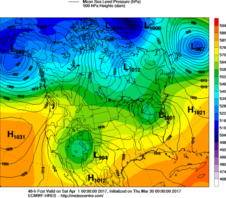
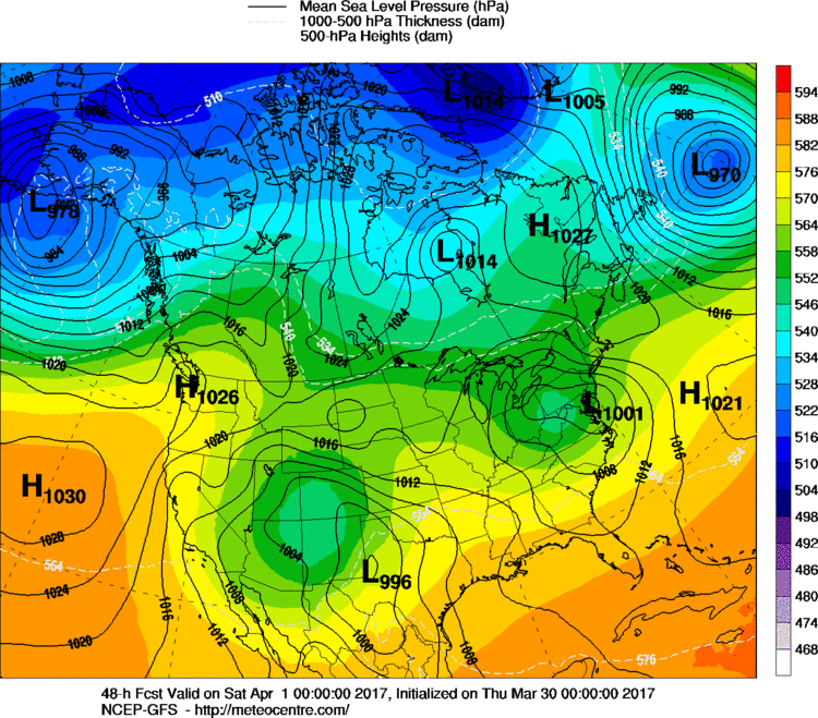
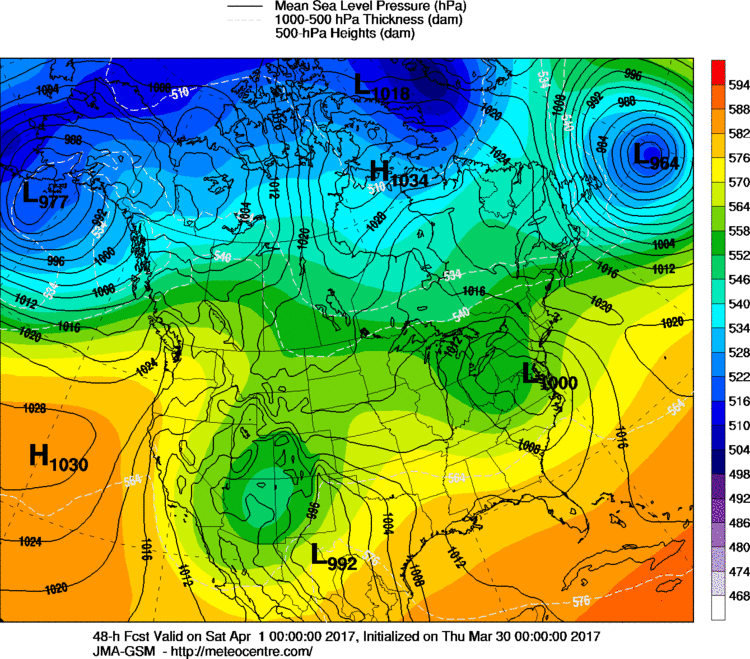
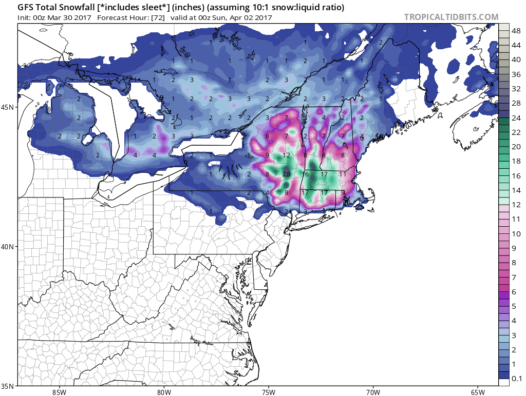
Above - today's weather map showing that March Lion over Missouri. As the storm moves off the Mid Atlantic Saturday...it will bring heavy wet snow from New York State to New England...many places getting over 1 foot of heavy wet snow....sure to cause power problems. Below - see how the models are in sync with storm for Friday.
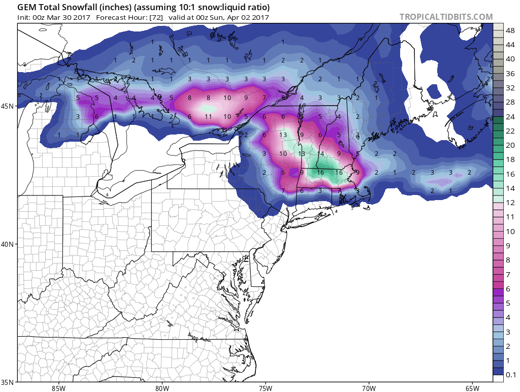
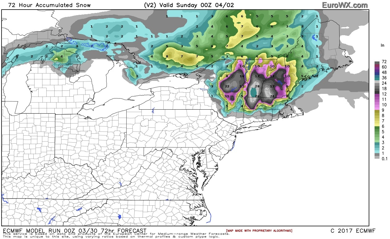
Finally....the models and their forecast for amounts of snow. If you are in any of these areas.....it's no April Fool's joke. Be safe.

 RSS Feed
