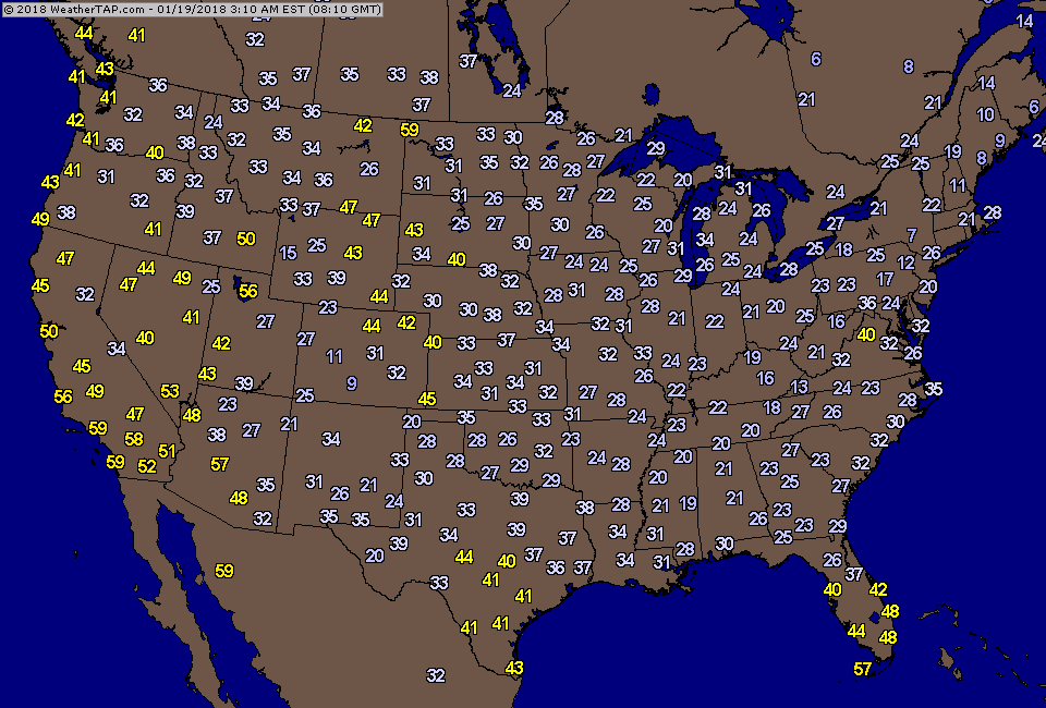
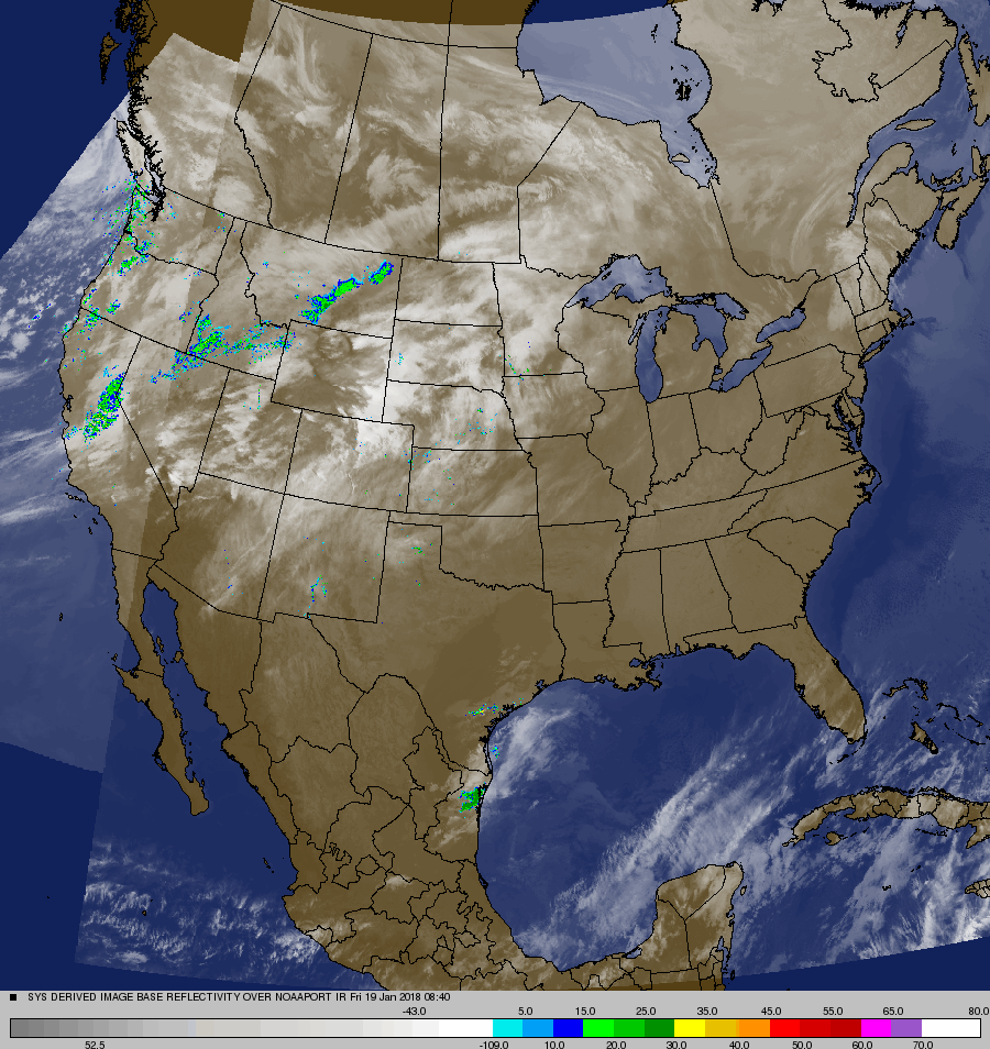
Look at this....morning temperatures...and no one is below zero....now that's a change and that's a thaw. These conditions should prevail much of next week. Below...satellite picture showing next storm in west which will be a big snow maker from Central Plains to Great Lakes - SUnday and Monday.
Below - chance of severe thunderstorms this weekend in areas of green and dark green - followed by animated maps for the weekend.
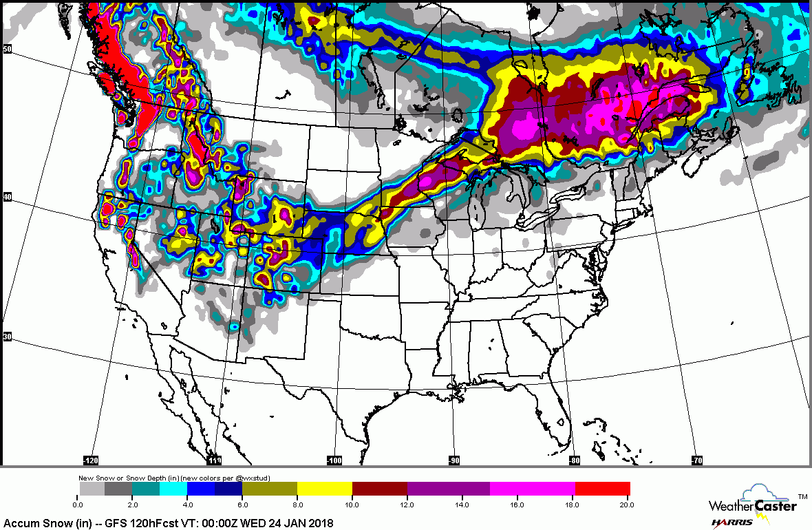
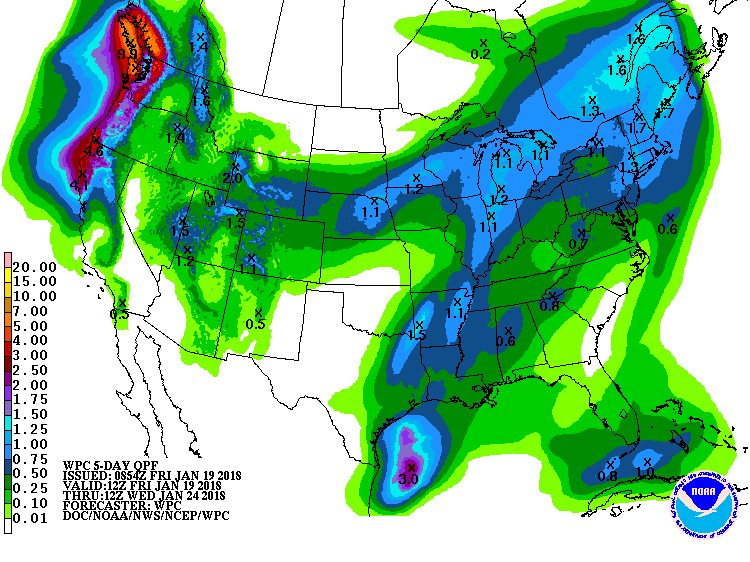
Below - expected snowfall over the next 5 days....followed by expected rainfall.
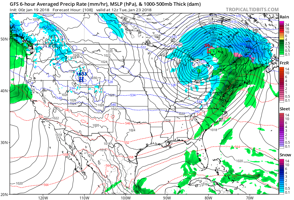
Finally...GFS Model for Tuesday....showing cold front moving into the east with rain...and some snow. In back of it...no much to worry about. Have a nice weekend.



 RSS Feed
