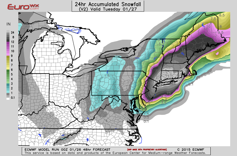
Above...Euro Model total snowfall by Tuesday. White area
in middle...indicates 2 feet or more .
in middle...indicates 2 feet or more .
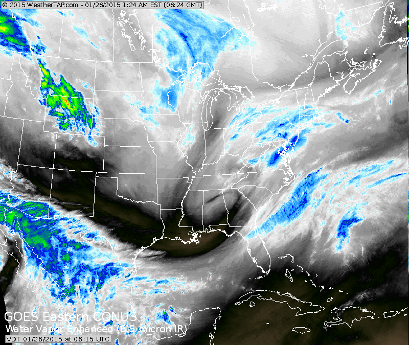
Satellite shows storm in Appalachians heading for the coast where it will become an intense storm. We told you about this possibility last week when most models including the Euro said "no". Models are to be used as guidance and not "the word"....that's why there will always be a need for meteorologists.
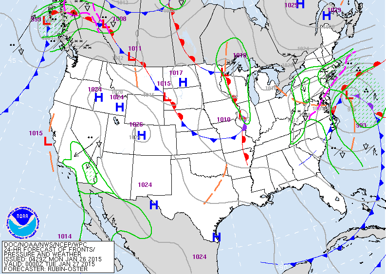
Map above is for early this evening. Storm intensifying off mid Atlantic coast. Snow will fall at rate of 2-3" per hour across Northeast tonight into Tuesday. Many places will
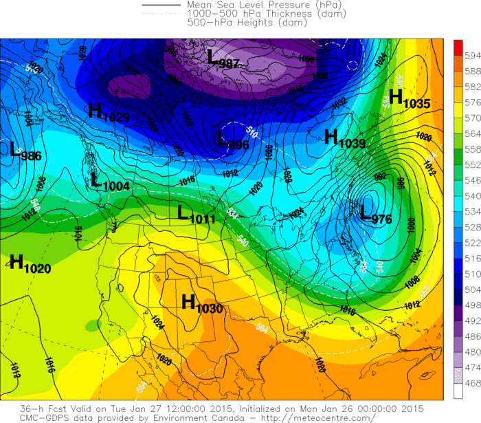
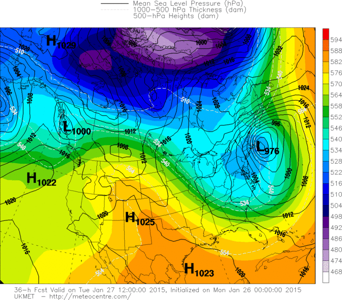
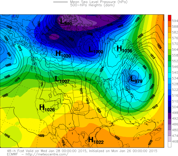
wind up with 2 ft + including NYC. NYC could break a record if they receive more that 26.9" of snow...which fell on 2-11-06.Below....you will find the 3 models projection for this storm on Tuesday. In order....Canadian....UKMET...and Euro. Travel tonight in Northeast is not recommended.
Be safe.
wind up with 2 ft + including NYC. NYC could break a record if they receive more that 26.9" of snow...which fell on 2-11-06.Below....you will find the 3 models projection for this storm on Tuesday. In order....Canadian....UKMET...and Euro. Travel tonight in Northeast is not recommended.
Be safe.

 RSS Feed
