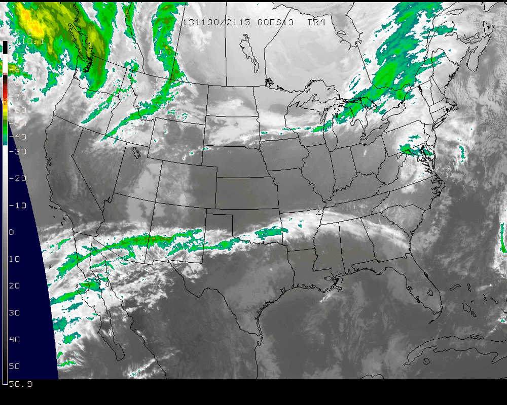
The IR image for this Saturday afternoon shows a rather tranquil weather situation for most of the United States. In the 'Four Corners' states of Colorado, Utah, Arizona, & New Mexico, widespread snow can be seen on the ground. Meanwhile, clouds are building through the northern states and are starting to cover the east coast into this evening.
Multiple shortwave troughs will shift through the Northeast tonight and into Sunday & Monday. As a result, some light rain/snow shower activity could spur up though the states more likely for this are Pennsylvania, upstate New York, and New England.
This will set up for a much deeper trough to move up the east coast on Tuesday with much much moisture associated with it. The outlook right now has greatest chances for bulk amounts of precipitation for the New England shoreline.
This will set up for a much deeper trough to move up the east coast on Tuesday with much much moisture associated with it. The outlook right now has greatest chances for bulk amounts of precipitation for the New England shoreline.
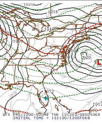
In the above image from the GFS model showing Tuesday morning before sunrise, the low is placed off the Atlantic coast and will be traveling in a general Northeast direction. The back end of this system will provide the precipitation Monday night into Tuesday. At the moment doesn't appear to be the makings of a big storm but rather just make late Monday and Tuesday a wet early December day.
Speaking of, Thanksgiving & Black Friday are now beyond us, and Chanukah will wind down in this next Thursday. There's just one month left in 2013 and only 24 shopping days left until Christmas.
- JL
Speaking of, Thanksgiving & Black Friday are now beyond us, and Chanukah will wind down in this next Thursday. There's just one month left in 2013 and only 24 shopping days left until Christmas.
- JL

 RSS Feed
