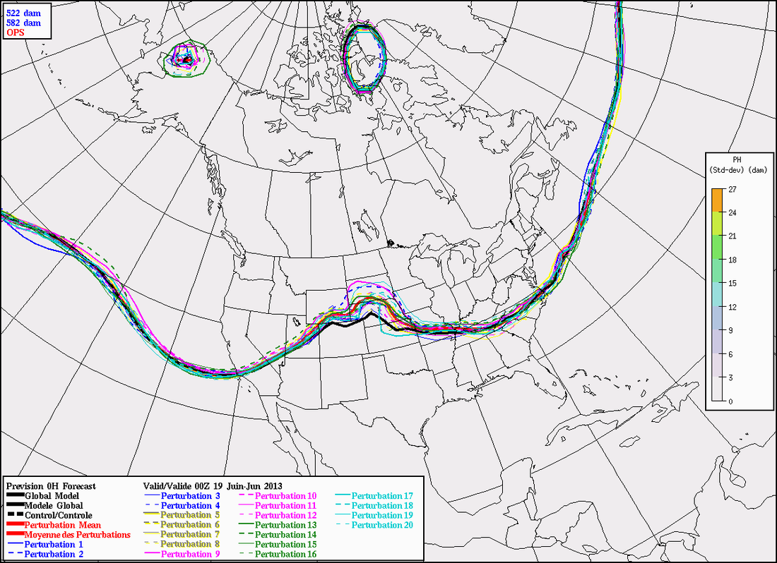
Pleasant weather for the East thru end of week. Trend is for warmer weather Nation-wide as summer arrives this weekend. The chart below is a projection of the 582 Thickness by enembles members of the Canadian model. This usually represents 90F or better.
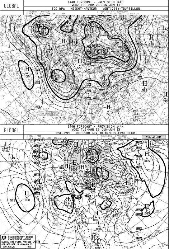
The long range Canadian ensemble 500 MB flow takes us to July 5-2013. If they are right...northeast will be cooler while much of the Nation soars into 90's...to locally 100.
The 144 Hr. Canadian model clearly shows the warm humid weather for the East....with a short wave in mid section of the Nation. That shortwave should come east to break the muggy weather in NE by next weekend.
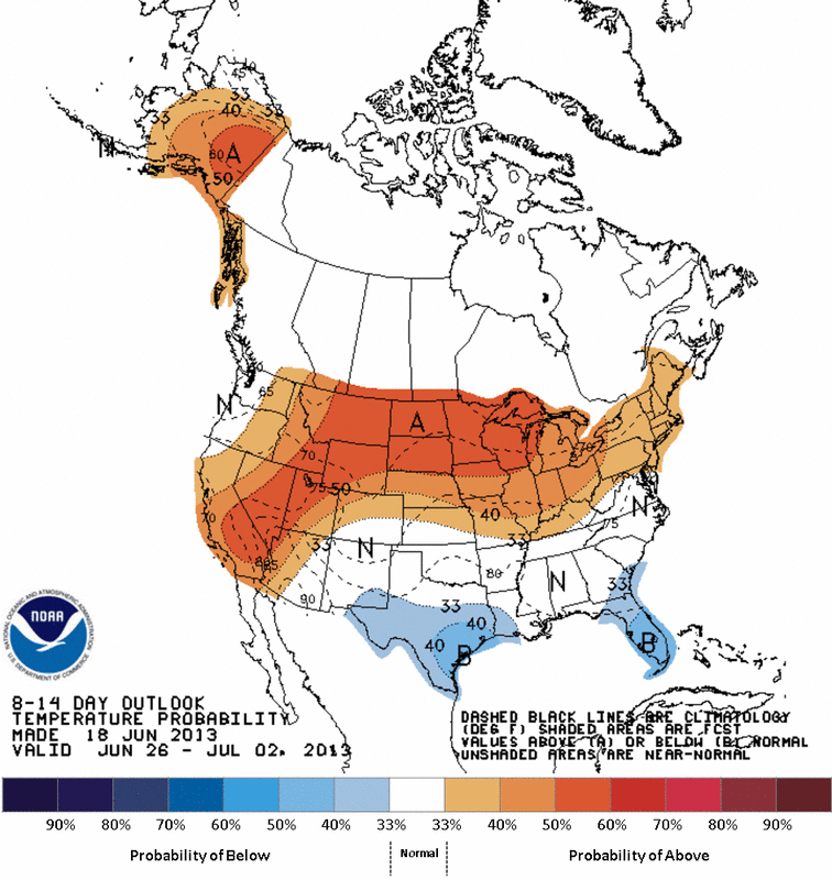
The NWS 8-14 day outlook also agrees that much of the Nation will be warmer than normal.
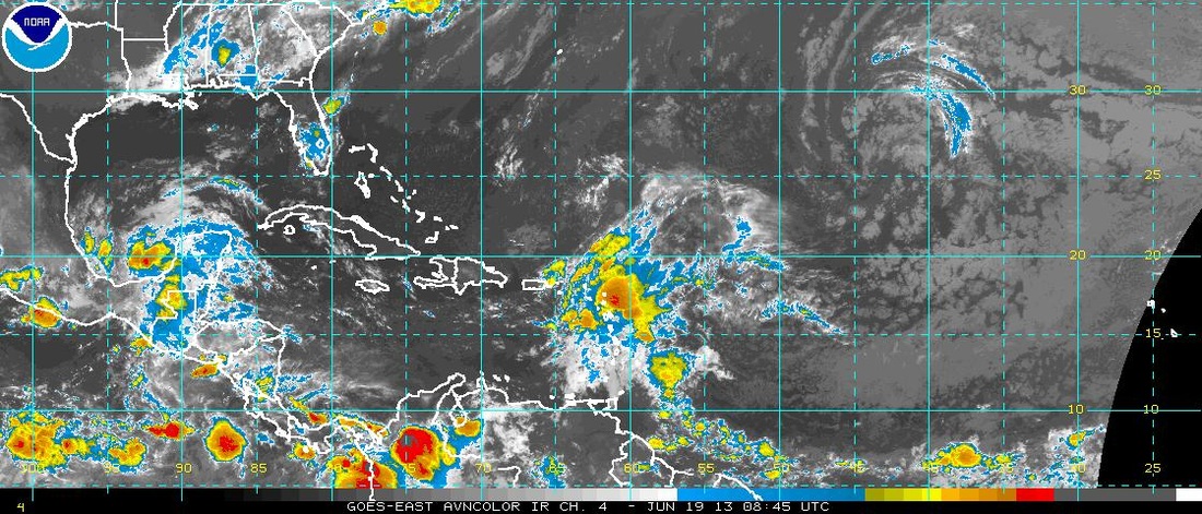
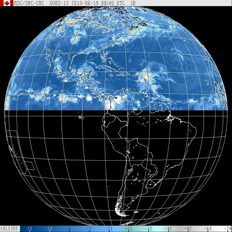
Lastly....a couple of satellite pictures showing an impressive tropical wave coming across the Central Atlantic. It shows promise and could become Barry, will keep you posted. Later.

 RSS Feed
