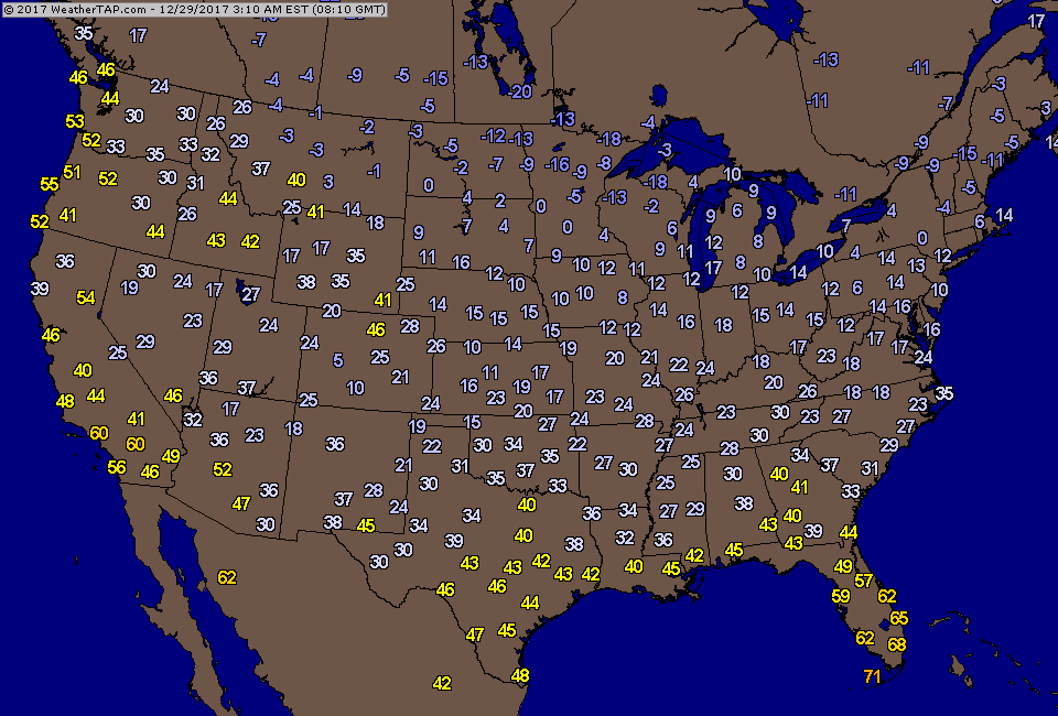
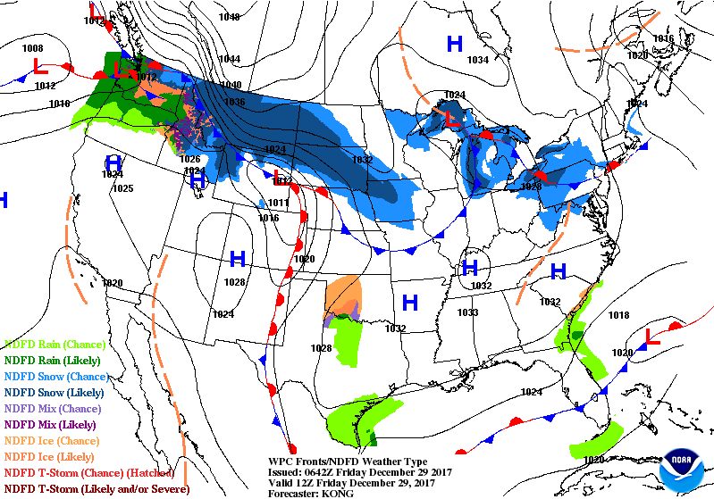
Above - early a.m. Friday temperatures.....just the tip of the iceberg as it will be even colder by New Year's Morning in many places. Below...satellite & radar showing small areas of snow and snowshowers from Rockies to Northeast...with no big winter storms in the forecast for at least the next 5- days or so.

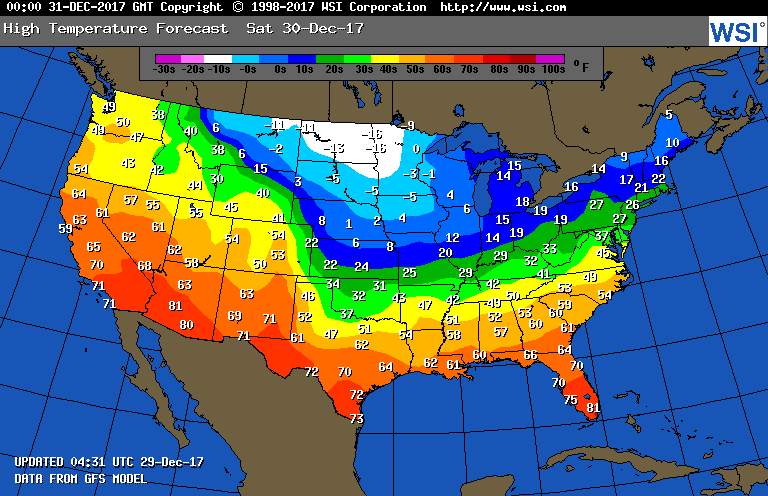
Below - animated maps for the next couple of days. following - highs for Saturday.
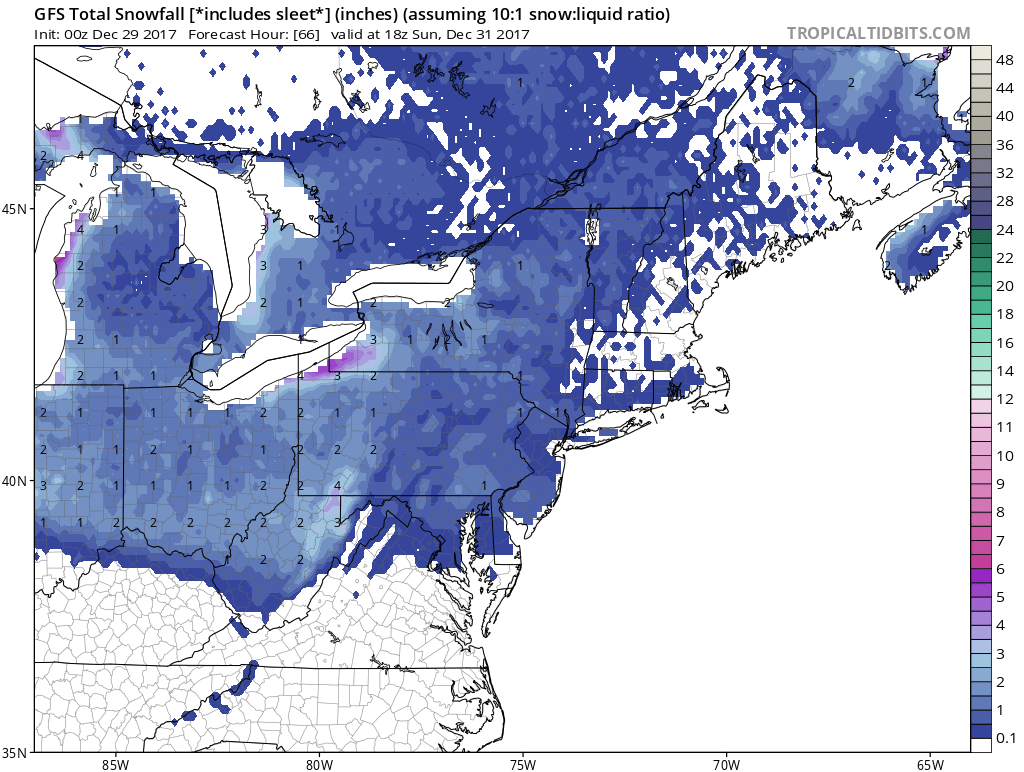
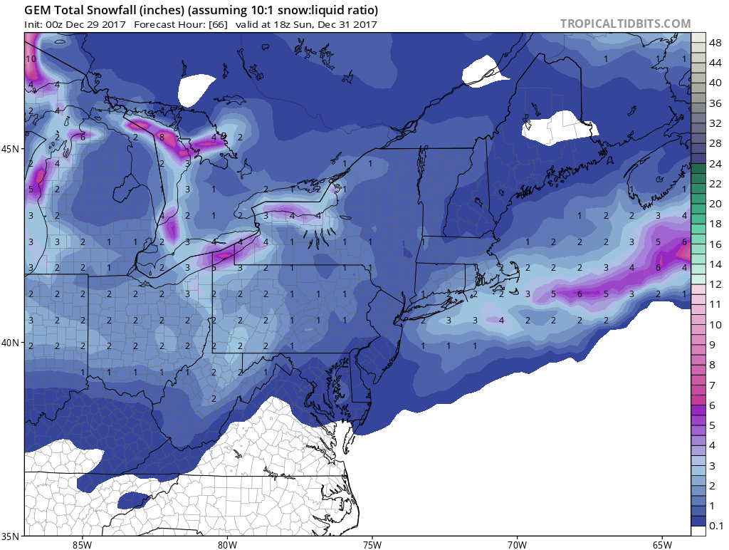
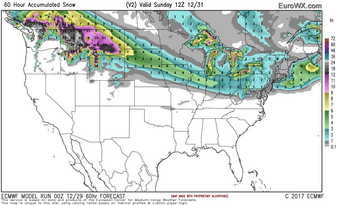
A closer look at snowfall expected this Saturday by GFS...Canadian..and Euro. On behalf of the weather center...a happy - healthy and safe New Year.

 RSS Feed
