
Two jet streams...one moving through the Great Lakes with snowshowers....headed for The Northeast tonight. In back of that another large mound of arctic - dry air. In the south...that jet stream bringing wintry precip to Carolinas....another band of moisture moving out of Texas.
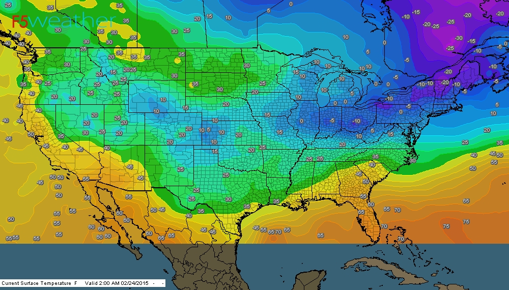
Map above (click on it)....shows 4am temps. Colors indicate the coldest.....purple......warmest - orange.
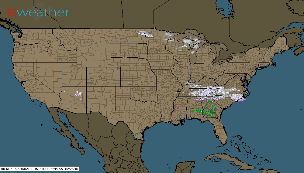
Early morning radar shows snow from Tennessee to No. Carolina. Snowshowers from Minnestoa to Gt. Lakes.
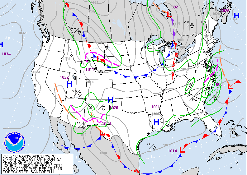
Map above is valid for Tuesday night. Cold front over Great Lakes causing snowshowers. System off Carolinas moving out. Low in Texas will take the southern route.
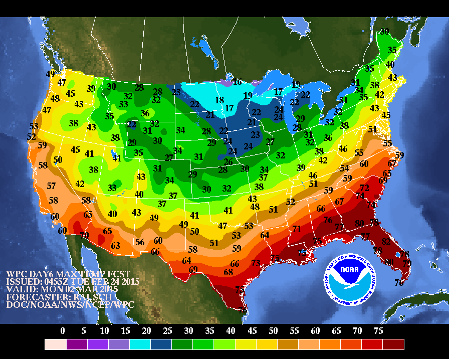
Above...daytime temps for this coming Monday. Looks like March will start off quiet but quickly act up as a wintry mix pushes into The Northeast....colder air Midwest....and thunderstorms in the south. Be safe...stay warm.

 RSS Feed
