The trends in the models are bringing the storm system through the northeast at a faster pace, and also centered further north, thus resulting in a warmer situation, and much less snow likely throughout sections of New York and New England.
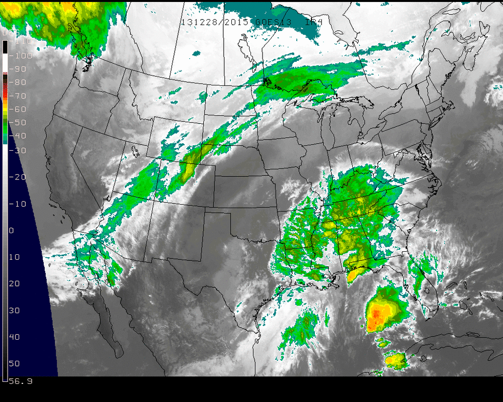
Infrared Imagery 12-28-13 2015 UTC
The Infrared imagery from this Saturday afternoon shows the storm in the southeast with plenty of moisture and it will retain all of it and more as it traverses up the eastern seaboard Sunday.
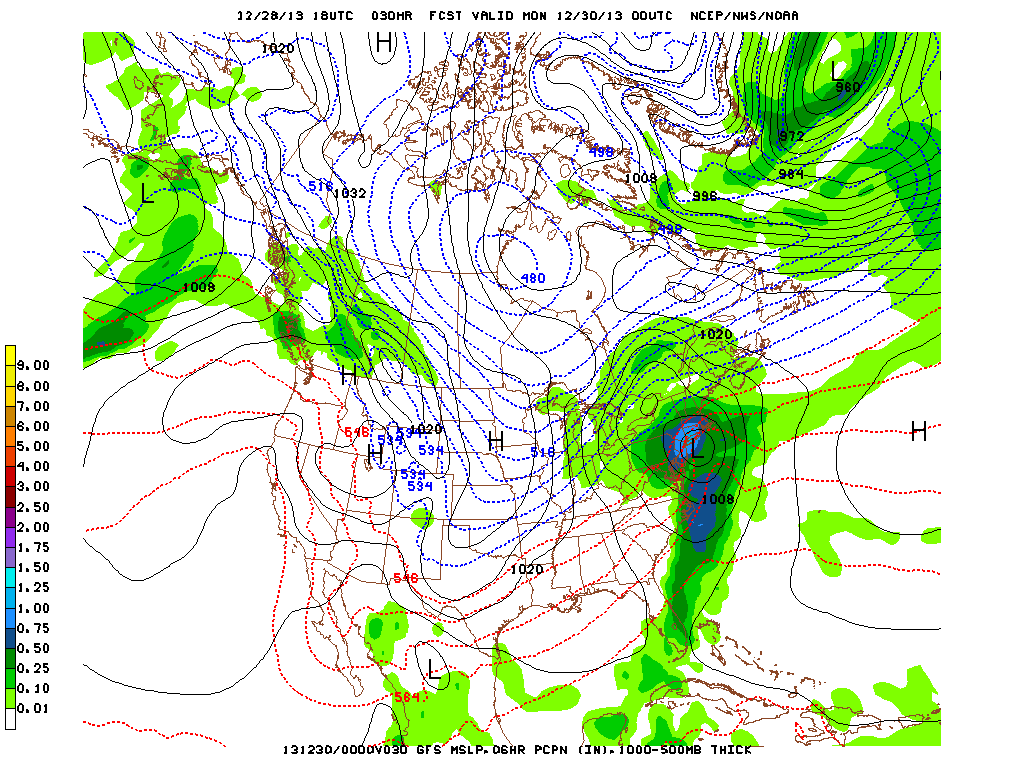
The GFS models form midday today bring the Low right across Long Island by 7 pm ET. The center may be travel bit slightly further north but the overall path is northeast, into the night. Even portions of Massachusetts and southern New Hampshire & southern Maine will be susceptible to a decent amount of rainfall to wash away any threats of a major winter storm. In the more mountainous regions further north and the mainland of Maine is where the threat for major snow accumulations will be.
After this passes, the Arctic High that will bring many negative temperatures to the upper Midwest on Sunday & Monday will bring 10's and 20's to parts of the Northeast to finish off 2013.
- JL
After this passes, the Arctic High that will bring many negative temperatures to the upper Midwest on Sunday & Monday will bring 10's and 20's to parts of the Northeast to finish off 2013.
- JL

 RSS Feed
