
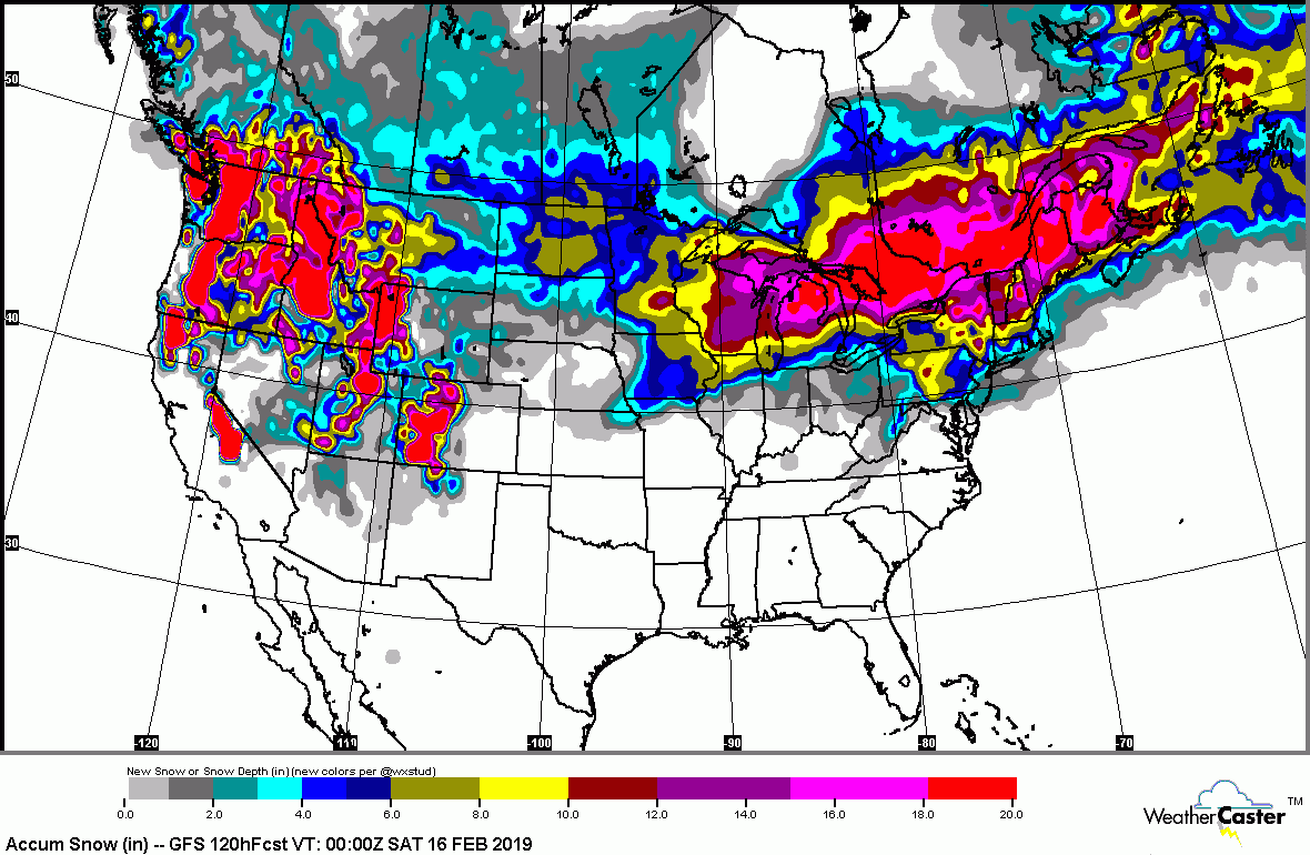
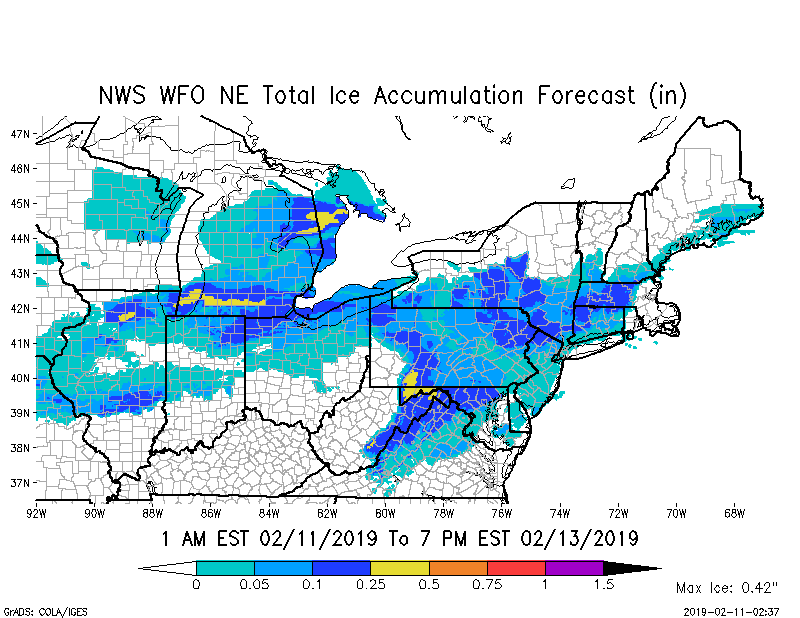
Satellite + radar shows large band of moisture from Texas to Mid Atlantic. This moisture moves north and when it hits the colder air - snow and ice from Chicago to New England. Most of which Tuesday. Below - expected snowfall through Friday...followed by expected ice accumulation thru Tuesday.
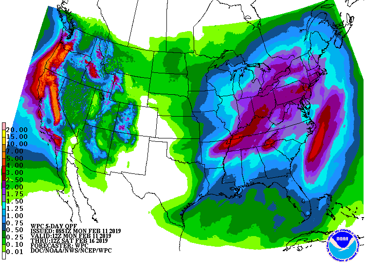
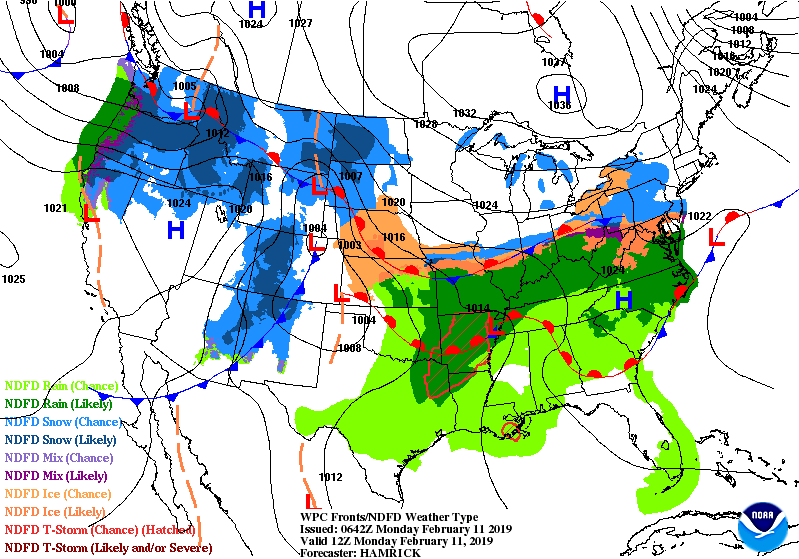
Below - expected rain amounts through Friday....followed by weather maps for next 2 days to track this winter storm.
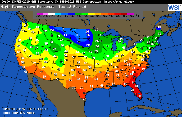
Below - high temperatures for Tuesday. Be safe.

 RSS Feed
