Metro Weather Inc. Services
Like us, follow us, link to us, contact us!
  • Home
    • Daily Weather Discussion
  • Weather Prepared for You
    • Film and TV Production
    • Radio & Television
    • Government and Industry
    • Forensic Services >
      • Weather Record Request Form
    • Metro Morning Monitor
  • About Metro Weather
    • Senior Staff
  • Your Weather Images
  • Contact Us

A Frigid Punch.....

1/29/2019

0 Comments

 
Picture
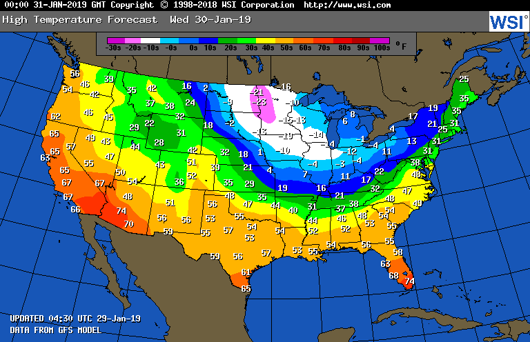
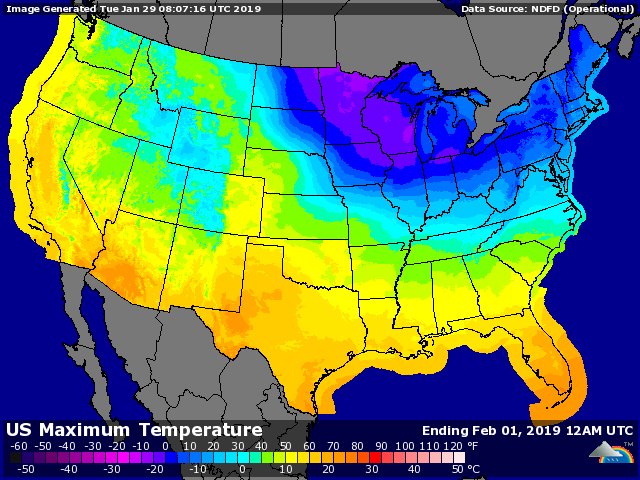
Above - high temperatures for Wednesday.  Arctic air is pushing south and east into Tenessee Valley and Carolinas.  Below...high temperatures for Thursday.
Picture
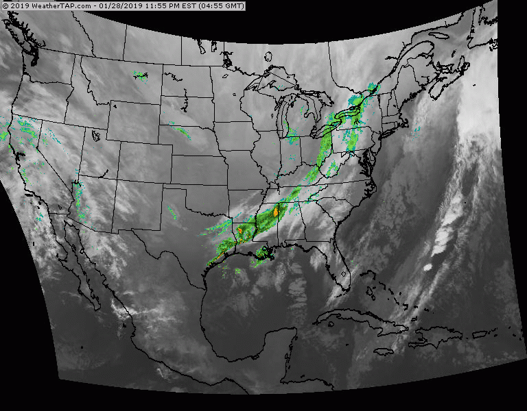
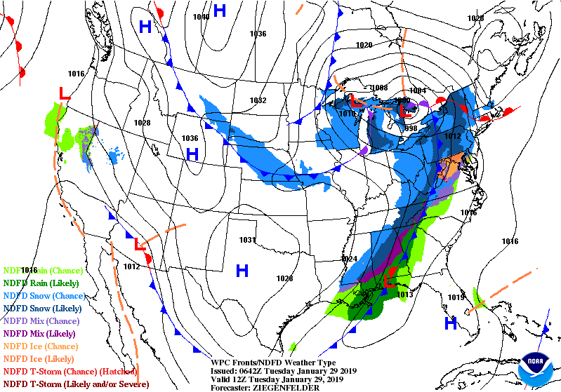
Below ...satellite = radar showing cold front moving into Appalachians with rain and snow.  That will head for Northeast today...changing to snow there tonight. Big cities...1" or less...interior New England...3"-6" possible. Temperatures will do nothing but fall from Wednesday into Friday. 
Picture
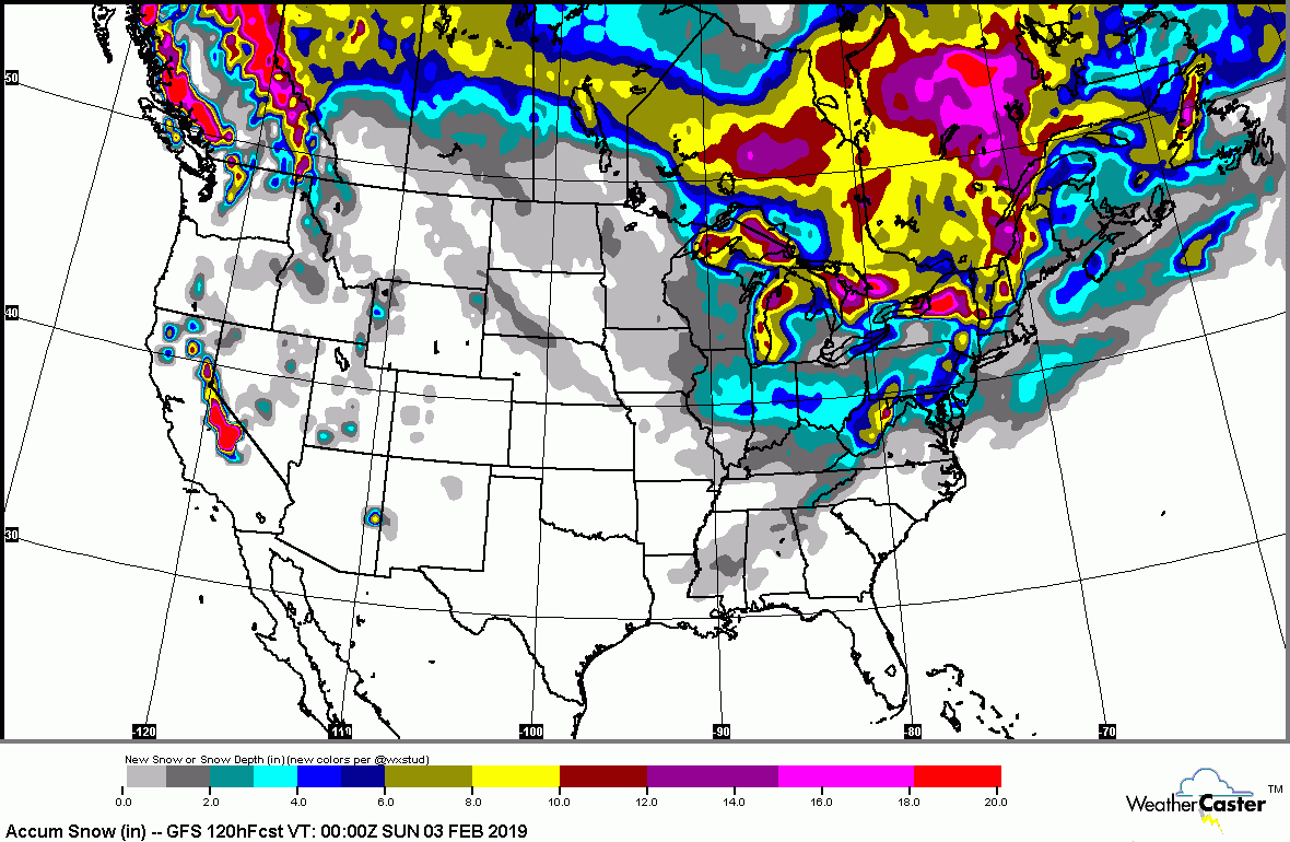
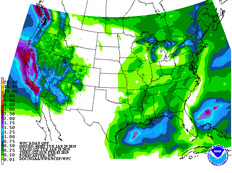
Below - snowfall and rainfall amounts through the weekend followed by
animated maps into Wednesday - tracking the arctic air. Be careful and be safe.

Picture
Picture
Picture
0 Comments


Leave a Reply.

    Genesis of a Tornado
    We'll have daily weather discussions, talking about major systems on the horizon along with anything noteworthy that pops up on our radar.

    Pat Pagano,
    Mike Merin

    Follow us on Twitter and like us on Facebook to get updates whenever we post a new entry!

    RSS Feed

Powered by Create your own unique website with customizable templates.