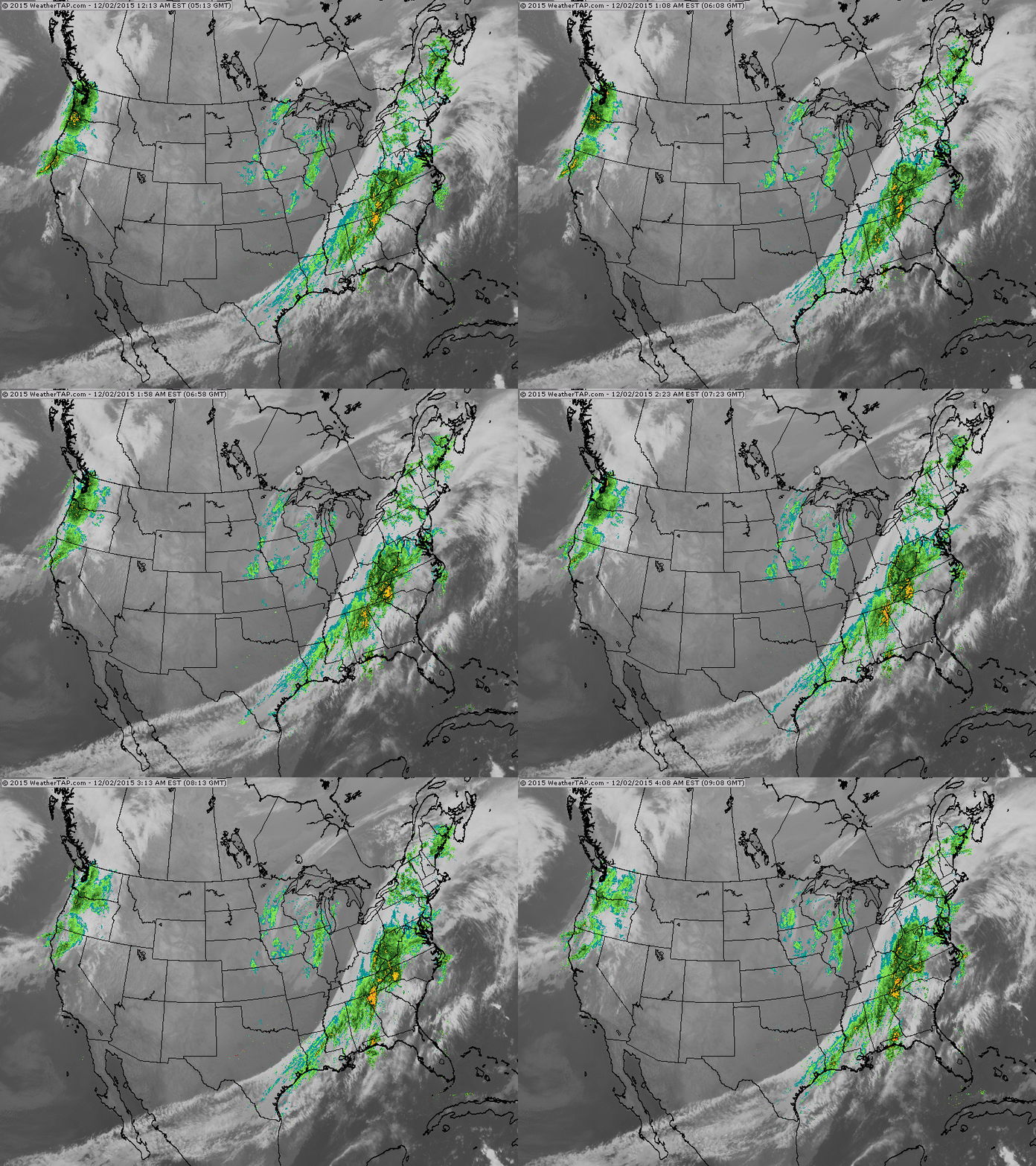
You can see the cold front on this satellite picture moving out
of Ohio Valley with rain ahead of it. The sprial over the Great Lakes is the low associated with front still causing some snowshowers there. Next front in Pacific Northwest could affect
east coast by mid part of next week otherwise the NW could see 5"-7" of rain through the weekend.
of Ohio Valley with rain ahead of it. The sprial over the Great Lakes is the low associated with front still causing some snowshowers there. Next front in Pacific Northwest could affect
east coast by mid part of next week otherwise the NW could see 5"-7" of rain through the weekend.
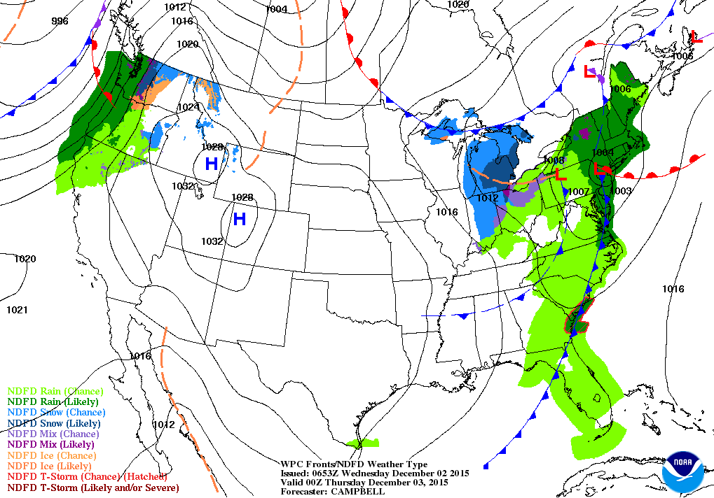
Above...weather map for this evening . Storm and front moving across East Coast. Florida....especially south....get ready for
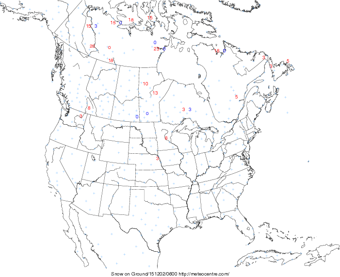
a few days of significant rain. Below....amount of snow on the ground across No. America in centimeters. Notice...not much
even in Canada.
a few days of significant rain. Below....amount of snow on the ground across No. America in centimeters. Notice...not much
even in Canada.
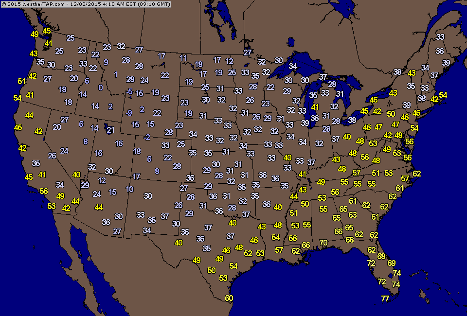
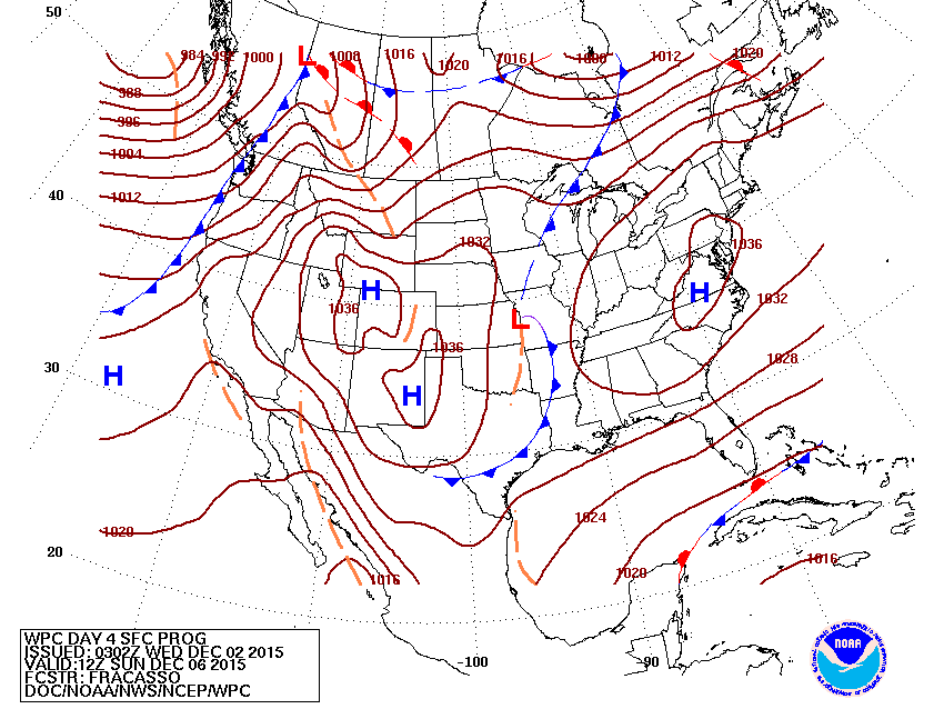
Below....current temperatures this morning. You need not
be a meteorologist to find the cold front. Below that...map for this weekend...indicating nice weather for much of the eastern
half of the Nation.
be a meteorologist to find the cold front. Below that...map for this weekend...indicating nice weather for much of the eastern
half of the Nation.
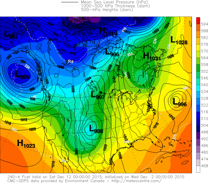
Lastly...a look at Canadian model for Dec. 11th. Notice how
the cold air is mainly in Canada. That says El Nino....so Santa may be using his car this Christmas. Be safe.
the cold air is mainly in Canada. That says El Nino....so Santa may be using his car this Christmas. Be safe.

 RSS Feed
