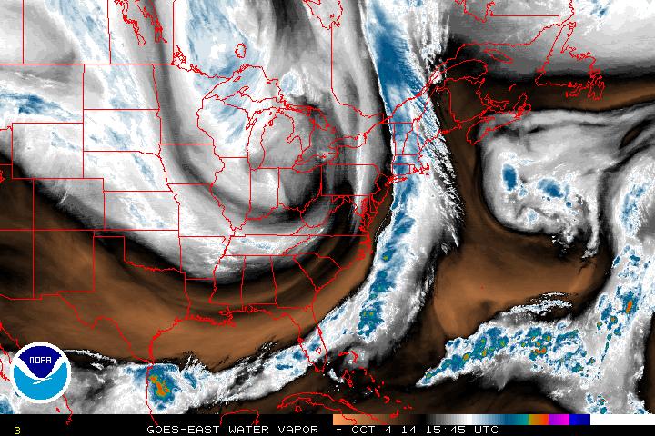
A front is moving by the east coast today bringing rain showers. In the Central US, cold air moving down from Canada has brought freeze warnings and snowflakes to areas near the Canadian border.
The jet stream is dipping well south towards the Gulf Coast. Dry weather is expected in the Southeast and Mid-Atlantic today as the cold front depicted in the water vapor imagery above moves off into the Atlantic. High Pressure will move up from the south to start off the upcoming week.
Below average temperatures are expected the next few days while the trough digs deep into the Eastern US with widespread 40's and 50's from North Dakota, down to Kentucky, over to Pennsylvania, and into New England. Temperatures rebound near seasonal averages mid-week as the trough recedes to the north.
- JL


 RSS Feed
