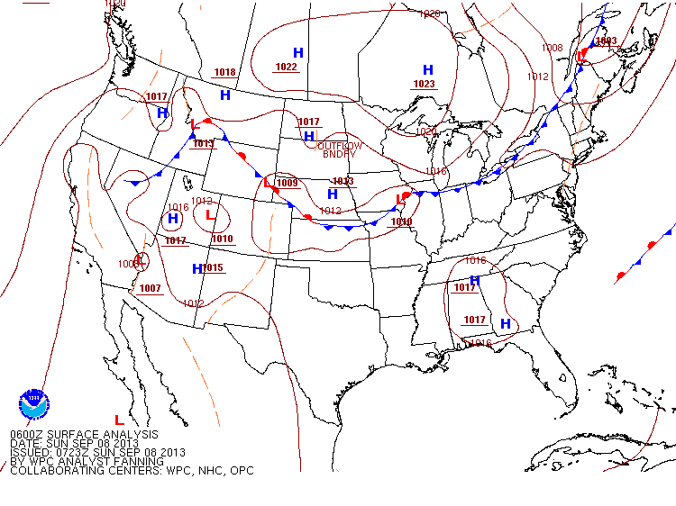
Today's cold front won't be bringing us more than a possible passing drizzle in certain locations but the gradients will be bringing winds of up to 20 mph in the metro area, up to 25 mph tonight. A look at the surface map shows there's not much happening in the way of severe gradients or even moisture with that dry line just to the east of the cold front.
The front will move through the metro area in the late afternoon meaning that highs will temporarily reach where they were yesterday before plummeting tonight (upper New England states will have the front move through earlier meaning their highs will be lower today instead). Tomorrow the metro area will have highs on average of 7-10° lower than today, but when you hear cold front you usually think showers right? Storms especially in months like September when it's hotter out, so why the isolated drizzles?
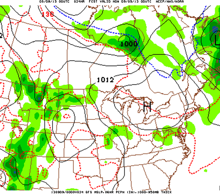
Again, the dry line will lower humidity considerably which lowers the energy in the atmosphere, and less energy with the less moisture means less instability and condensation. Also, the high pressure behind it is fairly deep at 1023 in a large area, and look where it'll be in the evening:
Again, the dry line will lower humidity considerably which lowers the energy in the atmosphere, and less energy with the less moisture means less instability and condensation. Also, the high pressure behind it is fairly deep at 1023 in a large area, and look where it'll be in the evening:
Higher pressure also adds, or rather takes away from the moisture in the air and further hurts the development of precipitation. The trade-off is that there will be higher winds and much lower nightly temperatures, but after the hot weather we've had for the past month (and remember the hot July) I think most of us would be just fine with cooling off and giving our air conditioners a rest.
Should be a good and sunny start to the week, enjoy it.
-Mike Merin
Should be a good and sunny start to the week, enjoy it.
-Mike Merin


 RSS Feed
