Looks like a compact but interesting event. Powerhouse shortwave at upper levels already generating an area of heavy convection across Pa and Virginias. Severe threat mid Atlantic....even down to Georgia. Looks like central and No. New England could miss out on heavy rain...but they don't need it. System kicks out tnte...lingering shower or t-storm Friday. Another batch of locally severe weather moves oout of Rockies thru Plains this weekend and into the East again next week.
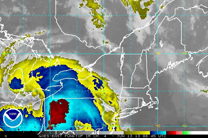
Below IR Satellite from early a.m. showing the extreme convection.
Below IR Satellite from early a.m. showing the extreme convection.
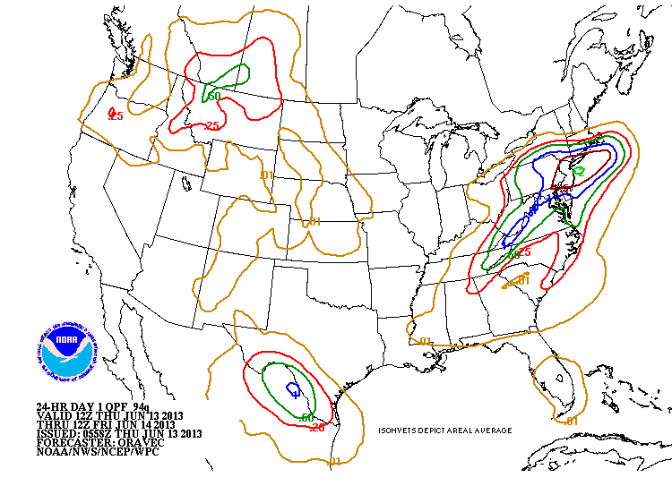
Here is the QPF chart...showing amounts of rain...greatly scaled down both in amounts and northern coverage.......?
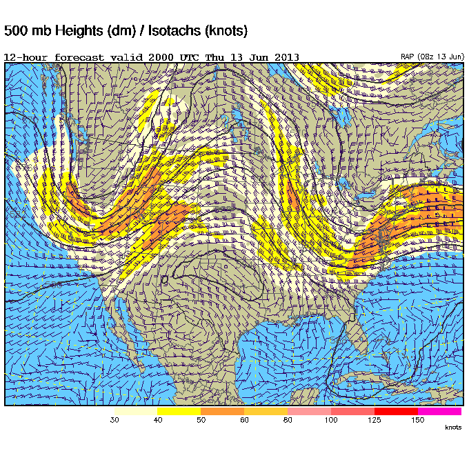
Below....500 Mb chart - you can see the strong jet...indicated by the dark wind barbs.....supporting this vigorous system in the NE.
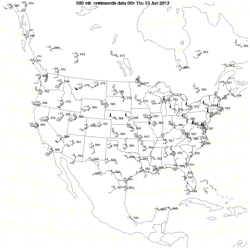
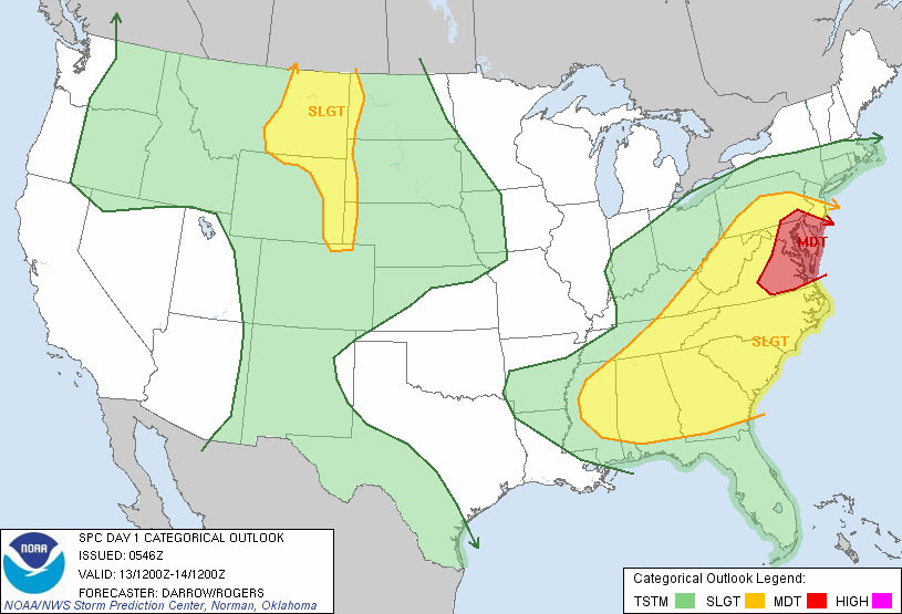
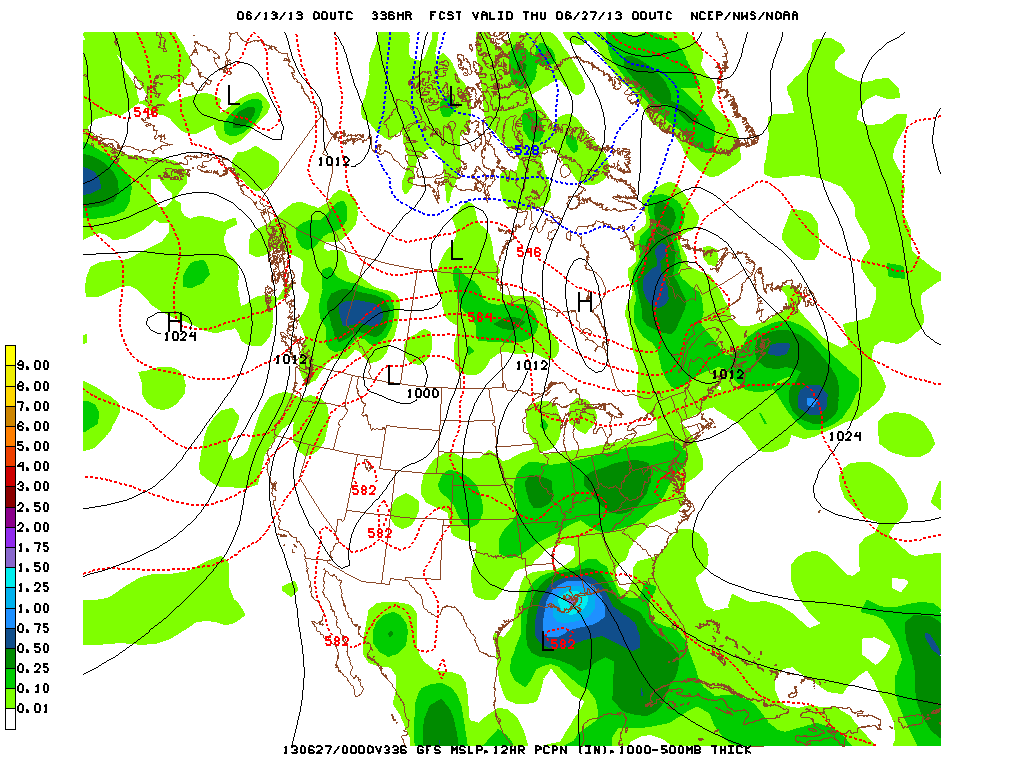
The severe weather outlook below...again - mid Atlantic for the target. Another 500 mb chart depicting the wind and speed Nationwide....and finally....the GFS version of yesterday's expected tropical system in the Gulf. It is still showing that for end of this month....let's see how it pans out. Be safe....Later.

 RSS Feed
