
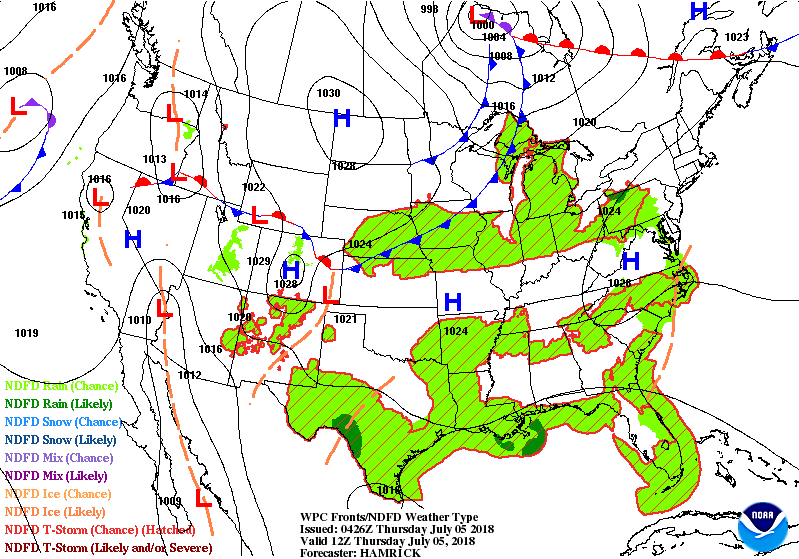
A strong cold front in Western Great Lakes is associated with showers and storms. It will move east and clear the Northeast and Mid Atlantic coasts by Friday night. ....leaving the weekend there to be beautiful.
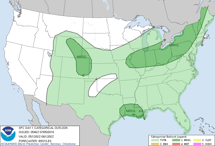
Clusters of showers and storms across the south. Below - today's chances of severe weather in dark green.
Clusters of showers and storms across the south. Below - today's chances of severe weather in dark green.
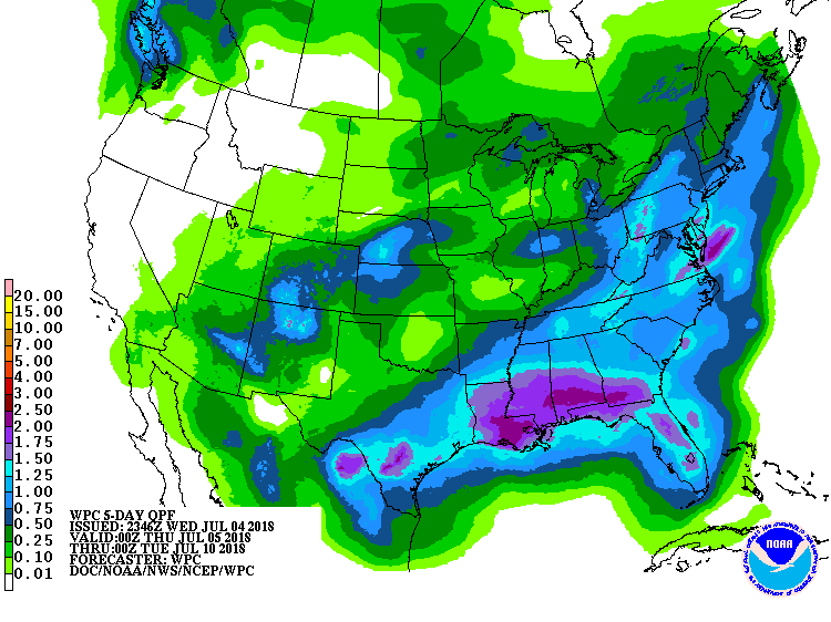
Following - animated maps for the next 2 days....followed by rainfall predictions for the next 7 days.
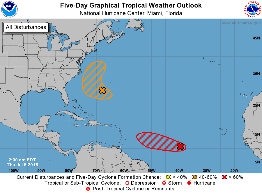
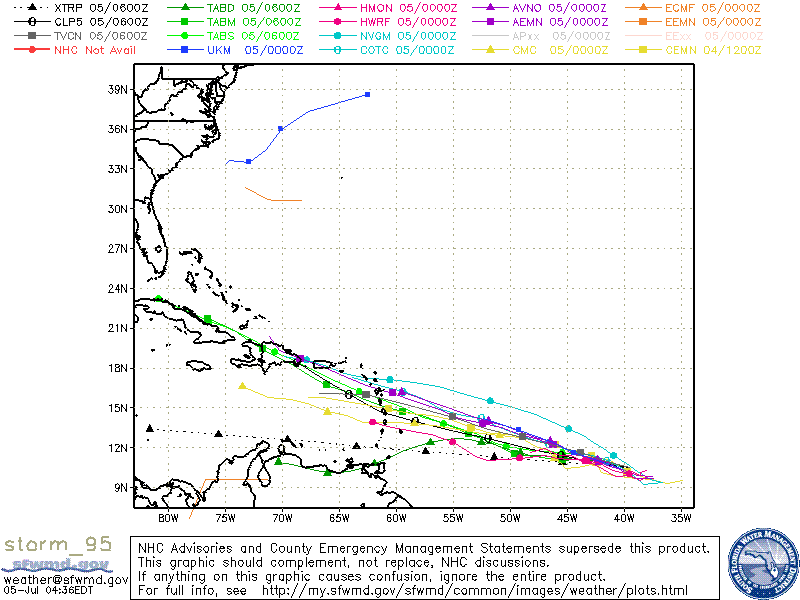
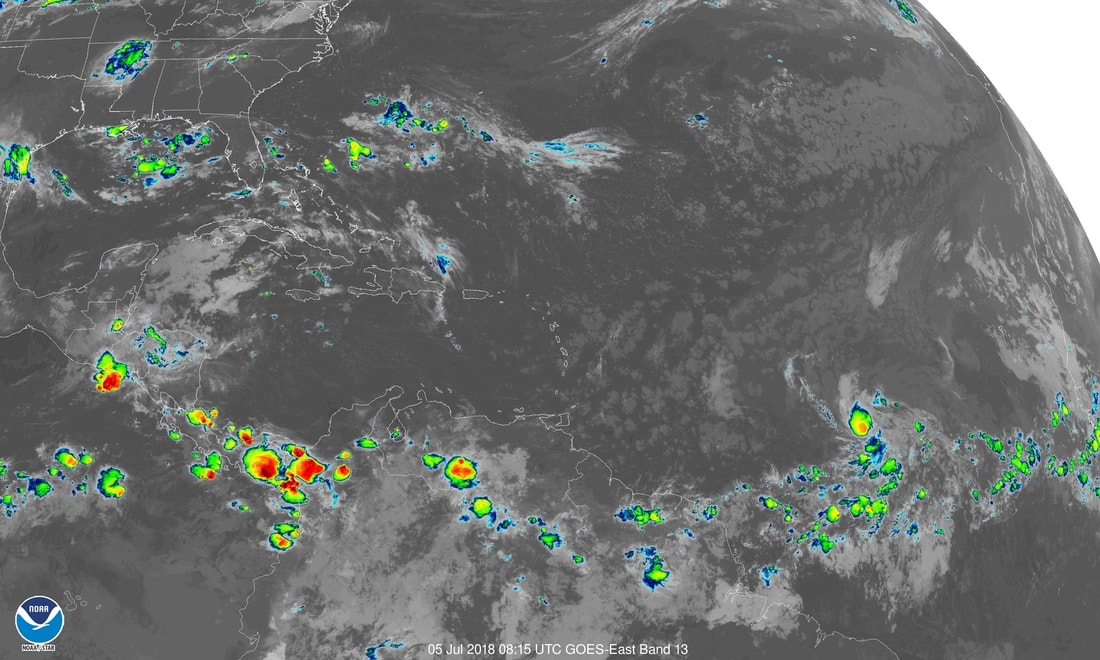
There are 2 tropical spots to watch...one off the Carolinas...moving out to Atlantic...the other in south Central Atlantic which is likely to become a tropical storm. We have shown projected tracks and satellite with that one. Be safe and try to stay cool.

 RSS Feed
