As some of you may know, today marks the official start of the 2013 Atlantic Hurricane Season. While the laws of the weather world do not operate solely by dates us Meteorologists label as "seasons", June 1 - November 30 is the time period that shows the greatest production of hurricanes in the North Atlantic.
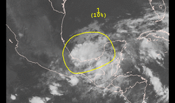
As of 8am EDT, there is a disorganized cluster of showers & thunderstorms centered off the coast of Mexico in the area where Hurricane Barbara (member of the Pacific Hurricane family) dissipated very recently. The National Hurricane Center places this system at a very low chance of 10% to form into a tropical cyclone within the next 48 hours and currently the models do not indicate this will form into one in the near future.
A bit closer to home, today marks the first day of Meteorological Summer! While many of you are familiar with the Summer Solstice on your calendars (June 21 for this year), Instead of basing the seasons off of the tilt of the earth like the seasons are mostly interpreted by the general public, "Meteorological" seasons break down each of the 4 based on temperature. The 3 hottest months for us are June - August. Thus, June 1 - August 31 is Meteorological Summer! The upper air plots from midday today at 850/700/500 mb all show warm air shooting up the eastern seaboard giving the warmth that has Meteorological Summer in full swing!
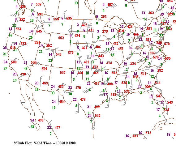
850 mb Upper Air Plot
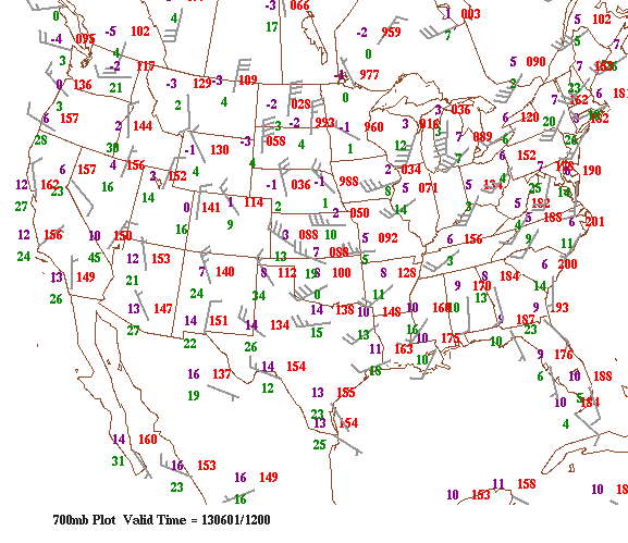
700 mb Upper Air Plot
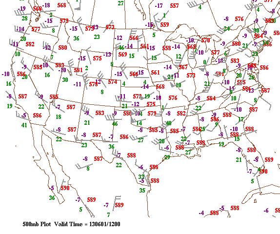
500 mb Upper Air Plot
Take care & be well!
- JL
- JL

 RSS Feed
