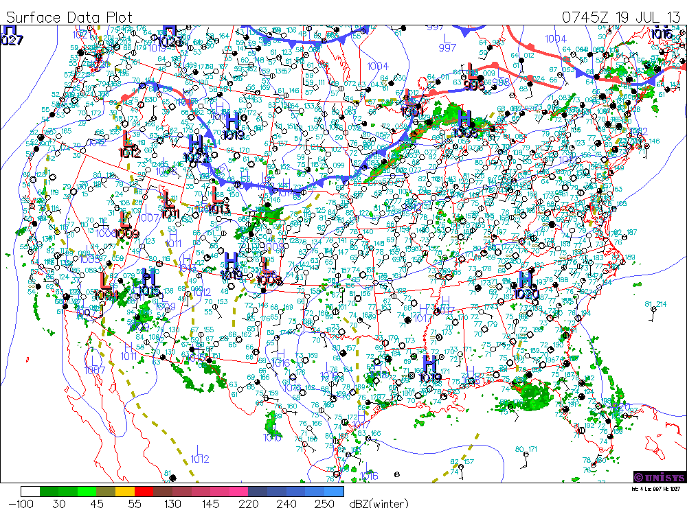
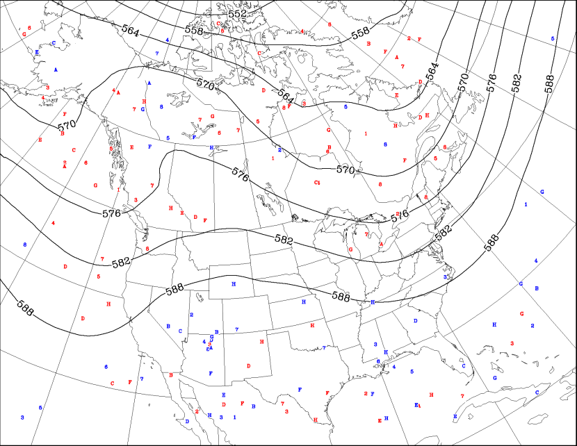
100 in places like JFK....Lakehurst, N.J......Newark, N.J. and where it did not reach 100......98 was a common reading yesterday. Another rough day today...not only temperature -wise....but humidity-wise. Humidity levels will be higher today....so discomfort outside will be greater and again...extreme CAUTION is advised if working out of doors. Here is the weather map for this a.m.
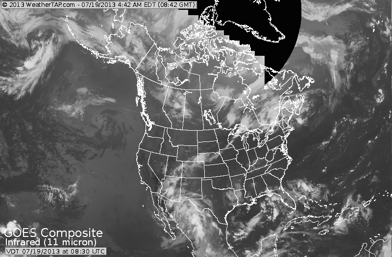
Our satellite picture clearly shows the cold front moving into the Great Lakes....so from The Northern Plains to The Northeast a break is seen.
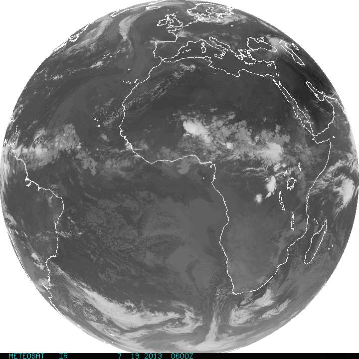
A quick look at the tropics....you can see things are quiet from The African coast westward across The Atlantic......thank God !
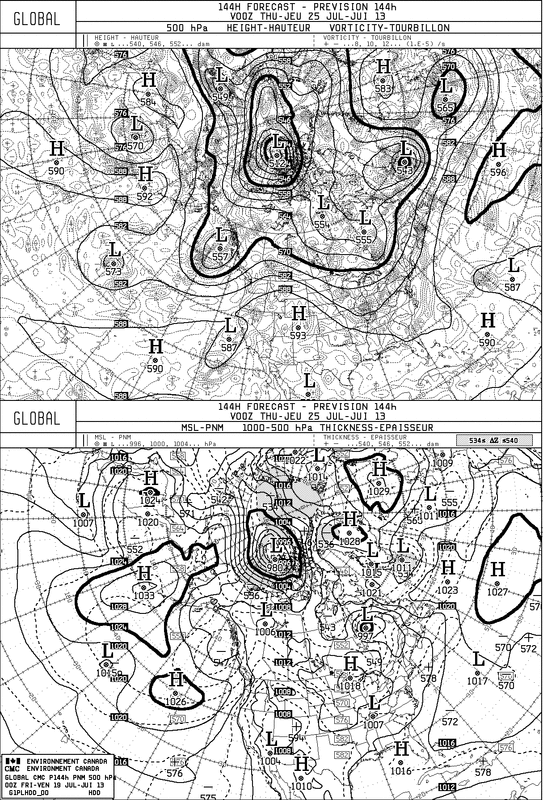
Looking down the road to next week...The Canadian Model for next Wednesday shows a trof moving thru the mid section of the nation and while that will cause wet weather for the eastern half of the nation....it will also prevent another heatwave....so your choice is: wet and humid....or dry and hot. Why can't we have sunny and nice...because at this time of year it seldom happens. The map following that is that upper air map for early August projected by The Canadian Model. It clearly shows cooler weather for the East. My long range forecast indicates that August will not be as hot as July...so something to think about.
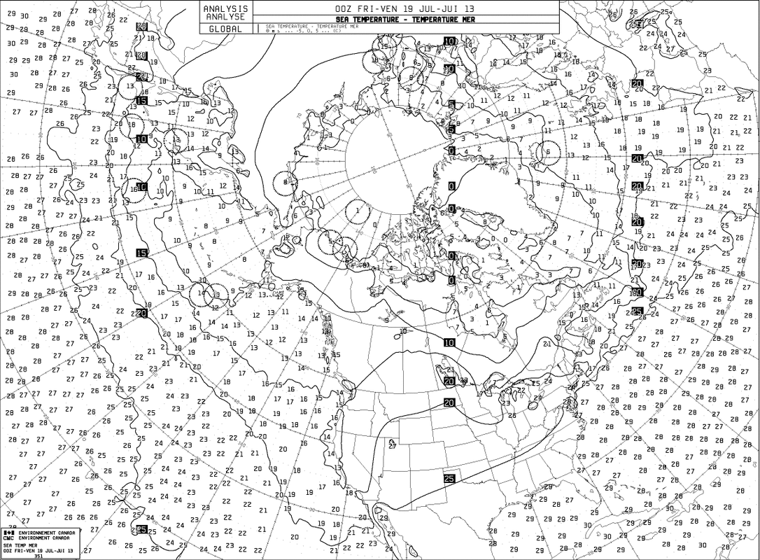
Finally...a look at sea surface temperatures. (In Celsius). Very warm...but not record breaking. Keep cool....have a nice and safe weekend. Later.

 RSS Feed
