
You can easily see on this picture the energy associated with the advancing storm now in Alabama. Below...our satellite radar overlay which continues to show convection and that's a sign that this storm will be a classic.

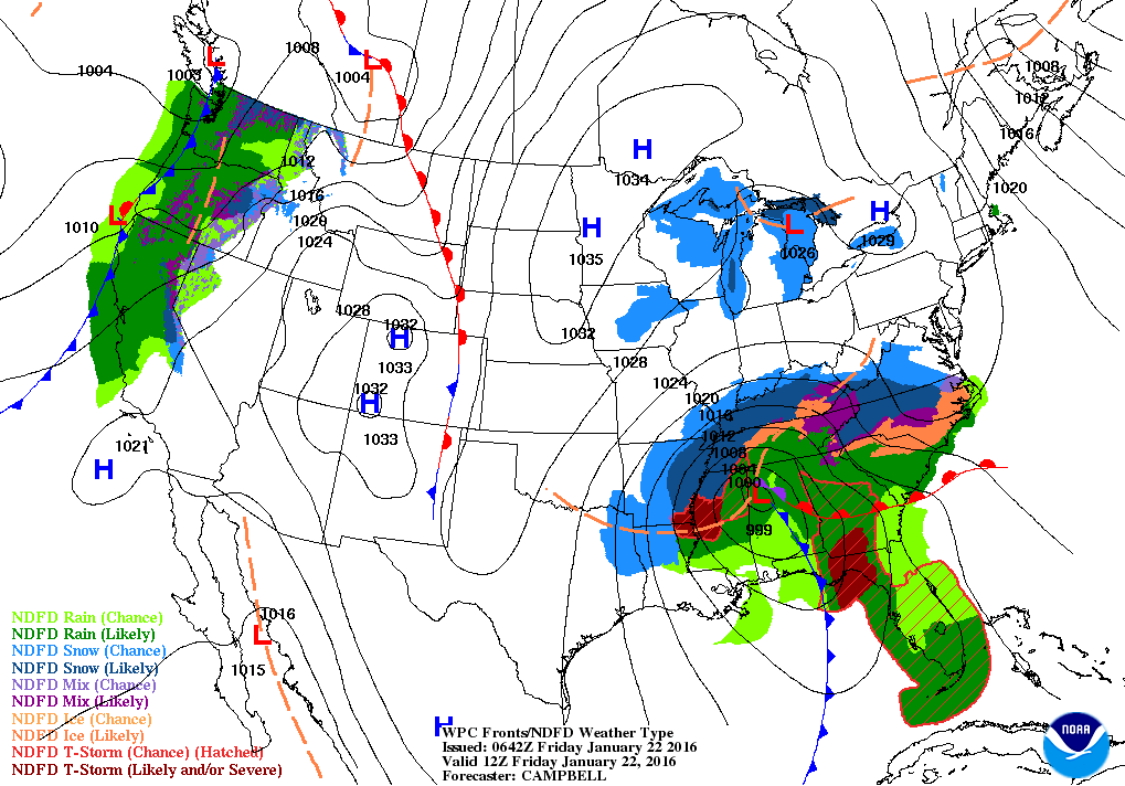
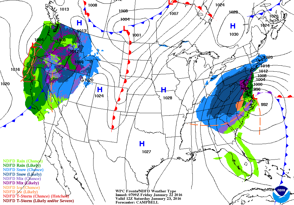
The following 2 maps are surface maps: 1 - Present.....2 - Saturday night as the storm heads up along the Mid Atlantic Coast.
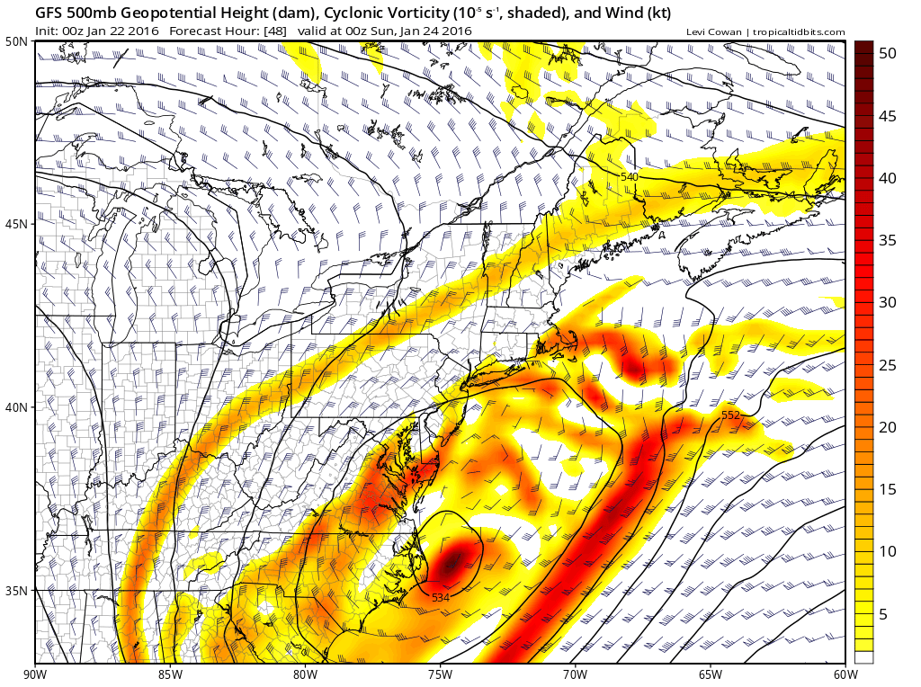
Below...is the 500 MB flow (20,000 ft) for Saturday night. It shows the upper low to be closed off...near N.Carolina coast.
This should slow the storm but it will occlude. Somewhere
north of the storm will be heavier banding...and that's where
2-3" of snow could fall per hour.
This should slow the storm but it will occlude. Somewhere
north of the storm will be heavier banding...and that's where
2-3" of snow could fall per hour.
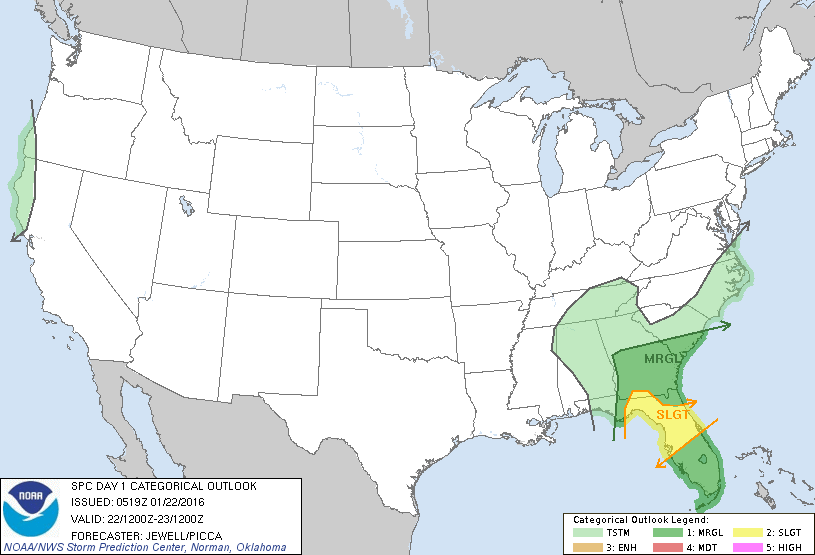
Below...the green and yellow indicate the risk of severe weather today.
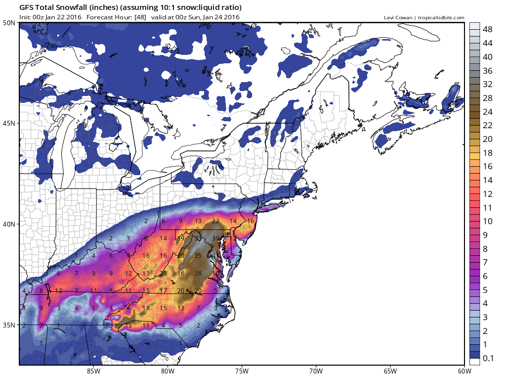
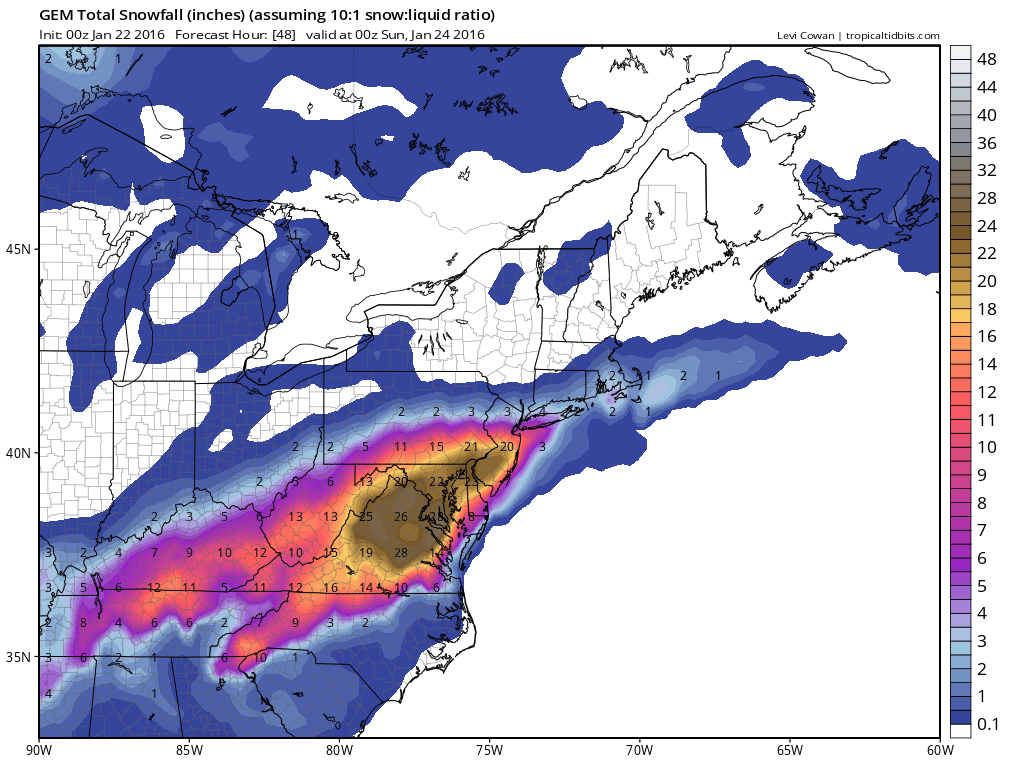
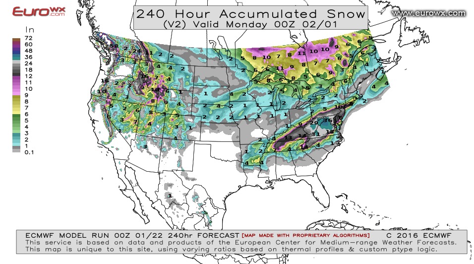
Below...maps representing total snowfall predicted by these models in this order: GFS - Canadian - Euro. Euro is once again leading the pack....now giving New York Metro Area around 15" of snow. Not ready to believe that until tomorrow at this time. Be safe....more on storm through the day.

 RSS Feed
