Metro Weather Inc. Services
Like us, follow us, link to us, contact us!
  • Home
    • Daily Weather Discussion
  • Weather Prepared for You
    • Film and TV Production
    • Radio & Television
    • Government and Industry
    • Forensic Services >
      • Weather Record Request Form
    • Metro Morning Monitor
  • About Metro Weather
    • Senior Staff
  • Your Weather Images
  • Contact Us

WINTER - B I G    T I M E !

12/13/2016

0 Comments

 
Picture
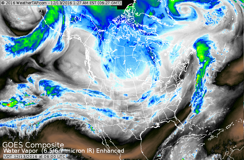
Satellite shows polar vortex spinning away in Canada and causing waves of frigid air to spill south. It's all headed east and south and most places will feel this snap by late week.  
Picture
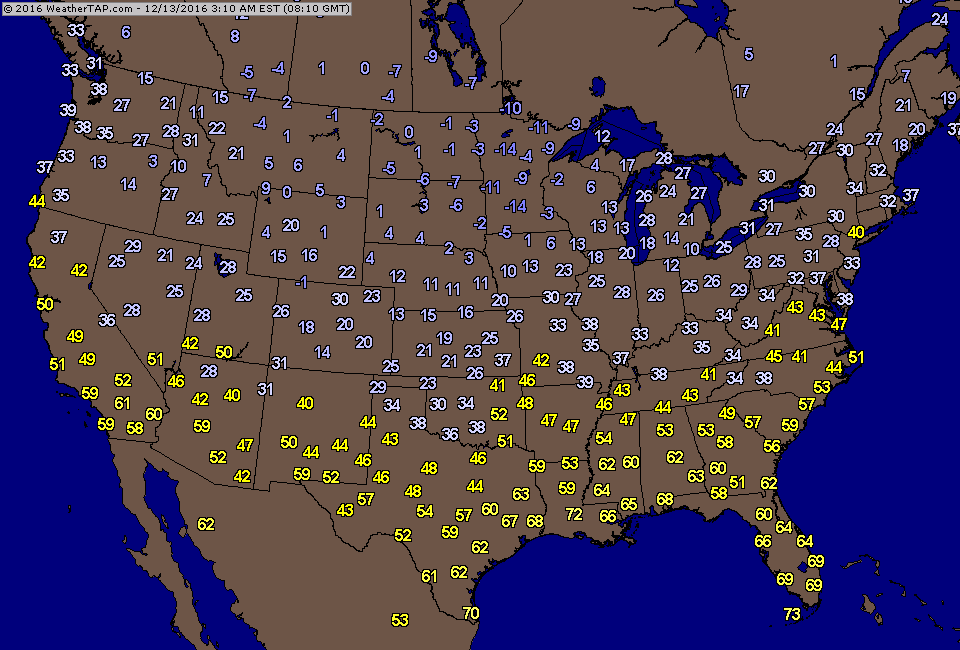
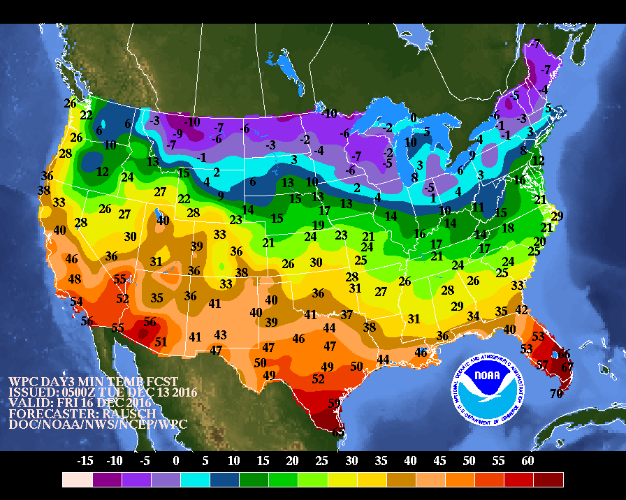
​Above - early morning temperatures. Below...expected morning temperatures for this Friday.
Picture
Picture
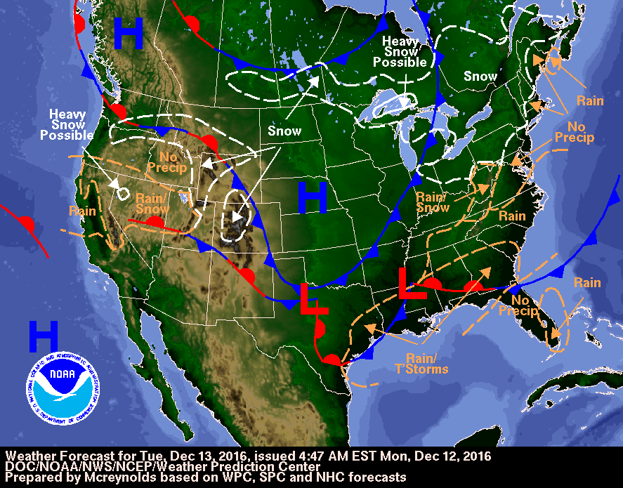
Current map showing cold air moving across the Central U.S. Storm on west coast heads to east coast by this weekend.
Picture
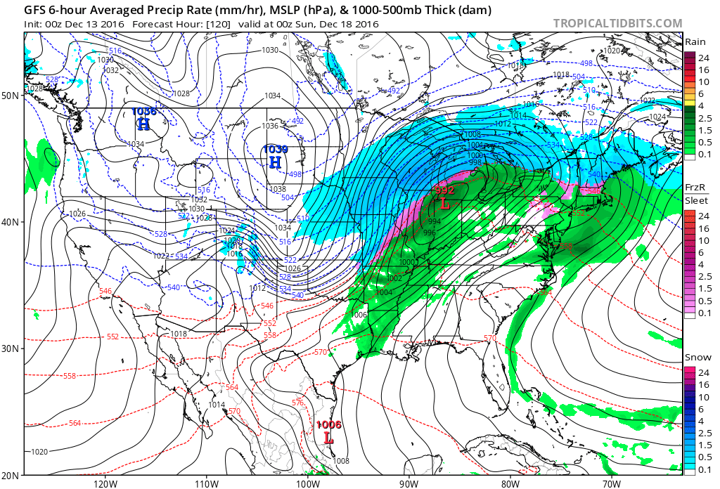
This map is the gfs model for Saturday night. Storm is near Chicago. Blue is snow..green is rain...pink is ice.  Below - gfs model for Christmas Day.
Picture
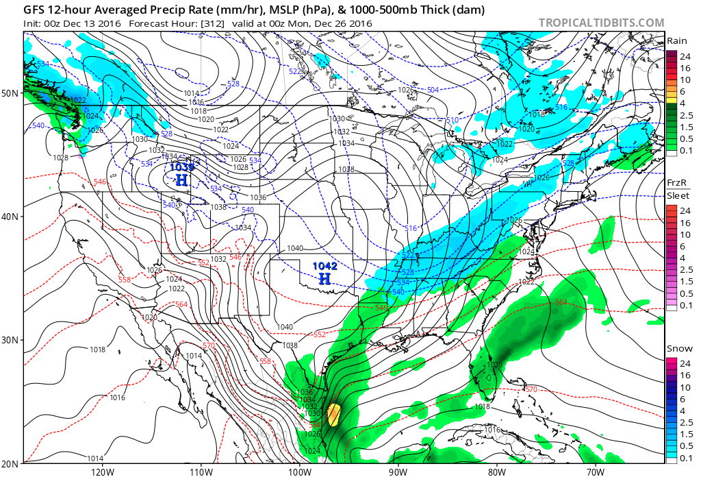
This is for Sunday- 12-25-16 at 7pm. Timing on long range weather is never right. This models shows snow from Ohio Valley to Northeast. Will it be faster or slower. If it speeds up..then a white Christmas is possible in the East.  "If" the big word here. For now...get ready for the cold. Be safe.
0 Comments


Leave a Reply.

    Genesis of a Tornado
    We'll have daily weather discussions, talking about major systems on the horizon along with anything noteworthy that pops up on our radar.

    Pat Pagano,
    Mike Merin

    Follow us on Twitter and like us on Facebook to get updates whenever we post a new entry!

    RSS Feed

Powered by Create your own unique website with customizable templates.