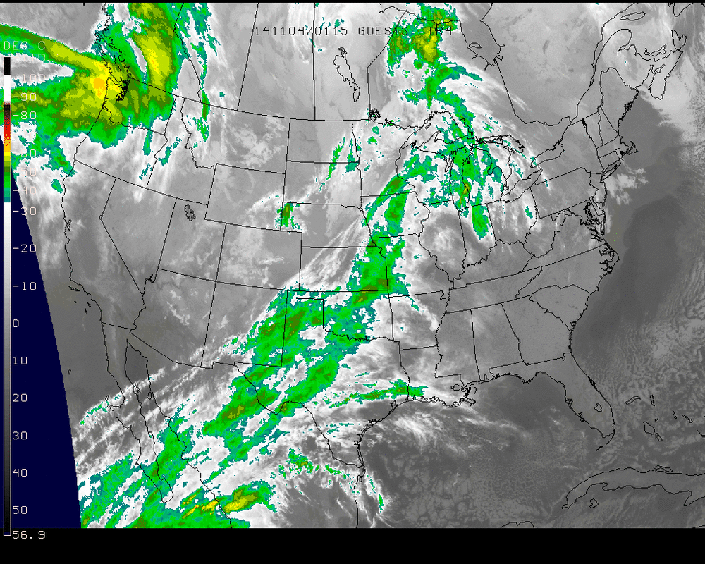
Satellite above shows front from Great Lakes to Texas.
Moisture from Hurricane Vance ( Mexico) will get involved and heavy rains are possible up and down the front.
Moisture from Hurricane Vance ( Mexico) will get involved and heavy rains are possible up and down the front.
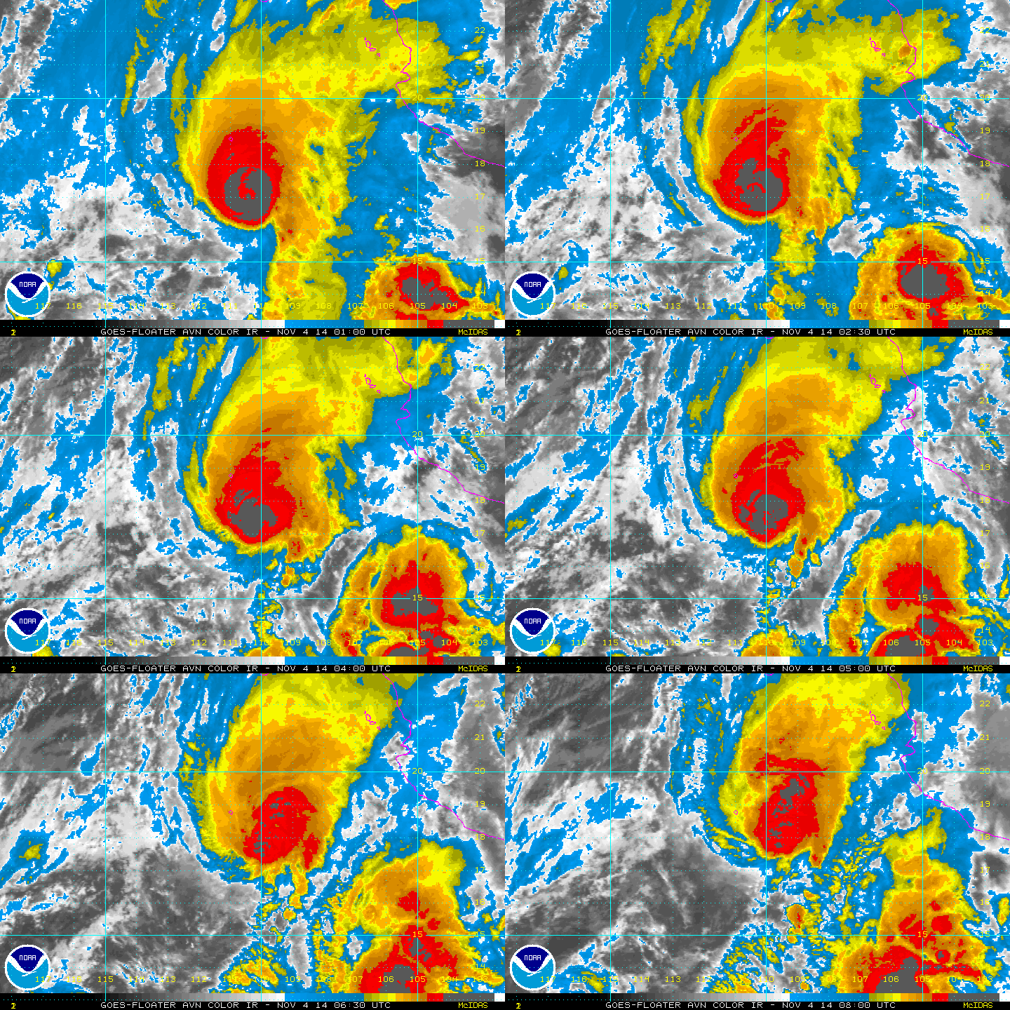
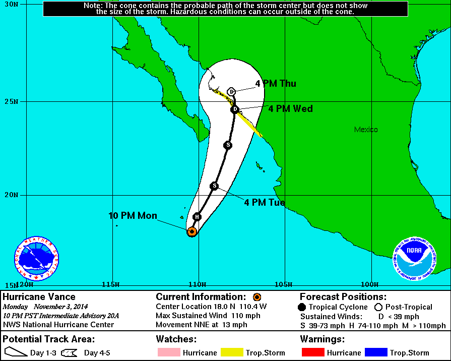
Vance is losing it's definition...but another area of moisture to the southeast shows signs of injecting energy into the system before hitting Mexico. Track below.
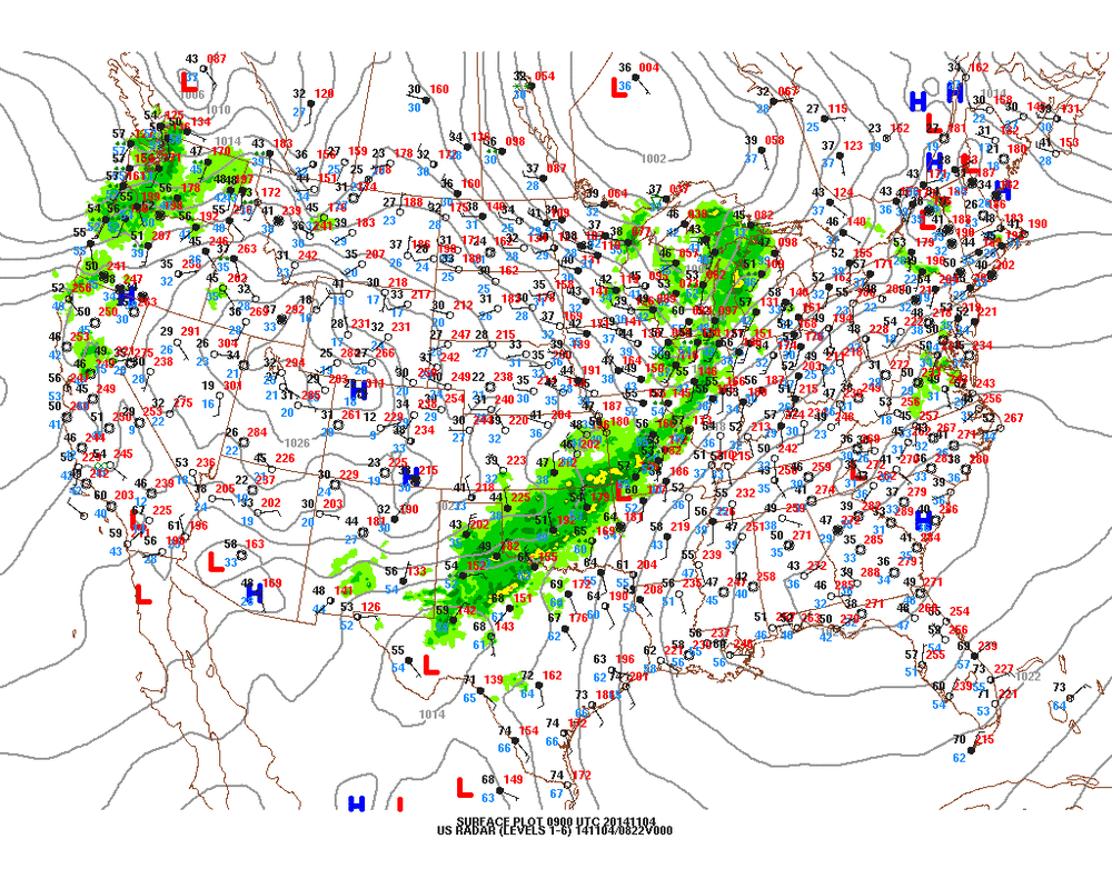
While this surface map does not draw in the fronts...you can clearly see where it is by the rainfall plotted ( green).
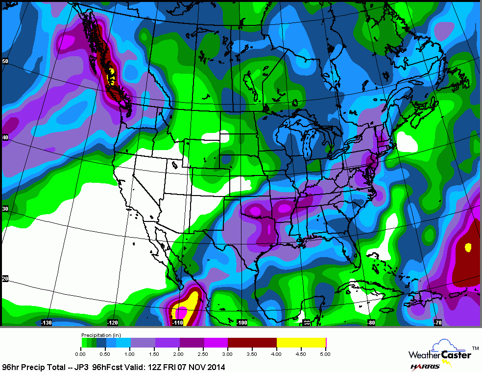
Above - The Japan model showing how much rain could fall Thurs/Friday. It is wetter than most models...but may very well be right.
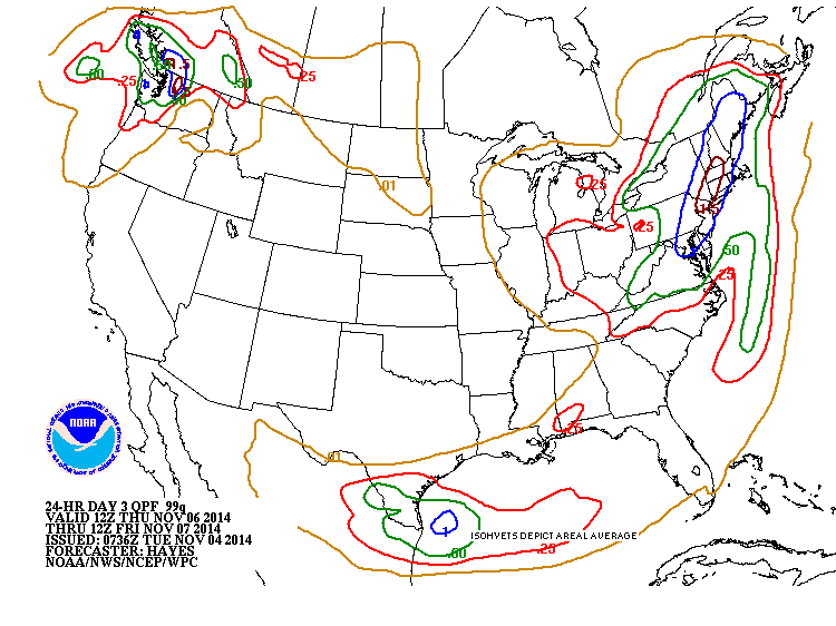
Map above produced by our U.S. models...averaging
about 1/2 of what the Japan model indicates.
about 1/2 of what the Japan model indicates.
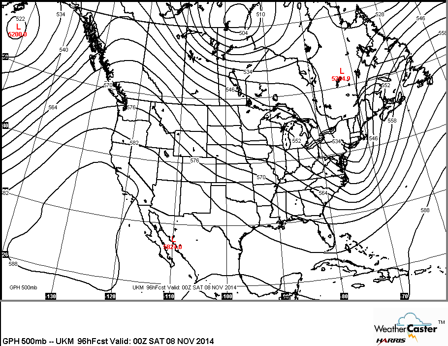
This is what the upper flow will look like by late week.
Ridge out west - warm - dry......trof East - chilly and unsettled. Have a nice day....be safe.
Ridge out west - warm - dry......trof East - chilly and unsettled. Have a nice day....be safe.
 RSS Feed
