Metro Weather Inc. Services
Like us, follow us, link to us, contact us!
  • Home
    • Daily Weather Discussion
  • Weather Prepared for You
    • Film and TV Production
    • Radio & Television
    • Government and Industry
    • Forensic Services >
      • Weather Record Request Form
    • Metro Morning Monitor
  • About Metro Weather
    • Senior Staff
  • Your Weather Images
  • Contact Us

Unsettled weather becomes more widespread......

4/2/2015

0 Comments

 
Picture
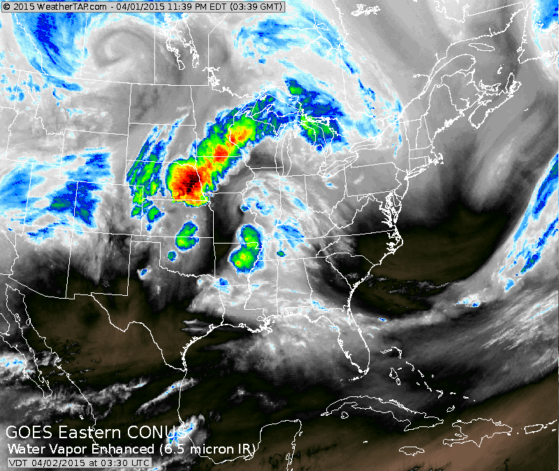
Brighter colors on satellite are not for Easter. That's moisture that will trigger thunderstorms today...some of which may be severe. That system will head east to affect the East Coast Friday and Saturday. 
Picture
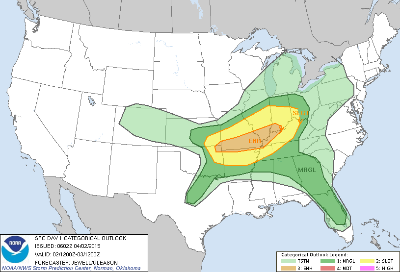
Above...area that is expected to have severe weather today. Yellow and brown tells us where the best chances are...which is southern Illinois & southern Missouri.
Picture
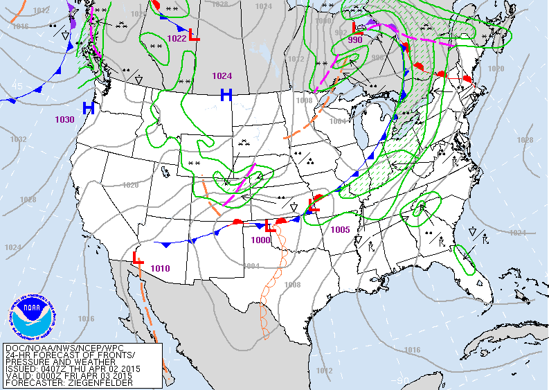
Map above shows the cold front moving through the Ohio Valley with lots of weather turbulent weather ahead of it. Cooler drier air Plains and Rockies.
Picture
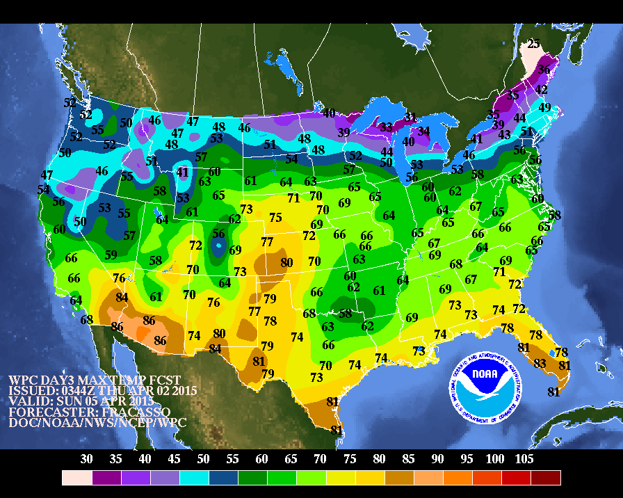
These are expected afternoon temperatures for Easter Sunday. Most of the Nation.../mild to warm with the exception of the Northern border states. Best chance of wet weather...lower Mississippi Valley and Pacific Northwest.
Be safe.
0 Comments


Leave a Reply.

    Genesis of a Tornado
    We'll have daily weather discussions, talking about major systems on the horizon along with anything noteworthy that pops up on our radar.

    Pat Pagano,
    Mike Merin

    Follow us on Twitter and like us on Facebook to get updates whenever we post a new entry!

    RSS Feed

Powered by Create your own unique website with customizable templates.