
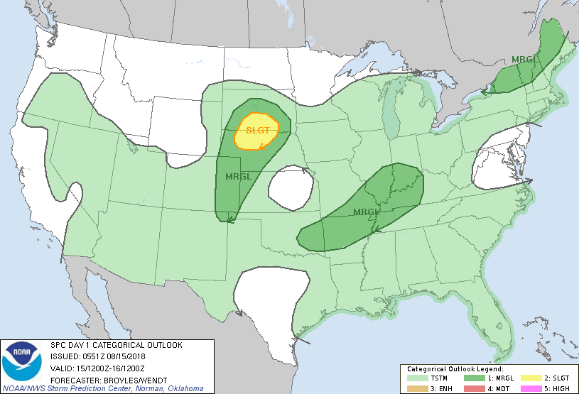
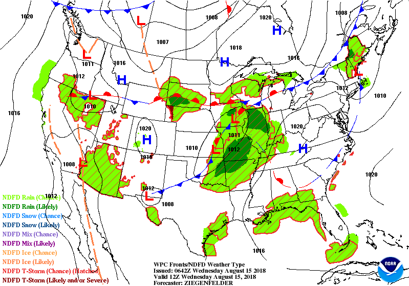
Satellite + radar above shows one swirling low moving out across New England putting an end for now of all the flooding rains. The next one in Midwest will head east and affect the East Friday and the weekend. Below- today's threat of severe weather in dark green and yellow.
Animated maps below followed by rainfall amounts for next 5- 7 days. Notice....heaviest rain in same places it has been this summer.
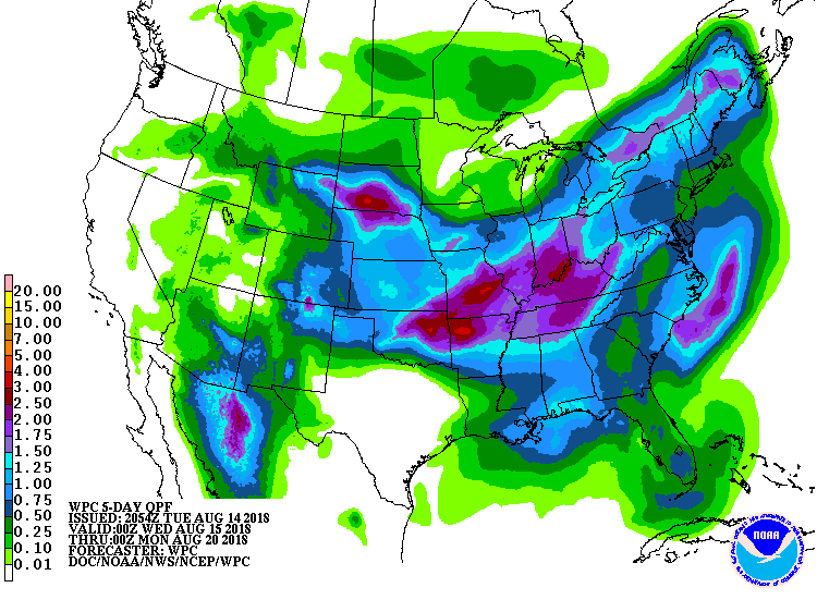
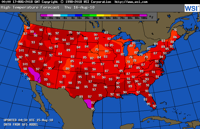
We don't see any significant break in this weather pattern for rest of this month. Lastly - Thursday's high temps......very warm to hot for most of the Nation.
Be safe.
Be safe.

 RSS Feed
