
We can now see the southern jet from The Pacific thru Gulf of Mexico and off the Carolinas. This will result in more wetness next week...but milder for the East. Moisture over Texas panhandle and Central Canada will combine to produce a swath of snow and wintry mix Sunday in Midwest and then Northeast by Monday.
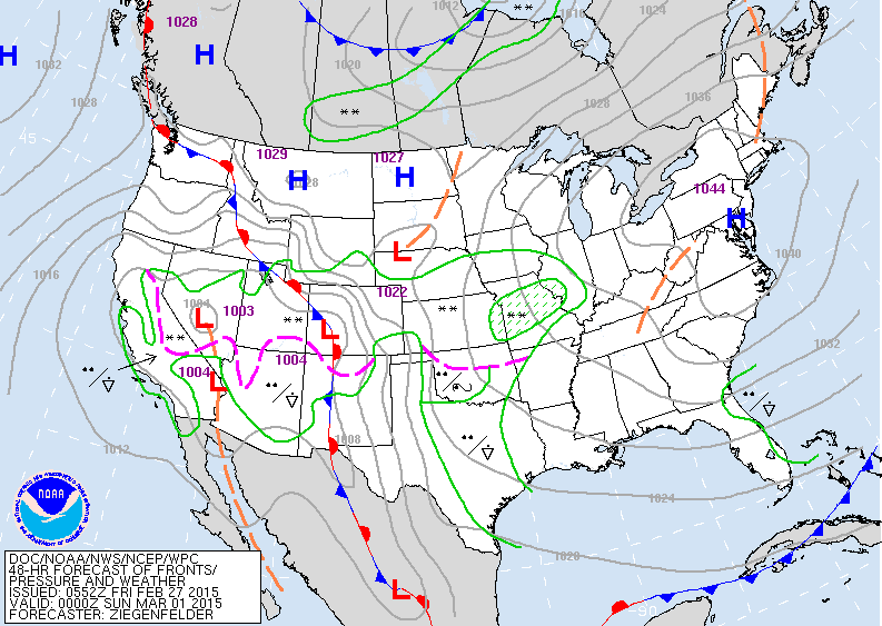
Map above is for Saturday evening. Fair in the east. Large area of snow...rain...from Central Plains to West Coast...all moving north and east.
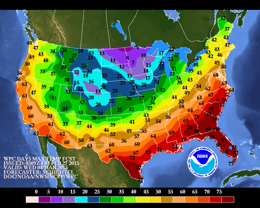
High temperatures expected next Wednesday....notice 47 at Boston....melting snows.........50 NYC & Washington DC...and even Chicago going to 32.
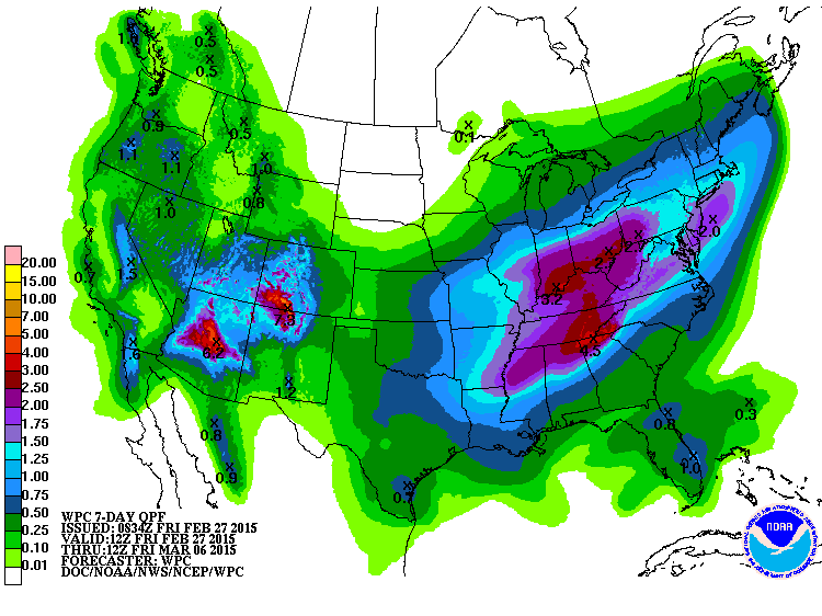
Chart above shows amounts of precipitation for the next 7 days. This is likely to cause flooding in Northeast and Mid Atlantic when combined with snowmelt.
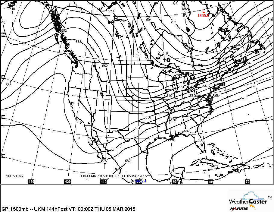
This chart shows the upper air flow next week. The southwest flow means milder - wetter eastern half...but colder western half. Be safe...have a nice weekend.

 RSS Feed
