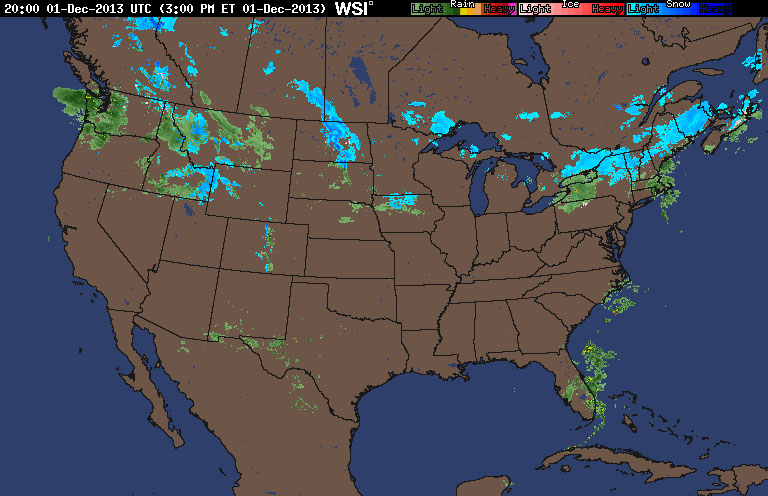
A look at the current radar for today shows the Northern third of the nation filled with regions of rain and snow. Of course if you go down to the Southern parts you'll see temperatures in the 70's so it's hard for some people in say, Minnesota who are getting almost a foot of snow over the next few days, to imagine a thunderstorm still pass through at this time of year.
That being said though, it'll be up and down as far as the quality of days we'll have across the US.
Starting in the NY metro area, today's very pleasant day will also be true for Monday and Wednesday, but early Tuesday and late Wednesday through Thrusday there will be a chance of rain moving through.
Moving to the Northern Mid-West in places like Minnesota or North Dakota there will be up to a foot of snow over the next few days with blizzard-like conditions before the temperatures nose-dive into the teens with lows well below zero.
The Northwest will have rain, then a drop of temperatures leading into snow, and then another drop in temps into the teens. The same can be said for the Southwest if you take out any precip. Oh, and of course shift the temperatures up 50 degrees (there will be winds between the two regions of course with that big of a difference).
Finally the South and Southeast: it's the opposite of everything else: a sunny and pleasant first half of the week leads into showers and thunderstorms. Here's a snapshot of Thursday just as an example:
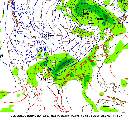
The South, SE, and parts of the East will see the turbulent weather as it dips down from the NW.
So now that all those directional forecasts are out of the way, for those in the Northeast in the NY metro area and in the southern parts of New England (okay I'll stop already with the directions), just simply enjoy the next two days.
-Mike Merin
So now that all those directional forecasts are out of the way, for those in the Northeast in the NY metro area and in the southern parts of New England (okay I'll stop already with the directions), just simply enjoy the next two days.
-Mike Merin

 RSS Feed
