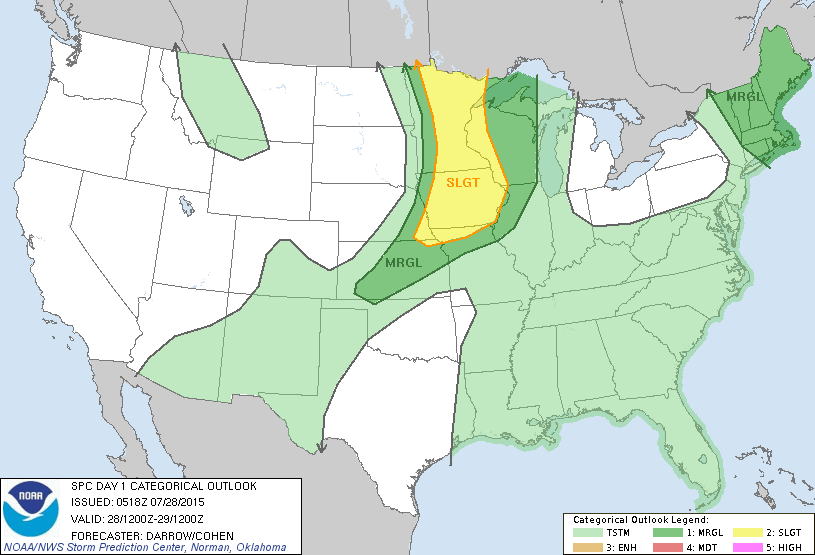
Heavy to severe thunderstorms from Dakotas moving into upper Midwest. Some storms across Nothern New England....but all of this will pop even more so this afternoon.
Today's severe risk...dark green and yellow.
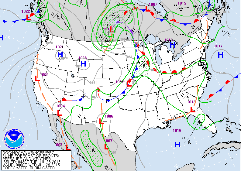
Best chance for storms today Upper Midwest with cold front. Elsewhere....random summertime storms.
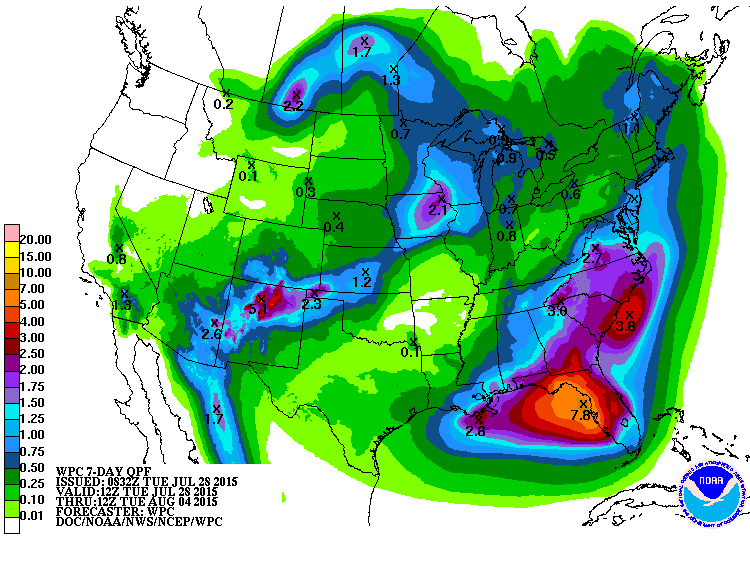
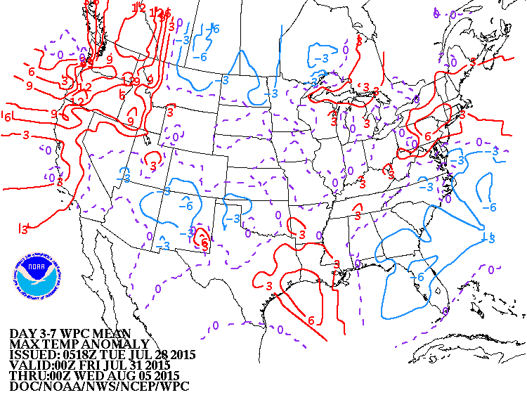
Rainfall amounts expected over the next 7 days....again...heaviest from Carolinas to Florida. Below...how daytime temperatures will average for next 7 days.


 RSS Feed
