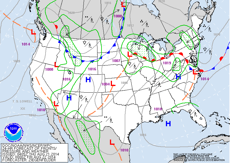
Above - warm front (red semicircles) will produce some showers and t-storms in NE and MidAtlantic. Heavier storms
Gt. Lks into Midwest. Cold front over Dakotas will bring some chilly air to Plains and Rockies this weekend...and
even some snow to higher elevations.
Gt. Lks into Midwest. Cold front over Dakotas will bring some chilly air to Plains and Rockies this weekend...and
even some snow to higher elevations.

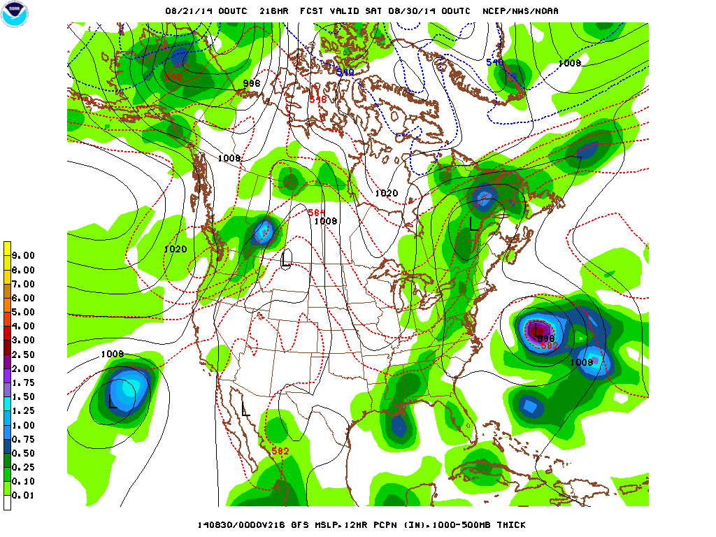
Rain total expected for the next week. Green = lightest, red = heaviest. Upper Midwest to Rockies...could see over 4" of rain in next 7 days.
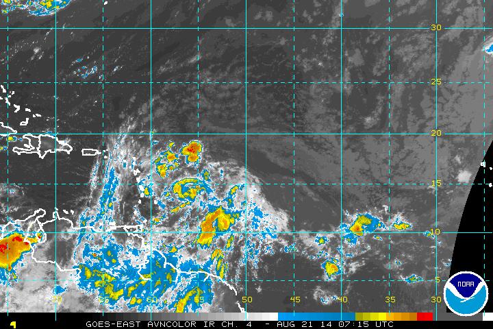
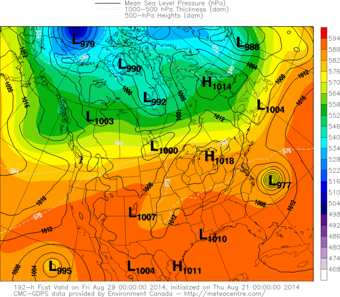
Tropical wave just east of Northern Windward Islands may be investigated today. Models take this storm northwest then North...staying off the East Coast all next week. Below..you will see what The GFS and Canadian Models are doing with it. Meanwhile...cool air moving to East coast is expected to keep the storm offshore. Later.

 RSS Feed
