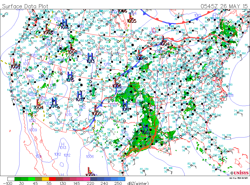
Early morning weather map shows a front from Texas to Great Lakes. This has resulted in a squall line with life threatening flooding in Houston area overnight. The wet soggy weather shifting slowly east all week.
Satellite/radar overlay shows the heavy rain and storms in Texas and Louisiana...heading east and north. Showers over New England heading out.
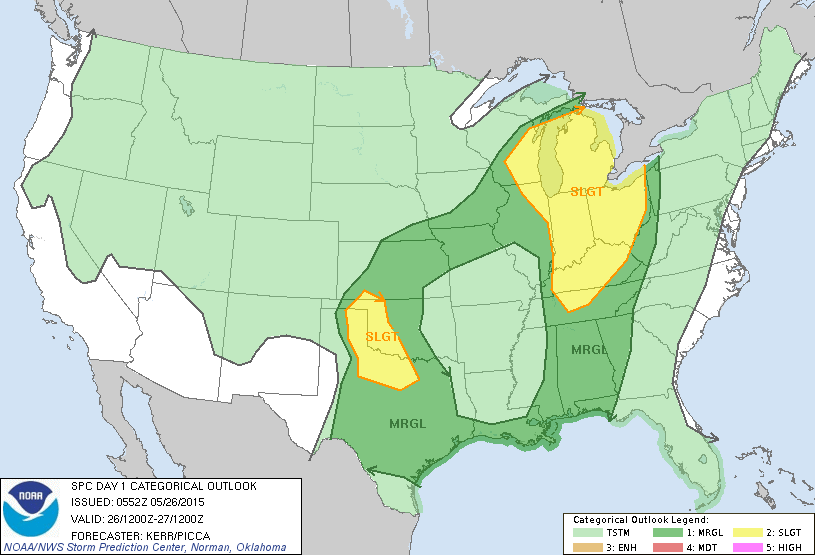
Greatest threat of severe weather today highlighted in yellow.
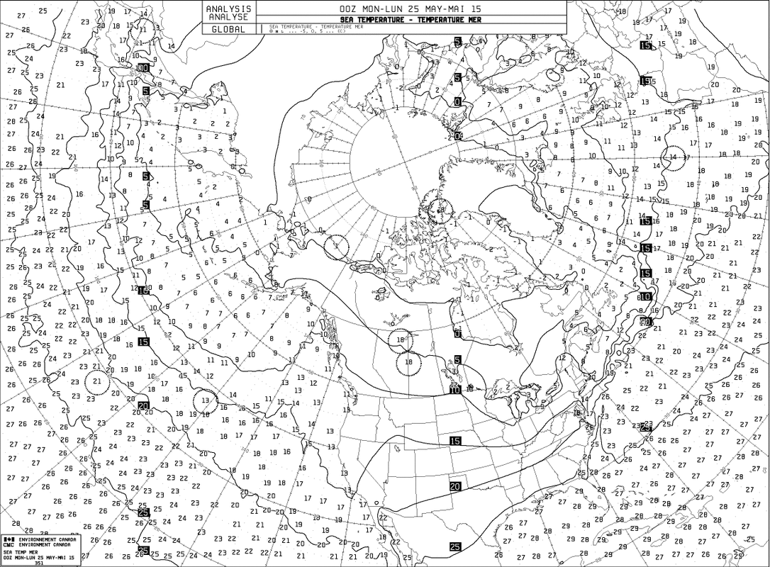
Above....water temperatures for Atlantic and Pacific. They are in Celsius...but clearly very warm over the Atlantic Basic and Gulf...in mid 80s.
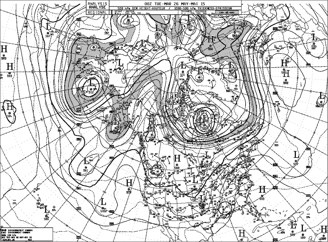
Map above is at 500 Mb or 18,000 feet. It shows a strong ridge off the East coast responsible for warm and more humid weather there. Dip or "U" shaped pattern in Plains is a trof and it is responsible for kicking up all of the wet and severe weather.
It moves east slowly as the high ridge slowly erodes during the week.
It moves east slowly as the high ridge slowly erodes during the week.
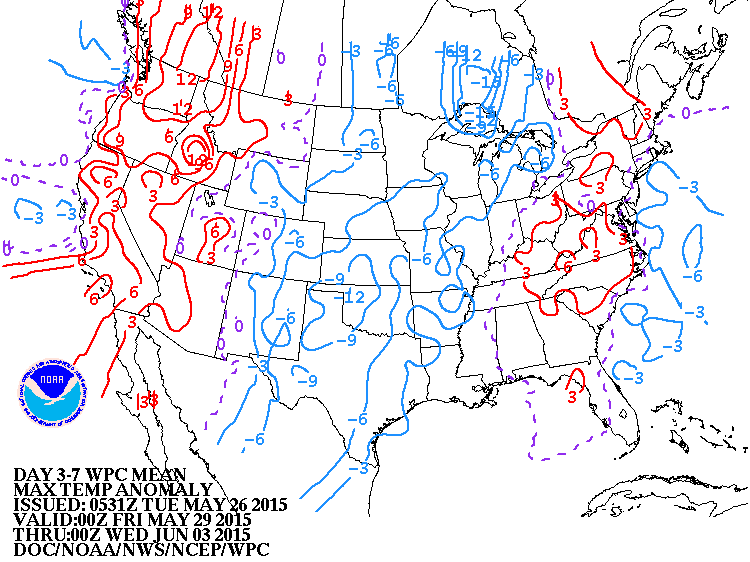
Map above is for the next 7 days...thru June 2, 2015. It shows how daytime temperatures will AVERAGE. Red is above...Blue is below. Most of the blue area is below due to persistent clouds and wet weather. Be safe....

 RSS Feed
