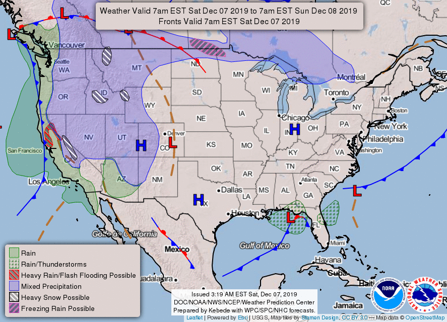
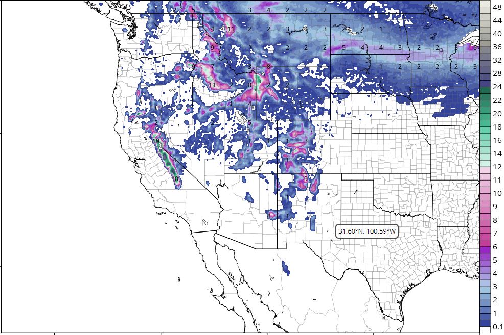
An upper level low just off the West Coast will slide southeastward into the Southwest by Monday. This will result in heavy rain over parts of Northern California and heavy snow in the higher elevations through Sunday morning. Due to the recent burn scares left from wildfires in the vicinity, the heavy rainfall could produce areas of flash flooding on Saturday. The rain and snow will begin to taper off by Sunday evening.
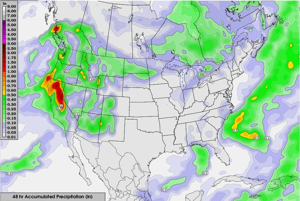
Meanwhile, an area of low pressure will move southward from Canada and into the Pacific Northwest by Sunday. This system will generate rain and higher elevation snow across those areas today. This storm will then move eastward stretching from the Northern Plains by Sunday afternoon and into the northern Great Lakes by Monday. It will produce a swath of snow as it does so with accumulations ranging anywhere from 1-4 inches.
Hope everyone has a great weekend!

 RSS Feed
