October starts next week and reaching 80 degrees will soon start to become a statistical improbability. This last weekend of September however will see a few areas reach over 80. A tall ridge across the Eastern US brings sunshine and warm air through the weekend from the Northeast, out to the Midwest.
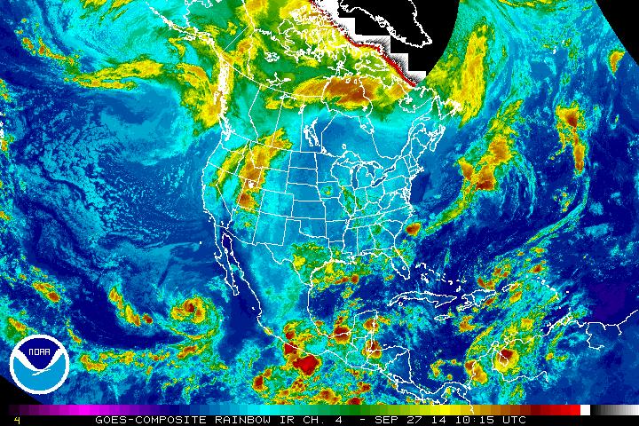
On the infrared image above, the air flow through the jet stream can be seen moving down the west coast, and up north through the Rockies into the southern Canadian region and continuing eastward into the Atlantic. High pressure along the eastern part of the jet will be settling in for the next few days, resulting in the aforementioned sunny & warm weather.
In the Southeast, another wet weekend is on tap with moist, unstable air along the Gulf Coast moving east-northeast through the weekend. Scattered rain showers and thunderstorms are possible along the immediate Gulf Coast today and will shift into Georgia and the Carolinas for Sunday and Monday before drying out mid-week.
Out west, temperatures are expected to heat up a bit as a ridge moves in behind the trough currently building out in the region. In Southern California, 90's could be reached late week with areas along the San Francisco bay area reaching over 80 to start October.
- JL
Out west, temperatures are expected to heat up a bit as a ridge moves in behind the trough currently building out in the region. In Southern California, 90's could be reached late week with areas along the San Francisco bay area reaching over 80 to start October.
- JL

 RSS Feed
