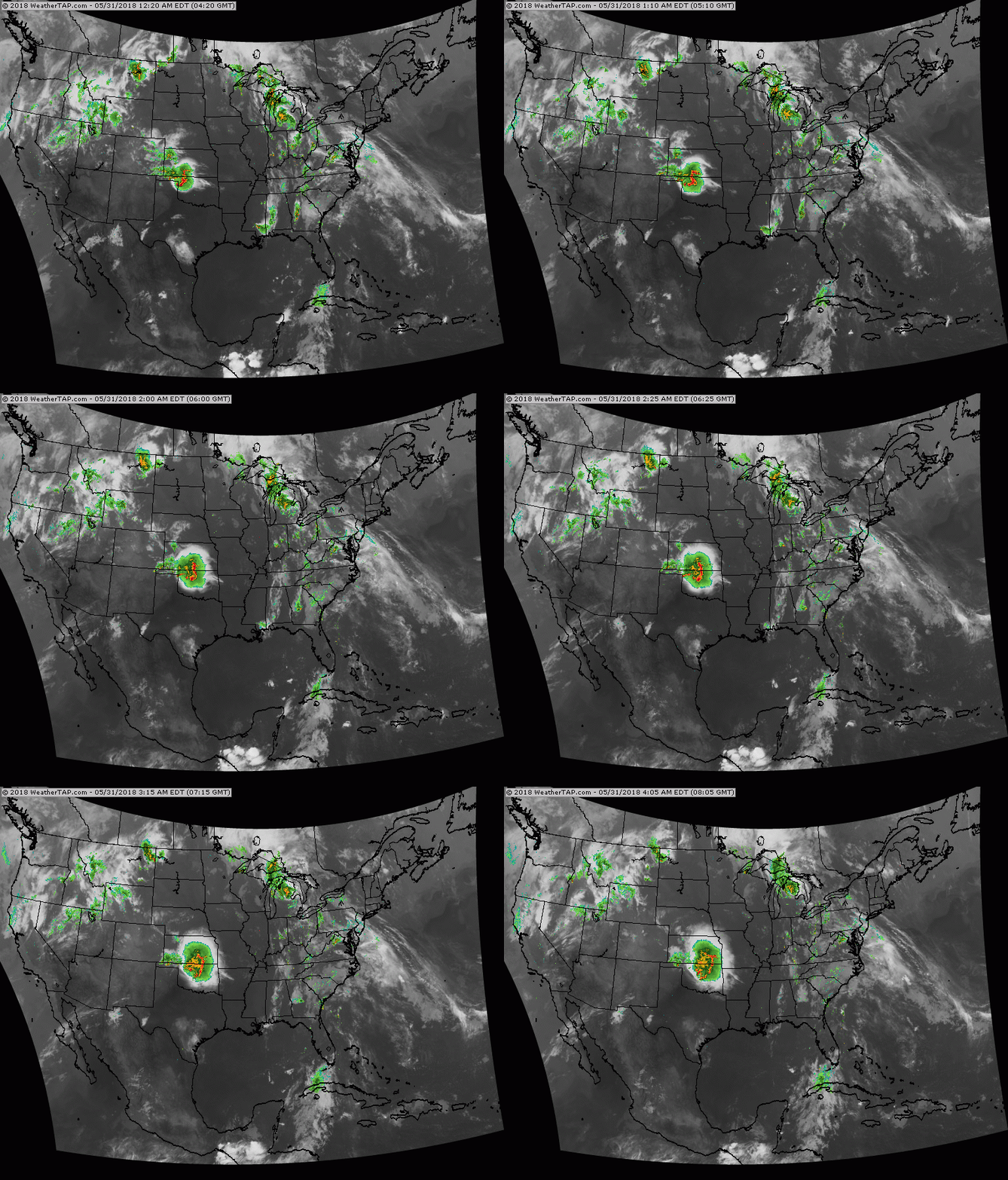
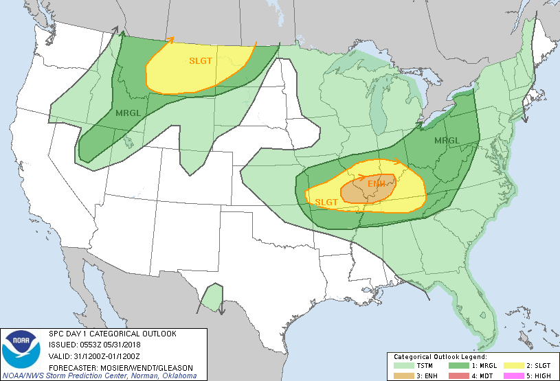
Satellite-radar shows moisture from Great Lakes to Southeast....moving north and this flow not likely to change into weekend. Heavy thunderstorms in So. Plains moves east to join this band over next couple. Showers in No. Rockies make it to Northeast early next week to continue an unusual spell of wet - unsettled weather. Below - today's risk of severe weather in dark green...yellow and tan.
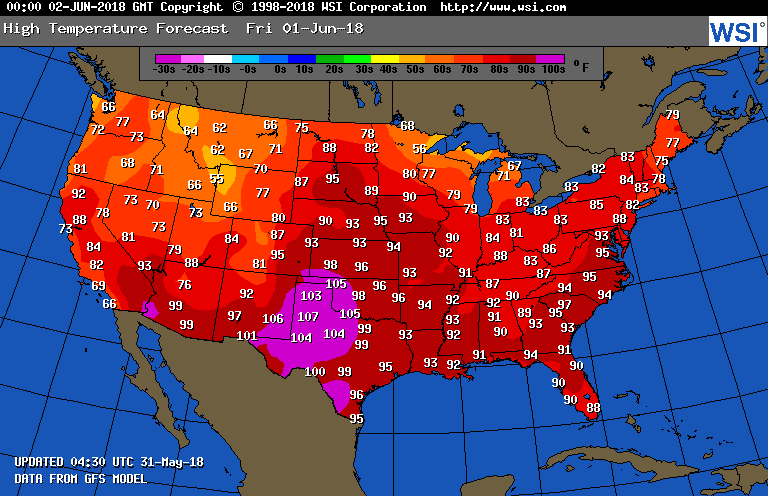
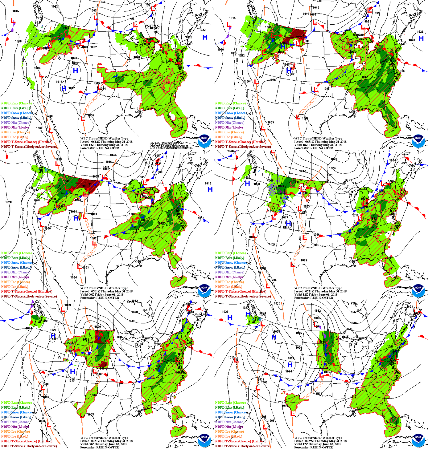
Below - temperatures for Friday. Heatwave in South Central. Followed by animated maps for the next couple.
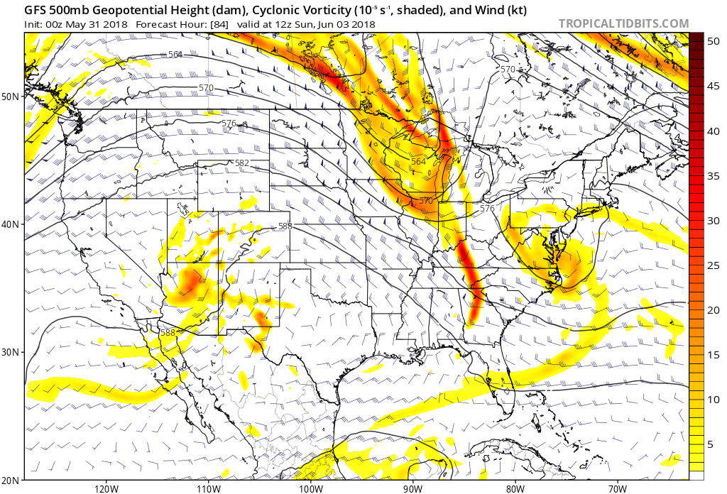
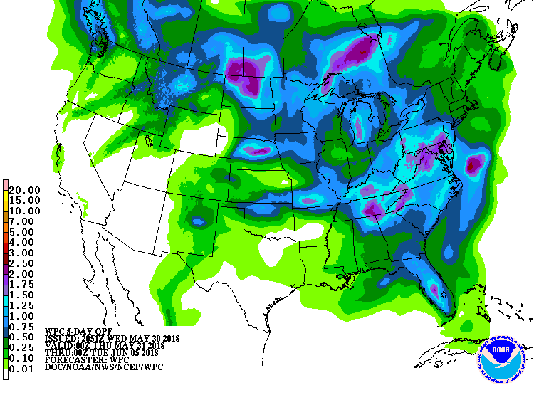
The upper air will produce a trof over the Northeast this weekend...which will cause a low off the Midatlantic with wet weather . Another trof over the Great Lakes will dive in to reform this trof next week with another storm off the Mid Atlantic. It all means cooler than normal and wetter than normal for the Northeast and Mid Atlantic. Below - upper air for Saturday...followed by amounts of rain for the next 5 days. Be safe.

 RSS Feed
