
Storm system in Plains will continue to bring central U.S. lots of rain and storms. System off lower Atlantic Coast will be subtropical and should meander there for a time.
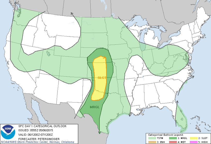
Threat of severe weather today....dark green and yellow.
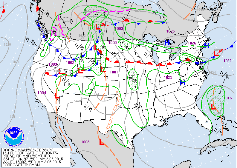
Today's map shows showers along a front from Daktoas to Mid Atlantic. Fronts over Rockies also will bring wet weather there with thunderstorms across the Plains.
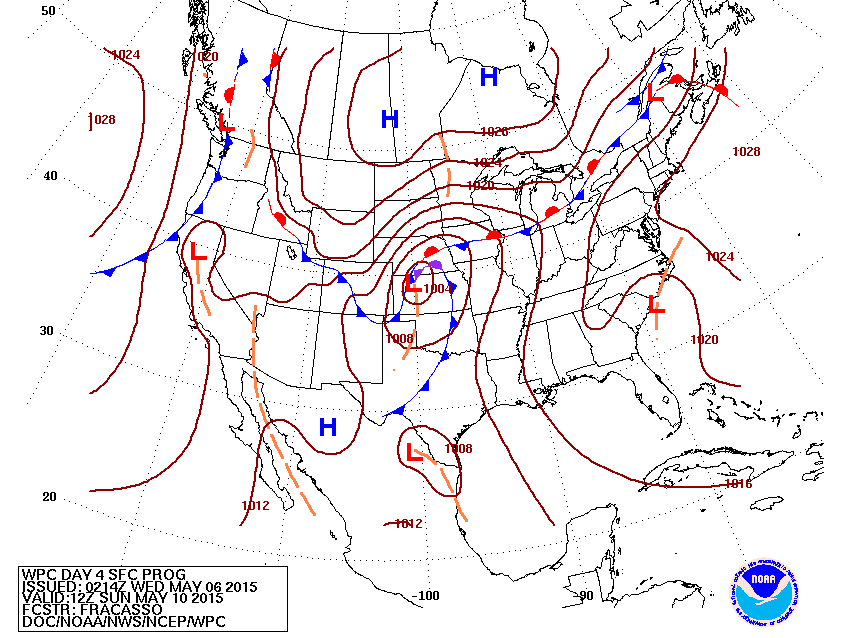
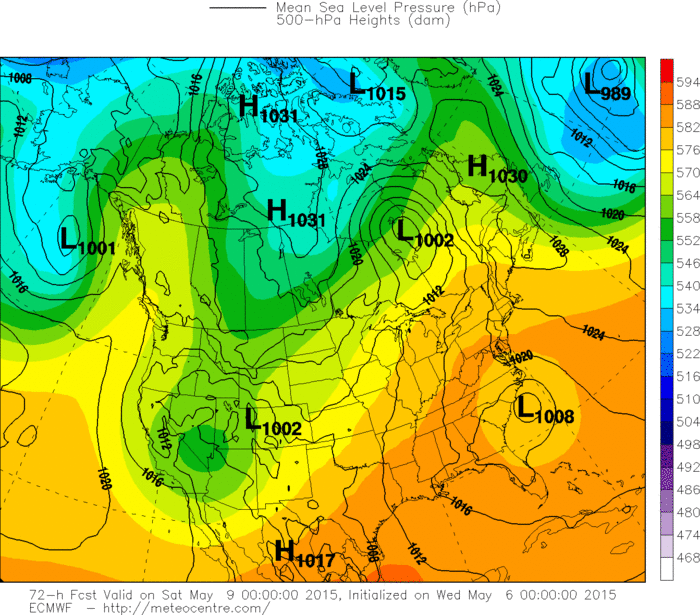
Map for Sunday - Mother's Day. Worst weather should be in the Plains with storm pulling out of The Rockies. Tropical like low over Carolinas will wring itself out.
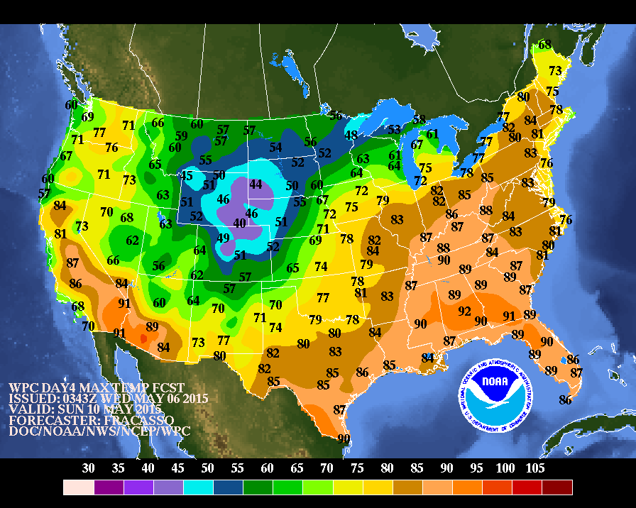
Expected day temperatures for Sunday. Warm east - cold Rockies and Plains.
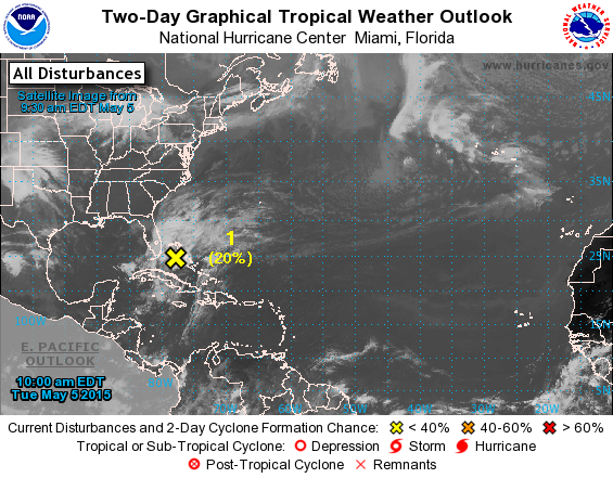
Tropical like low over Bahamas given a 20% chance next day or 2 but up to 40% chance over next 3-5 days of becoming a tropical depression or storm.
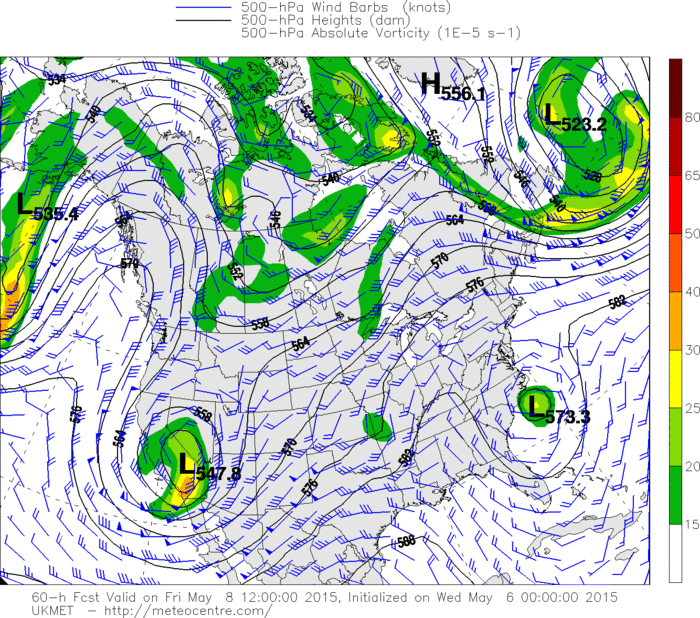
This is the upper air at 18,000 ft for Friday. Low off N.Carolina is cut off from westerlies therefore the surface low will move or drift little. The Euro model reflects this in its position as you will see below....so it bares watching.
Be safe.
Be safe.

 RSS Feed
