Metro Weather Inc. Services
Like us, follow us, link to us, contact us!
  • Home
    • Daily Weather Discussion
  • Weather Prepared for You
    • Film and TV Production
    • Radio & Television
    • Government and Industry
    • Forensic Services >
      • Weather Record Request Form
    • Metro Morning Monitor
  • About Metro Weather
    • Senior Staff
  • Your Weather Images
  • Contact Us

Springlike now, big changes next week.....

4/16/2015

0 Comments

 
Picture
This satellite/radar shows moisture from Midwest to Carolinas to Gulf States all moving northeast. Sprawling area in Rockies will evolve into a major rain event over weekend.
Picture
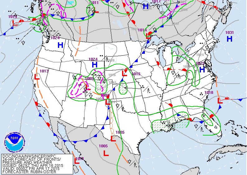
Map for this evening. Area of showers in Ohio Valley work into Northeast.  Wet weather prevails in Gulf States. Rain and snow in Rockies moving east and will be a major player this weekend into early next week.
Picture
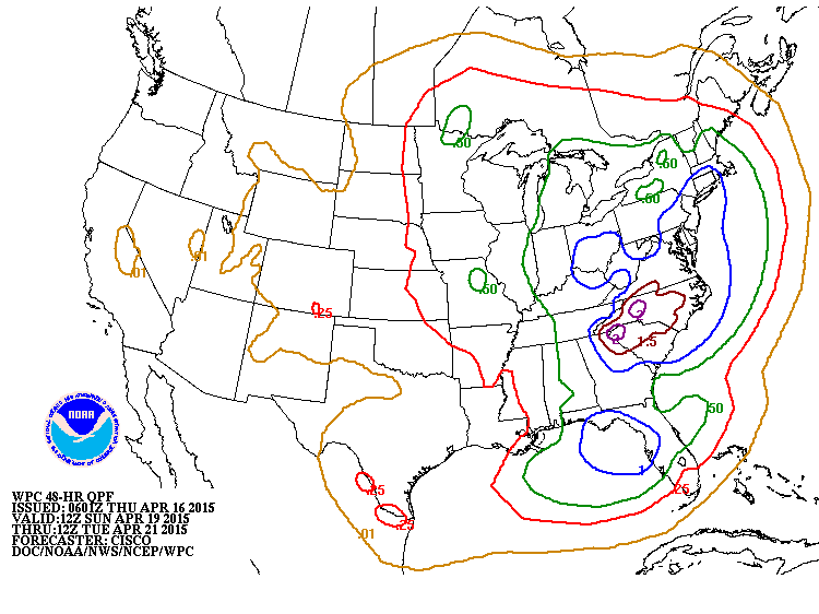
Amounts of rain expected with Rockies storm from Sunday night into Tuesday morning. Notice how dry the west continues to stay.
Picture
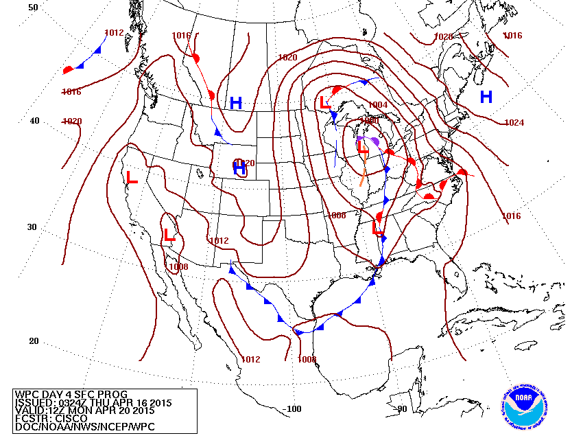
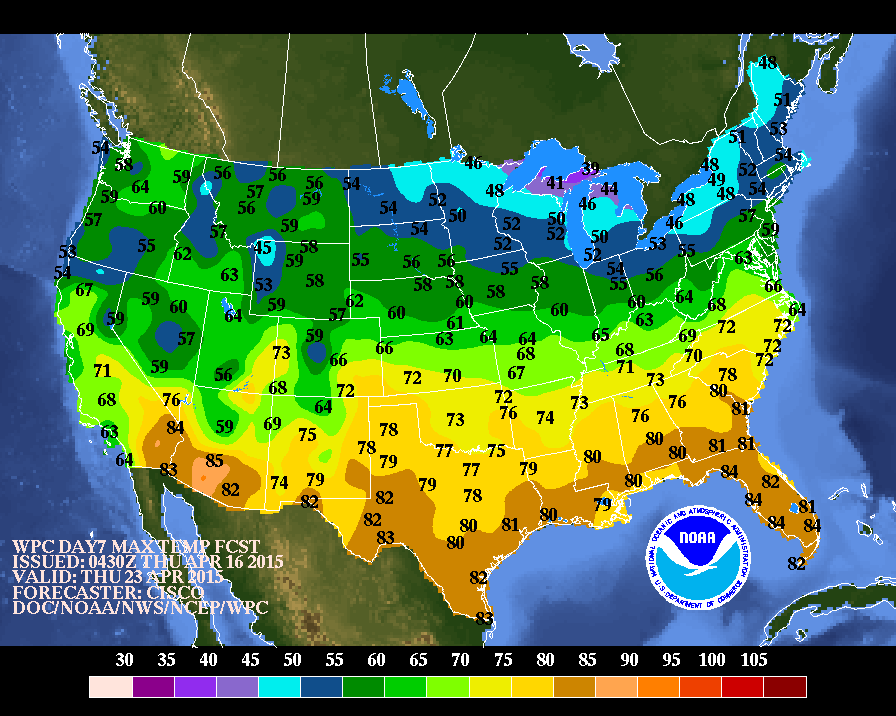
Weather Map for next Monday.  Rockies storm in Great Lakes will large area of rain and storms for the Eastern half of the Nation.  Behind the storm....it's going to get unseasonably cool...especially in the north. Below...look at temps. expected next Thursday for afternoon highs. 
Be safe.
Picture
0 Comments


Leave a Reply.

    Genesis of a Tornado
    We'll have daily weather discussions, talking about major systems on the horizon along with anything noteworthy that pops up on our radar.

    Pat Pagano,
    Mike Merin

    Follow us on Twitter and like us on Facebook to get updates whenever we post a new entry!

    RSS Feed

Powered by Create your own unique website with customizable templates.