
Moisture in center of the Nation will head east with plenty of wet weather for the southern half of the nation and threat of severe in the Plains today. Chilly air with freeze watches for the Northeast. More unsettled weather in the NW.
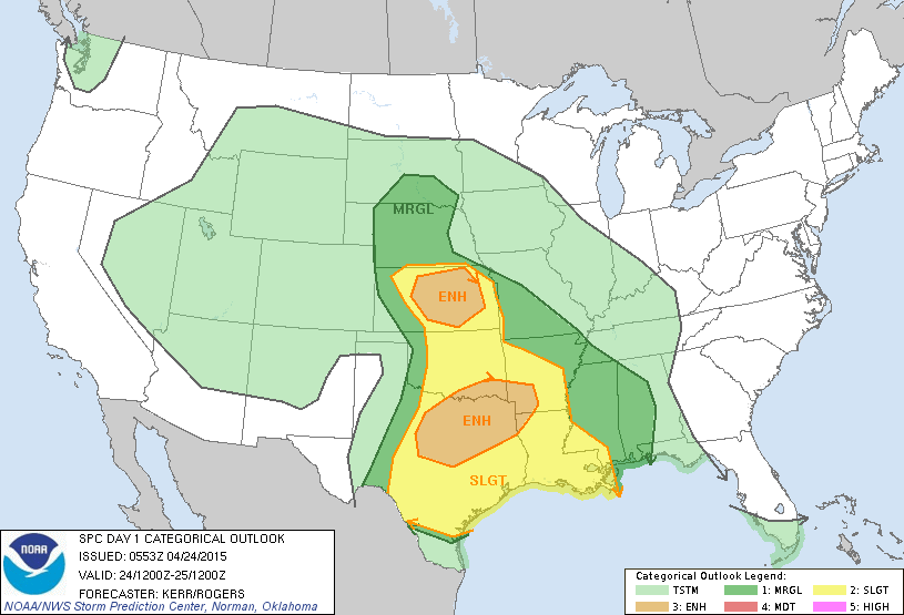
Large threat for severe weather today in Plains.....yellow and brown indicate the strongest chances.
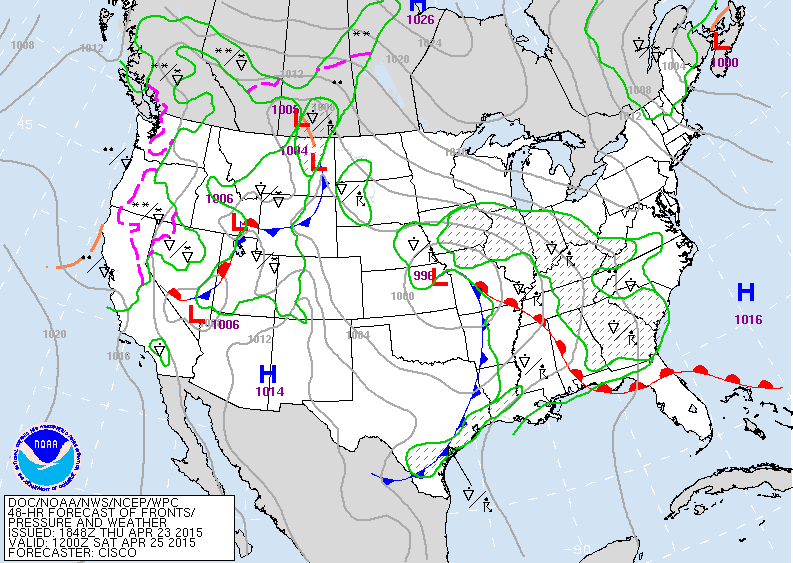
Above...map for Saturday showing storm in Mid Mississippi Valley with widespread rain and storms from Midwest thru Gulf States and Carolinas. More unsettled weather headed into The Rockies. Fair in Northeast and Mid Atlantic.
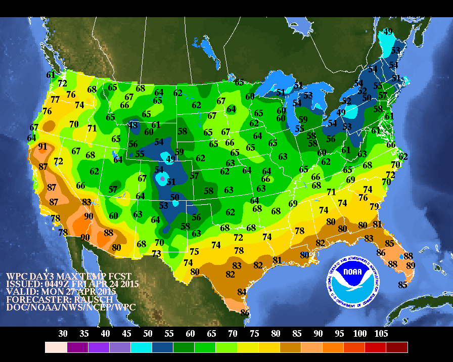
Above....afternoon high temperatures for Monday. Notice that the warm air is suppressed far south and west. That's the same reason why the storm projected by some models for late next week will do likewise....stay south.
Enjoy your weekend...be safe.
Enjoy your weekend...be safe.

 RSS Feed
