First off before I get into this blog post, the upcoming cold is NOT caused by the Polar Vortex. I'll explain that shortly.
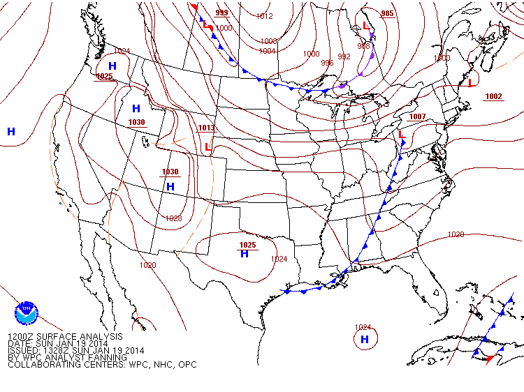
For the NY Metro area the average lows are around 24° for this time of year and come Tuesday the HIGH will be just that. Granted those of us who had the misfortune of having to be outside during the shift of the Polar Vortex when highs were in the teens and lows in the single digits, we'll still be feeling the chill. The cause? An Alberta Clipper passing through that is currently crossing the US border as we speak (as shown below). Just keep in mind when looking at it that the Low that's north of the Great Lakes isn't what we're keeping an eye on, it's the Low that's in Saskatchewan, or the Canadian Provence just above Eastern Montana if you're not sure which one that is.
For the NY Metro area the average lows are around 24° for this time of year and come Tuesday the HIGH will be just that. Granted those of us who had the misfortune of having to be outside during the shift of the Polar Vortex when highs were in the teens and lows in the single digits, we'll still be feeling the chill. The cause? An Alberta Clipper passing through that is currently crossing the US border as we speak (as shown below). Just keep in mind when looking at it that the Low that's north of the Great Lakes isn't what we're keeping an eye on, it's the Low that's in Saskatchewan, or the Canadian Provence just above Eastern Montana if you're not sure which one that is.
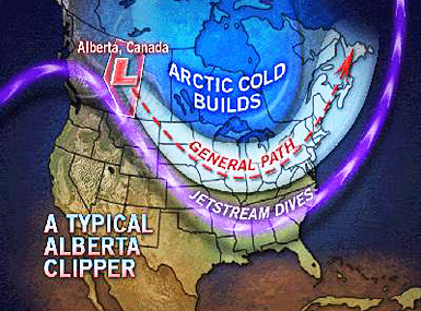
Now it's time to clear up the misconceptions. This Alberta Clipper is a normally occurring weather phenomenon that we see during the colder months. The Alberta part is because the cold air we see comes from the Canadian Province of Alberta (also includes air from BC and Yukon as well), and the Clipper means it is fast moving and has a low pressure system.
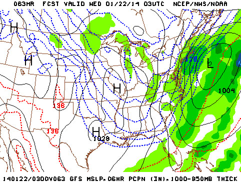
If you take a look at the surface map I posted above and at the picture below of Tuesday night, you'll see how that low pressure system I pointed out will pass through and end up just east of the NY Metro area, while also driving down the colder air well into the Deep South (represented by those blue lines).
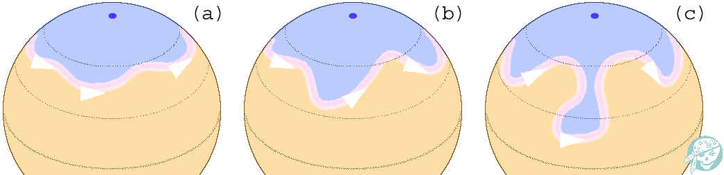
This isn't the shift of the Polar Vortex. Notice I said shift of the Polar Vortex, not "this is a Polar Vortex." The Polar Vortex is just the name of the colder air that sits at the south and north poles; it's the shift of it towards the US that caused the frigid temperatures two weeks ago. Without getting too deep into the terminology and talking about the Earth's convection cells (though feel free to look that up at your own leisure if you'd like), take a look at the pictures below to show what this is.
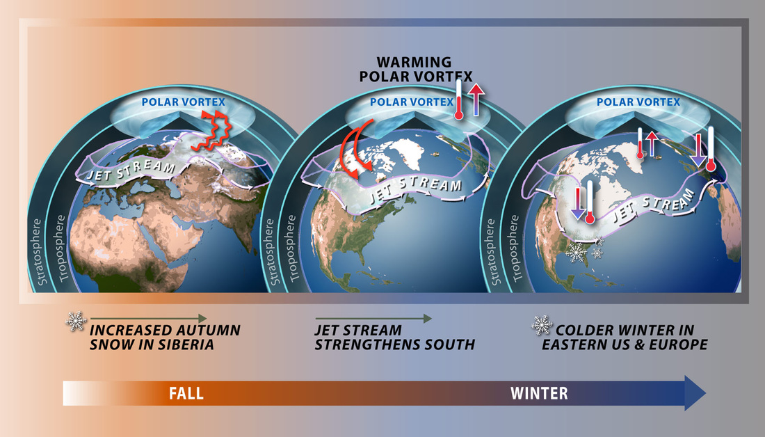
You know the lines of latitude on a globe? Think of it this way: they form a circle as they go around the Earth, and the Polar Vortex is normally centered on the pole itself. When it shifts, the circle literally moves and the center of that circle moved from the pole towards us. There's something else that can happen though. You've heard of the jet stream dipping down correct? Well that circle of the Polar Vortex is really a wobbly line represented by troughs and ridges (Pat always posts the Canadian models that show this). As you can see below, sometimes those get exaggerated and can pile up and then tip well south as shown below.
So brace for the colder temps come mid-week, and use what I just said to impress your friends and explain to them the real reason it's happening.
-Mike Merin
-Mike Merin

 RSS Feed
