
Old front is draped over the south and satellite shows moisture from Gulf to Carolinas.....fact # 1. Energy is seen in Central Plains - fact #2. Cold air is moving across the Lakes into the Northeast - fact #3.
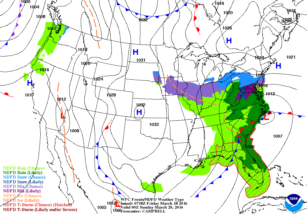
Map above for Saturday evening. Duo storm system in the southeast spreading snow to Mid Atlantic. While I don't see this storm becoming a monster...it may loop more northward and hit the Northeast will a plume of moisture that could result in heavy snowfall Sunday- Sunday night. On the other hand...if it stays just offshore...only light snow is possible. You will notice in all of the models below...that the majority has the storm closer to the coast as compared to further away. Very Interesting !
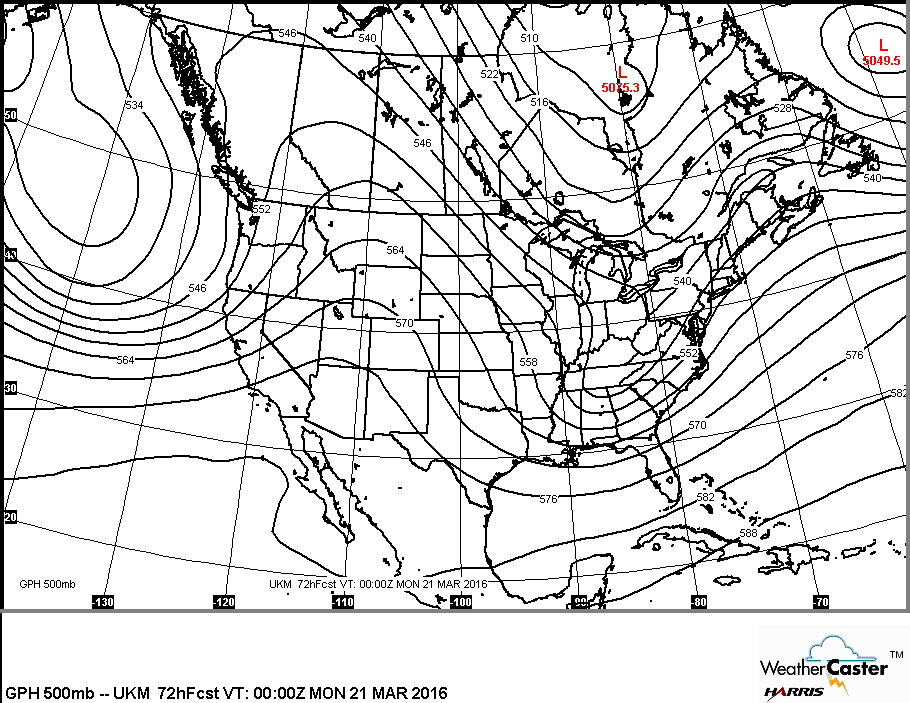
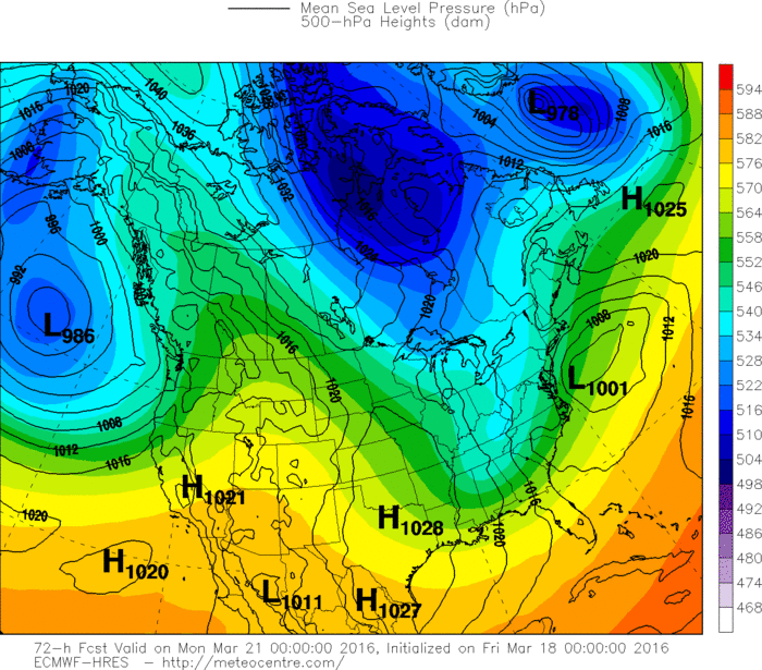
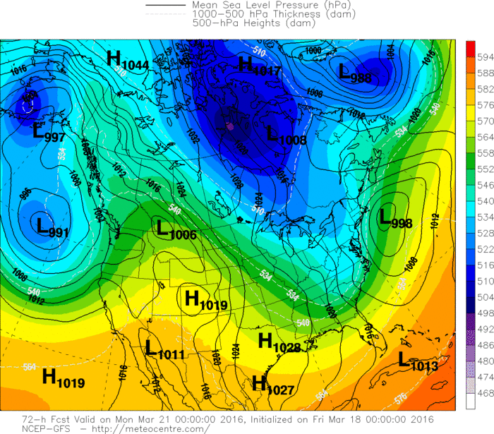
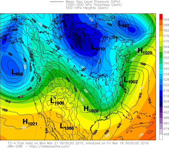
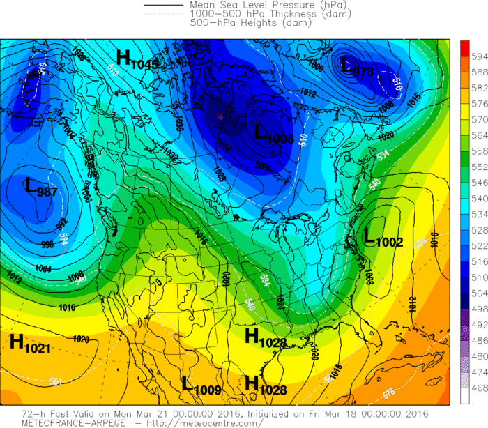
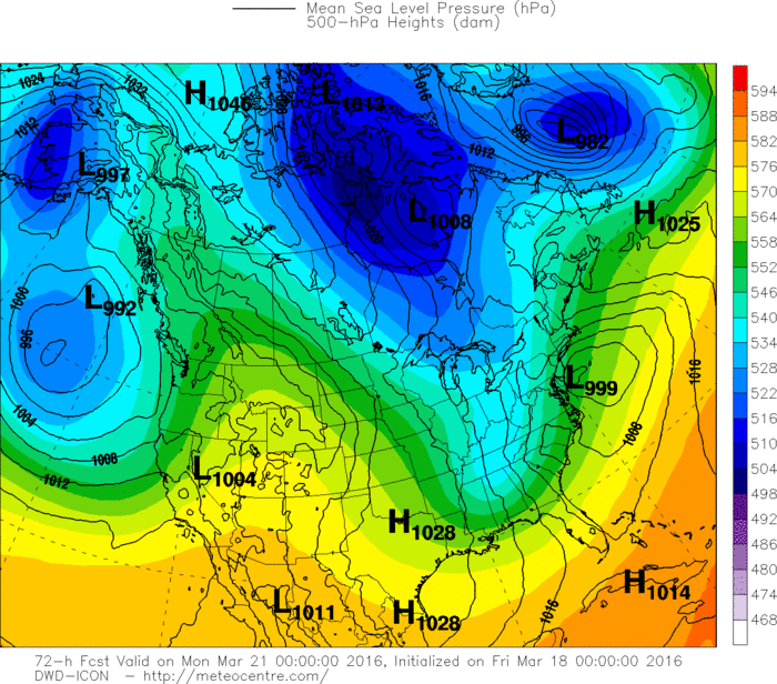
This map would lean toward heavy snow for much of the
Northeast of 6" or more. Below.....upper air maps which show enough energy for this low to pack a punch. I don't see the
trof taking on negative tilt until Monday...as which time it will be off Nova Scotia.
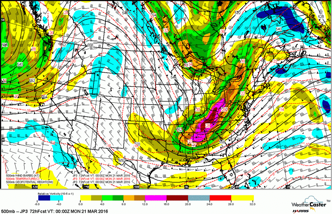
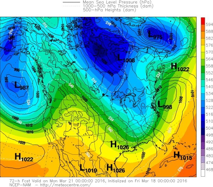
Northeast of 6" or more. Below.....upper air maps which show enough energy for this low to pack a punch. I don't see the
trof taking on negative tilt until Monday...as which time it will be off Nova Scotia.
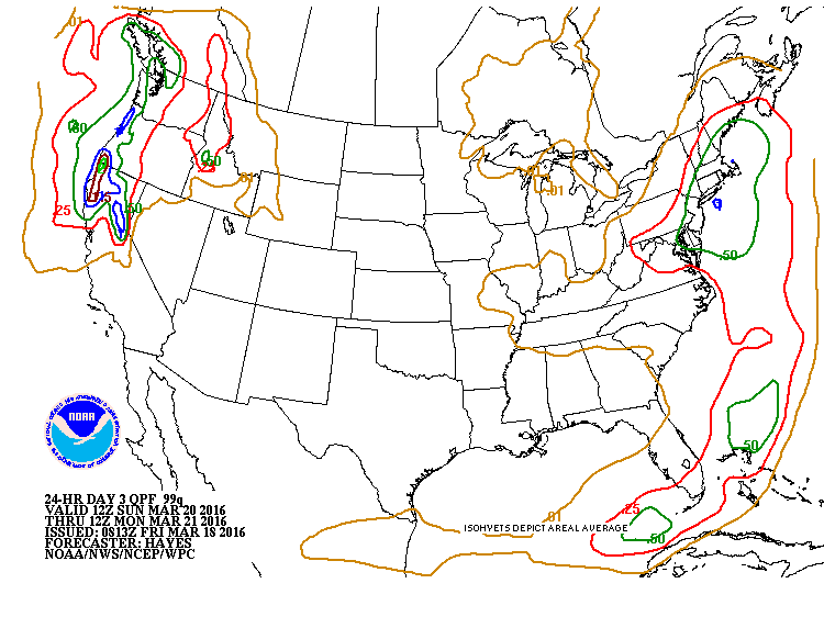
Finally...the models. Notice how the majority keep storm closer to the coast. Northeast ......keep the shovel handy. Have a nice weekend and Spring arrives at 12:30 am SUnday.


 RSS Feed
