
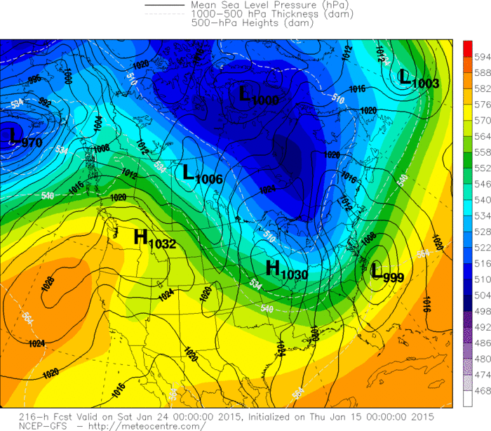
Light blue over Great Lakes is the next front which will bring another shot of cold air east into The Northeast.
System in the Pacific Northwest also heads east by Sunday and it will be combine with moisture over the Gulf to bring
heavy rain along the East Coast Sunday into Monday.
West of the I95 corridor...rain will be a wintry mix tending to change to snow in higher elevations by Monday.
System in the Pacific Northwest also heads east by Sunday and it will be combine with moisture over the Gulf to bring
heavy rain along the East Coast Sunday into Monday.
West of the I95 corridor...rain will be a wintry mix tending to change to snow in higher elevations by Monday.
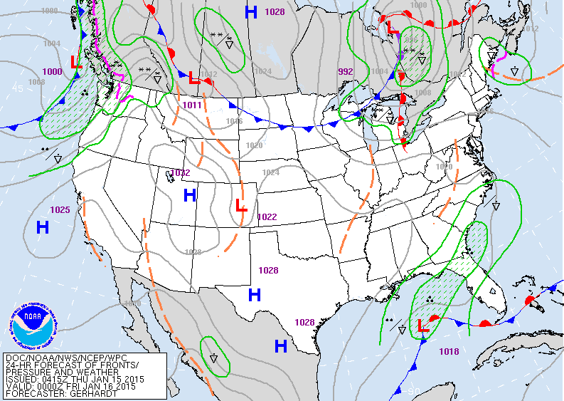
Above...valid for this evening. Front over Gt. Lks will bring in colder air....while low in Gulf moves slowly northeast to Carolinas this weekend. Lastly...system in Pacific Northwest heads east.
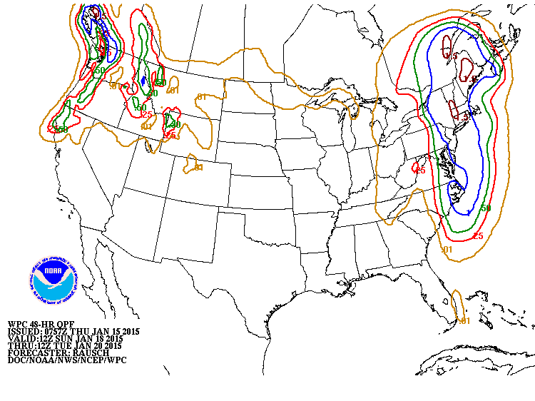
Above....amounts of rain expected Sunday into Monday.
East coast.... 1.00" to 1.50"....mainly rain....otherwise that
could have been 10"- 15" of snow.
East coast.... 1.00" to 1.50"....mainly rain....otherwise that
could have been 10"- 15" of snow.
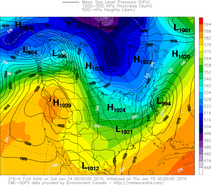
Above...Canadian model for late next week. Winter storm
for Northeast....Dry and warmer west. Below...other 2 models.
for Northeast....Dry and warmer west. Below...other 2 models.
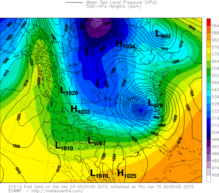
Unlike the Canadian...The Euro Model has a very intense storm over SE New York. This model would bring a blizzard to Western NY and Pa.....while Canadian would
want to keep snow closer to the coast.
want to keep snow closer to the coast.
GFS Model would want to keep the storm further offshore...which is a typical bias of this model so far out.
We will likely see these models converging next week.
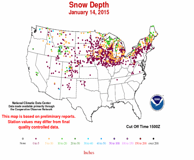
LASTLY - BELOW....current snowdepth across the area.
Be safe.
We will likely see these models converging next week.
LASTLY - BELOW....current snowdepth across the area.
Be safe.

 RSS Feed
