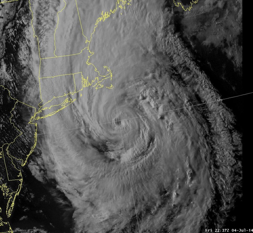
Arthur (shown below yesterday evening) has moved on after bringing a wet start to the Fourth of July holiday weekend to much of the East Coast.
Following Arthur though is a beautiful stretch of sunshine and dry air through across the eastern half of the US.
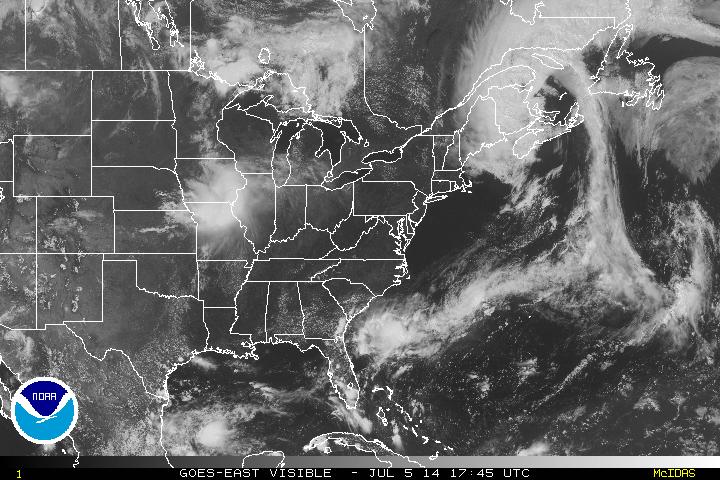
As you can see above, Arthur has become an Extratropical Cyclone as it moves through Canada. The tropics right now show no threats for cyclone formation in the near future...
The clouds moving through the Midwest producing rain and thunderstorms will not progress each much with high pressure controlling the Eastern US through the weekend and into next week. Low pressure stationed in Manitoba, Canada will move due east into next week with the resulting trough producing numerous scattered showers and thunderstorms across the Northeast. Temperatures will heat up a bit into the mid-week but generally be seasonable as July kicks into gear.
- JL

 RSS Feed
