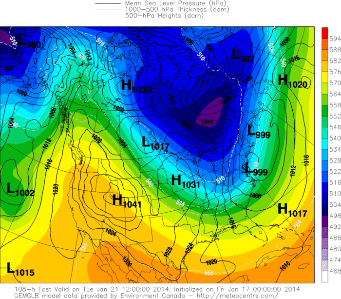
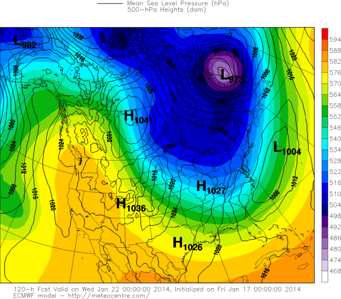
You do not have to be a meteorologist to see the jet stream come down from Alaska thru the Plains and turn up The Appalachians. The darker areas represent moisture...and since this flow is not tapping moisture from the Gulf of Mexico or Atlantic...moisture will be sparse...but the cold air will be plenty starting next week and lasting longer than any of us would like.
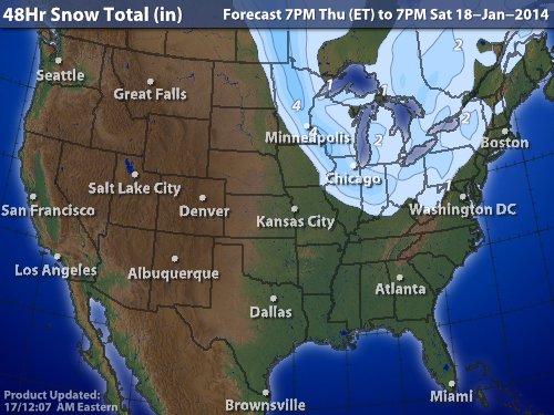
This map shows expected snowfall thru weekend. Most areas in and around the Great Lakes will see 2"-4"....not hard to take...but the cold and wind will be. Below...will show you to models for next Tuesday.
Canadian model wants to bring a snowevent to the East...while the European is offshore. Wasn't ready to buy into a snowstorm yesterday for Tuesday...and still am not.
Canadian model wants to bring a snowevent to the East...while the European is offshore. Wasn't ready to buy into a snowstorm yesterday for Tuesday...and still am not.
Needless to say...models are in agreement....it gets COLD! We should enter into a pattern of more persistent cold..with the worst of it
coming last week of January leading up to SuperBowl. Much too early to say whether the predicted snowstorm for Superbowl comes to pass...but it certainly looks like it will be cold enough for penquins.
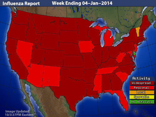
Lastly ...below...the discouraging map about flu reports. Looks like the healthiest state in the nation is Vermont....could that have something to do with skiing ? Have a nice - safe weekend...see you next week in
the frozen Tundra.


 RSS Feed
