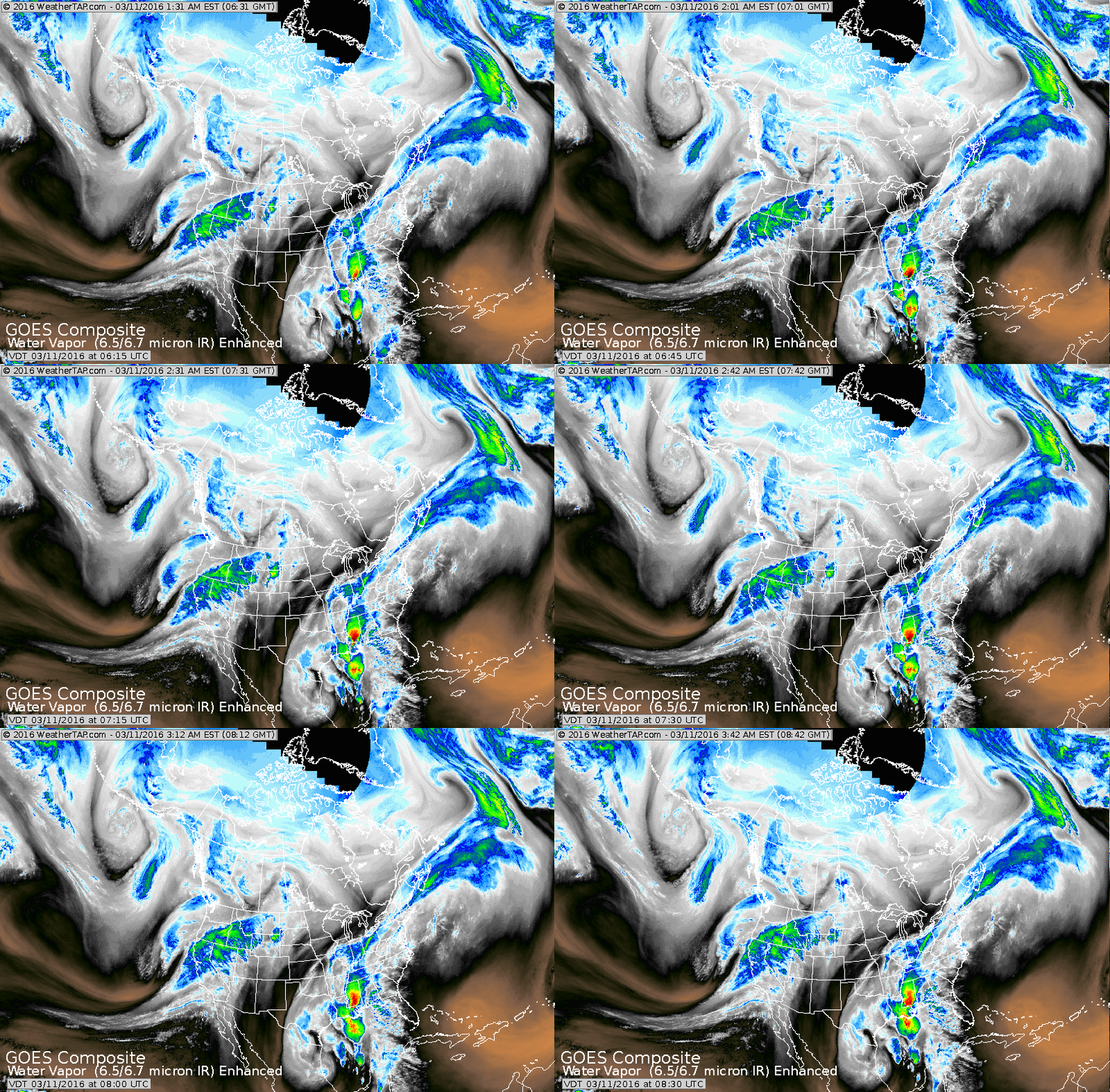
Satellite shows plume of moisture still hammering the Gulf States while the next band of rain heads in along the west coast.
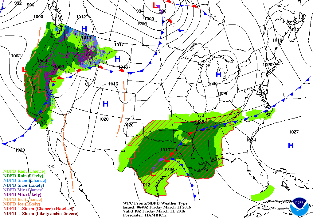
Map above is for today. Wet weather continues in the south.
Dry and pleasant Great Lakes and east...as well as Plains
Another wet system for the West Coast.
Dry and pleasant Great Lakes and east...as well as Plains
Another wet system for the West Coast.
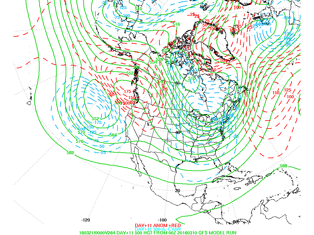
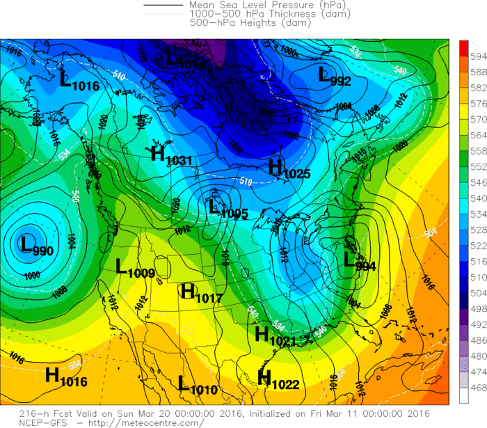
Above map is for 10 days away...and shows upper air. Light blue shows falling pressure....red - rising. The rising red indicates a ridge which usually mean dry....while blue is just the opposite. Models are indicating a turn back to winter for the East in next 10 days or so.
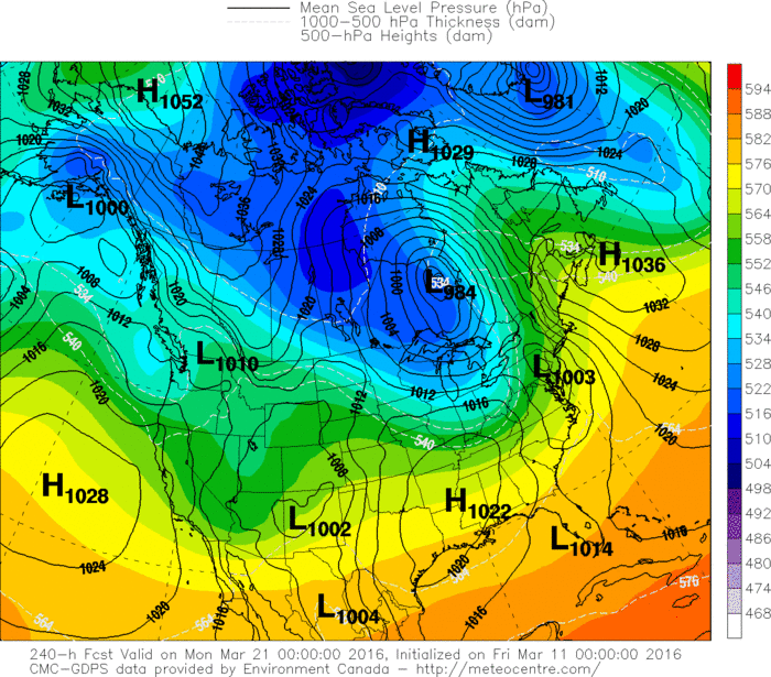
Below...3 models for next weekend: GFS and Euro want to bring a storm into the east for weekend - 3-18-19......while the Canadian says....too fast - it will wait for Monday. We shall see.
Have a nice and safe weekend.
Below...3 models for next weekend: GFS and Euro want to bring a storm into the east for weekend - 3-18-19......while the Canadian says....too fast - it will wait for Monday. We shall see.
Have a nice and safe weekend.


 RSS Feed
