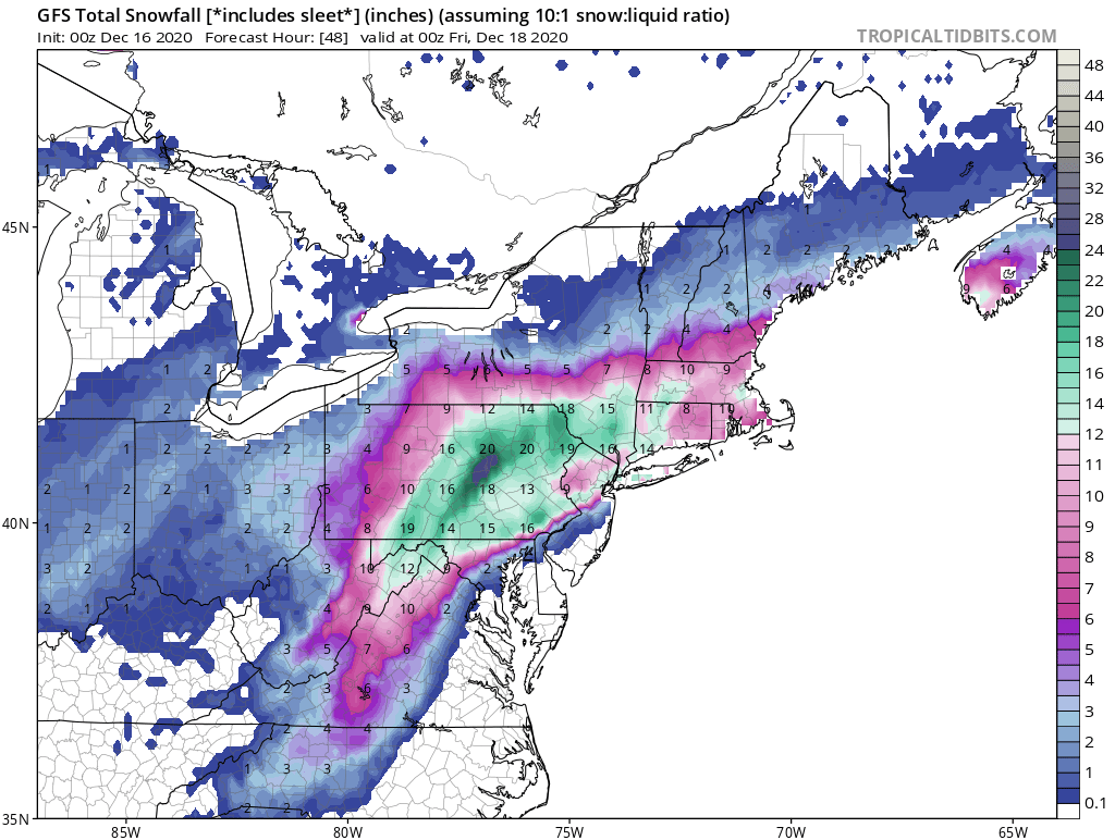
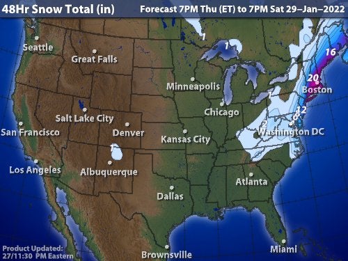
Above - GFS Model prediction of snowfall over next 24 hours. It was the last model to join in predicting double digit snowfall. Along the NJ Coast and Long Island...snow tonight will mix or change to sleet and rain for a time resulting in lower accumulations otherwise...6"-12" on the average with 15"-20" interior New England and Lower Hudson Valley. Dangerous storm tonight..all travel should be avoided. Below - 48 hr. snowfall - animated maps - rainfall through Monday.


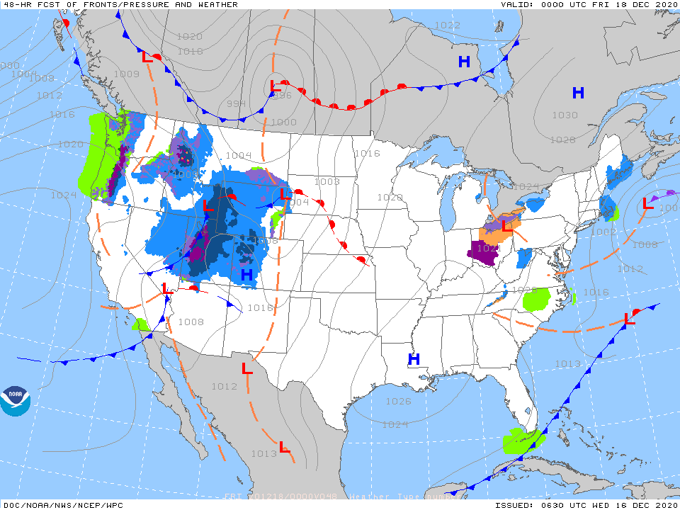
Below - snapshot weather for Thursday. Be careful and safe.

 RSS Feed
