
Satellite shows energy and moisture with the jet flowing over ridge out west. This pattern will have some subtle changes next week when we expect stormy weather from the Gulf states to
head for the East...again.
head for the East...again.
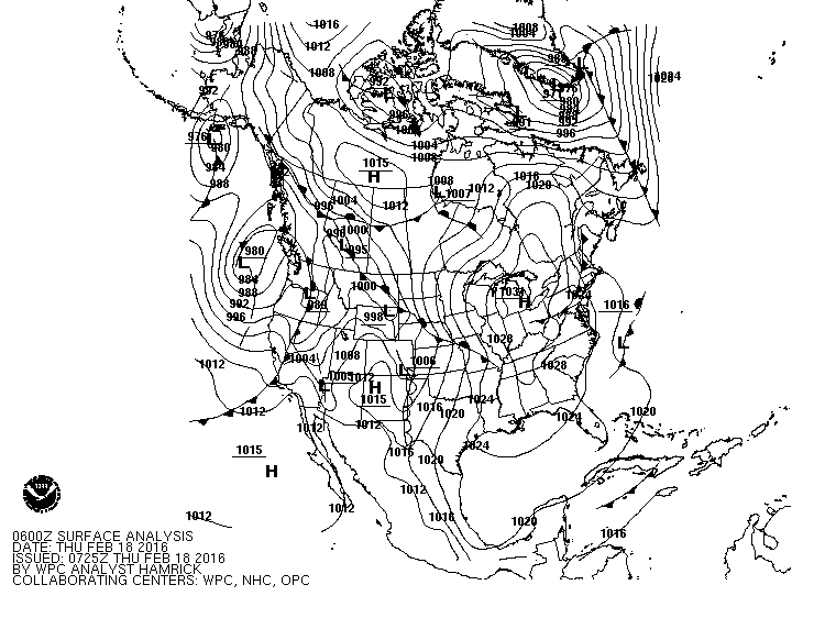
No.American surface map shows high pressure from NW Canada down to Great Lakes with stormy weather in the Pacific NW. Quiet pattern until storms in the NW head southeast...which is Tues-Thurs of next week.
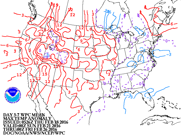
Above...projection of how daytime temperatures will average through Feb. 27th. Notice...lack of real cold air...thus storms
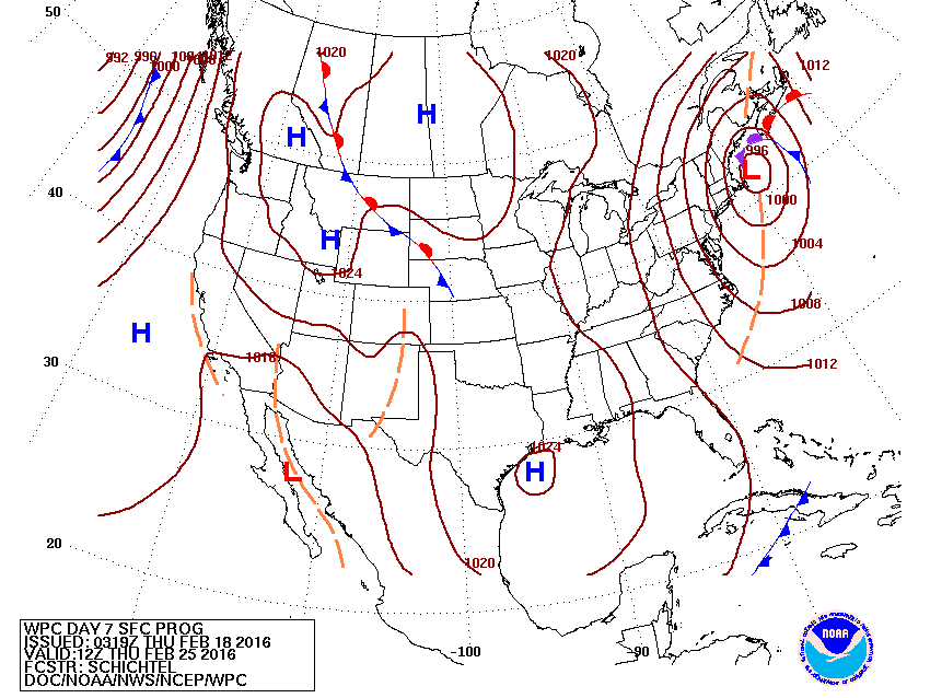
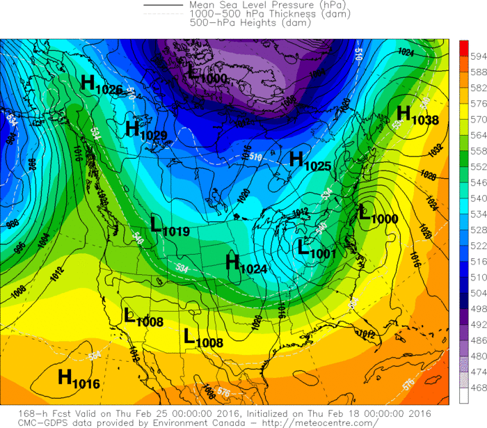
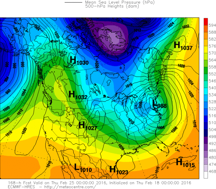
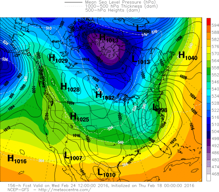
may be more liquid than white. Below...what the long range prediction center projects for the storm on next Wed/Thursday.
may be more liquid than white. Below...what the long range prediction center projects for the storm on next Wed/Thursday.
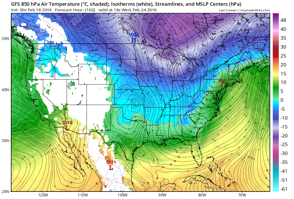
Above...map represents the flow and temp. at 5000ft. green is
warm enough for rain....blue - snow. Based on this...snow would fall over Appalachians and west...while big cities get rain. I tend to think this is correct. Below...various models and their projections for this storm next week. Be safe.
warm enough for rain....blue - snow. Based on this...snow would fall over Appalachians and west...while big cities get rain. I tend to think this is correct. Below...various models and their projections for this storm next week. Be safe.

 RSS Feed
