For those who do not know, meridional flow refers to atmospheric flow that is generally dominated by north-south motion. Is the kind you so see for example this upcoming week when a trough will dig deep into the east while a tall ridge will stay to the west.
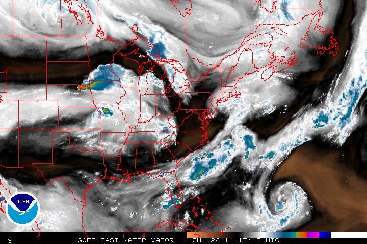
Water Vapor 7-26 17:15 UTC
The water vapor image above shows a dry slot that will hit the Northeastern seaboard to finish off this Saturday. What will follow as the flow indicates, is a wave of low pressure down from the Great Lakes which will produce a slow moving frontal system into next week. Rain showers and thunderstorms will be quite numerous but sporadic for Sunday through early Tuesday before moving out. The threat for severe weather will be present for Sunday in the Ohio River Valley and then further east into Monday as winds pick up and the front moves through the Northeast.
Following this will be high pressure that will last through the remainder of the week with seasonable temperatures as August nears.
- JL
Following this will be high pressure that will last through the remainder of the week with seasonable temperatures as August nears.
- JL

 RSS Feed
