After a very wet April, it's time to see the flowers of Spring bloom throughout the month. The atmosphere has stabilized for much of the country as we begin to fall into a brief meridional flow (atmospheric flow mainly west to east) once the low pressure centered above the Great Lakes moves out east on Sunday.
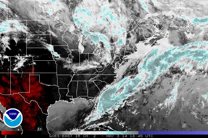
The IR imagery below shows just how dry the southern states are. It also shows the low pressure spinning north of Michigan and the relatively small amount of cloud cover it is bringing the US. Most areas are have seen some sunshine on this Saturday.
The IR imagery below shows just how dry the southern states are. It also shows the low pressure spinning north of Michigan and the relatively small amount of cloud cover it is bringing the US. Most areas are have seen some sunshine on this Saturday.
Beyond this, dry and comfortable air into next week for the eastern half of the country. The building blocks for the next system are off the Pacific Northwest coastline as seen in the below water vapor imagery.
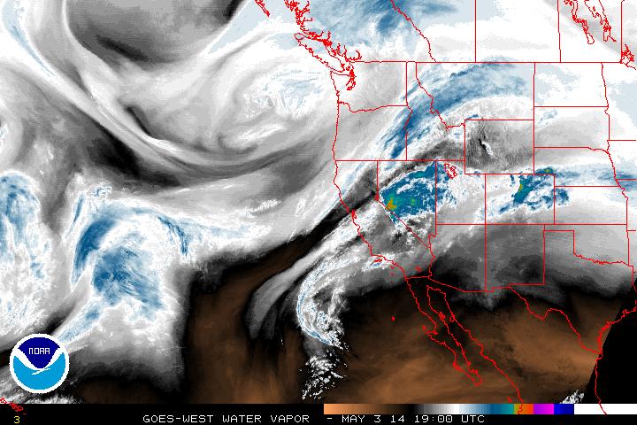
There is plenty of moisture in the atmosphere to the west. Off the Washington coast, there is broad circulation in the jet stream. This energy will funnel southeast and dig a deep trough into the country and forming a decent sized system as it tracks into the Midwest. This storm won't be as potent as the one this past week so while still capable of bringing plenty of rainfall, the middle of the week at least doesn't appear to have quite the severe threat that this past week saw. As this low moves northeast into Canada, the associated fronts with it will still trail through the southeast and eastern states into next weekend.
- JL
- JL

 RSS Feed
