
Storm brewing in Rockies and Plains will bring severe weather to parts of Plains with heavy snow in Rockies ...over 1 foot expected. Heavy snow moves into the
Central Plains in back of the storm Tuesday.
Central Plains in back of the storm Tuesday.
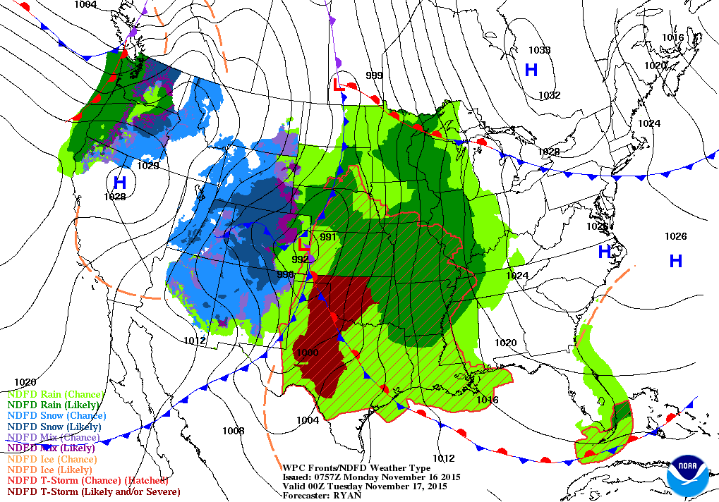
Map above for this evening. Widespread rain and storms from
Upper Midwest across all of the Plains. Widespread snow through the Rockies.....more rain and snow in Northwest.
Upper Midwest across all of the Plains. Widespread snow through the Rockies.....more rain and snow in Northwest.
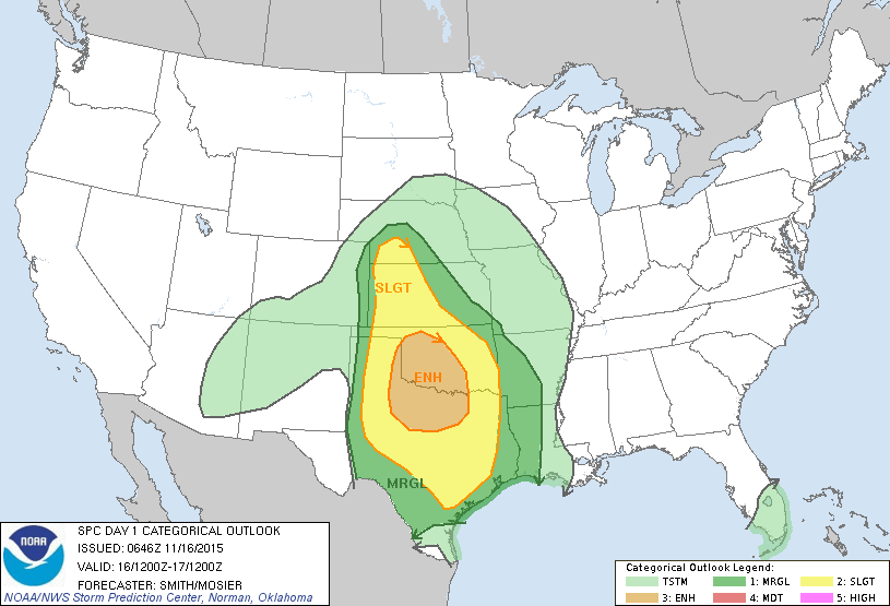
Threat of severe weather today - dark green to tan...with
tan having the best chance of even tornadoes. That area is
Oklahoma and No.Central Texas. Below....amounts of rain
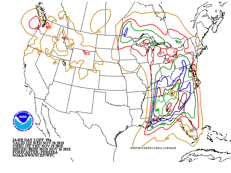
expected on Wednesday.
tan having the best chance of even tornadoes. That area is
Oklahoma and No.Central Texas. Below....amounts of rain
expected on Wednesday.
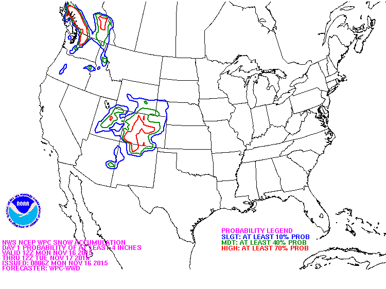
Below...probability of 4" or more of snow today and tonight.
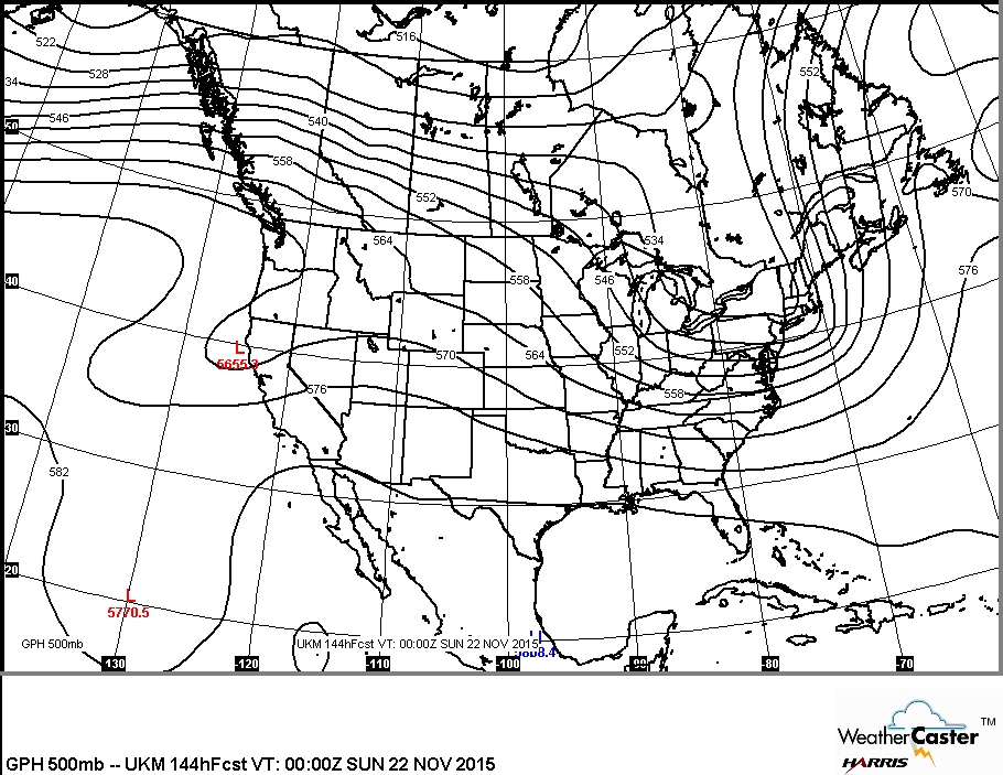
Map below shows the upper air flow for this weekend. It indicates that the coldest air is East while the warmest air
is west and south. Be safe.
is west and south. Be safe.

 RSS Feed
