Satellite shows dry air from Plains to East Coast. Immediate coastal areas from NYC to Carolinas and Gulf States may have some showers and storms. Dry air should cover much of the East Friday and Saturday before humidity and storms return Sunday and into next week.
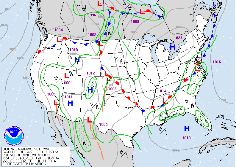
In summer....that blue "H" is our friend....especially when it's in the north....meaning dry and cooler. Showers and storms from Rockies thru Gulf State and Carolinas today.
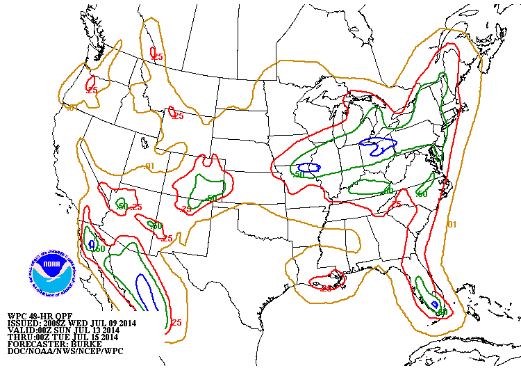
Above - rainfall amounts from Sunday into Tuesday next week. Heaviest in Ohio Valley.
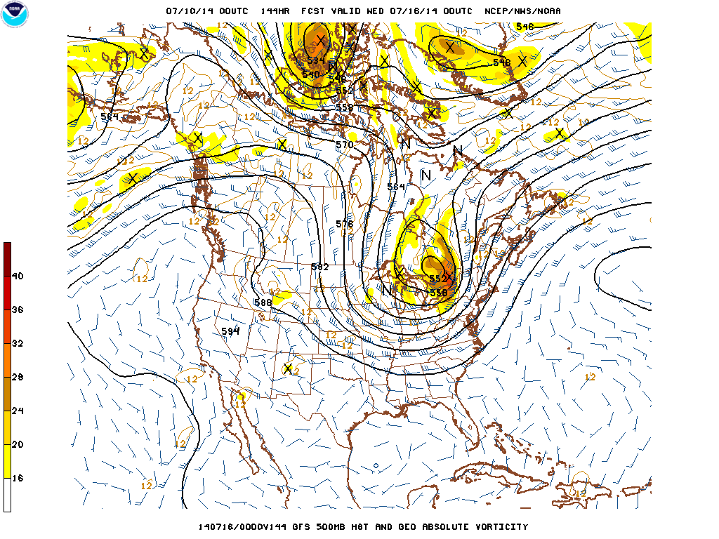
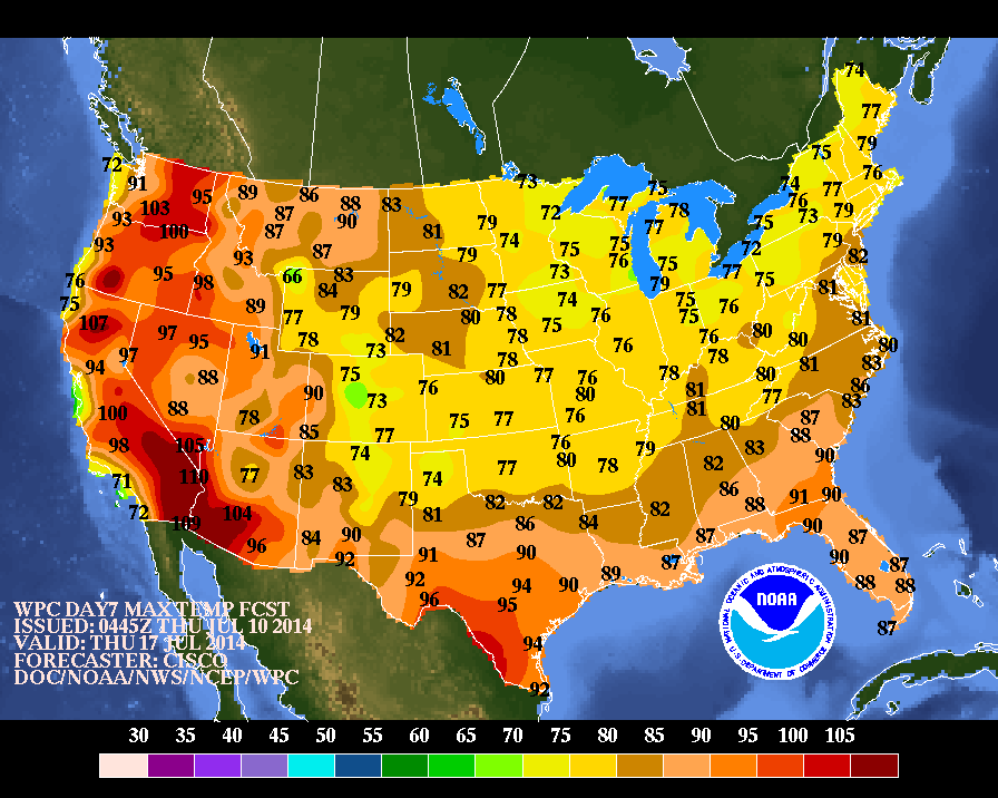
To most of you...the above means nothing. It is the wind flow at 20,000 ft. We can see little wind out west...that's why they will have a heatwave. This big "u" shaped pattern in the east depicts the "polar vortex" down to Onatario Canada...extremely unusual for this time of year. What is means is wet weather early next week...followed by unseasonably cool air by this time next week. Feel that computers are too high with temps next week...but below
is the high temps projected for next Thursday. I think they
could be about 3-5 degrees cooler than projected. For now..be safe.
is the high temps projected for next Thursday. I think they
could be about 3-5 degrees cooler than projected. For now..be safe.


 RSS Feed
