Metro Weather Inc. Services
Like us, follow us, link to us, contact us!
  • Home
    • Daily Weather Discussion
  • Weather Prepared for You
    • Film and TV Production
    • Radio & Television
    • Government and Industry
    • Forensic Services >
      • Weather Record Request Form
    • Metro Morning Monitor
  • About Metro Weather
    • Senior Staff
  • Your Weather Images
  • Contact Us

Last Weekend Of Summer..then JOSE ?

9/15/2017

0 Comments

 
Picture
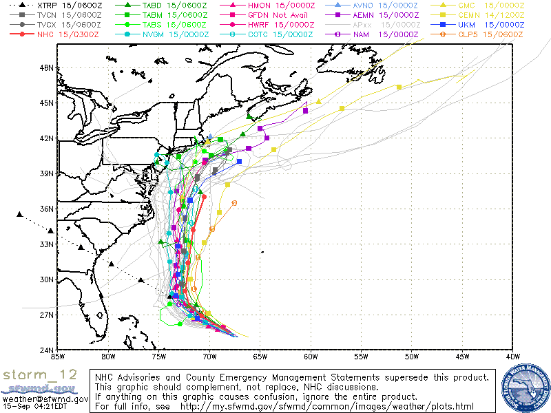
Jose is moving more northward now and this trend should continue. He is still not going to be an easy storm to forecast ...so the track will be changing through the weekend and again...residents from Mid Atlantic to New England have to keep a close eye. Looks like rain and wind from Jose could affect this area by Tuesday. Whether that is a fringe or hit...hard to say. Below....tracks of computer models.
Picture
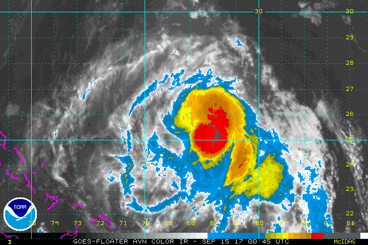
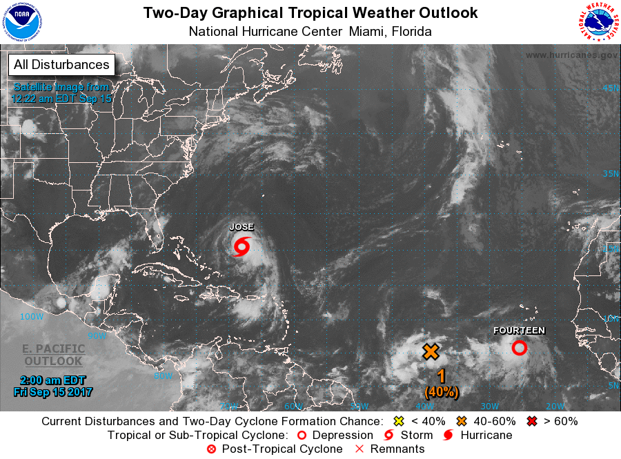
Below - Atlantic basin showing 2 more systems...one of which is already a depression near The Azores. That one looks to be a tropical storm already....if so...will be given the name Lee. The other could be given the name Maria. Following the Basin...a close up of new tropical depression.
Picture
Picture
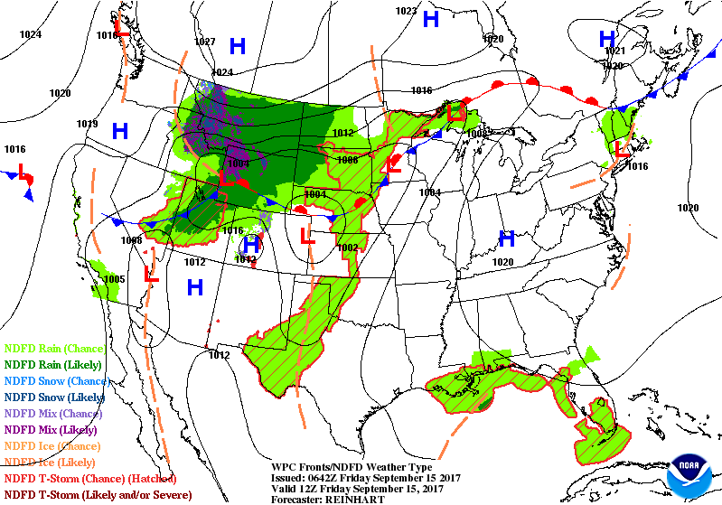
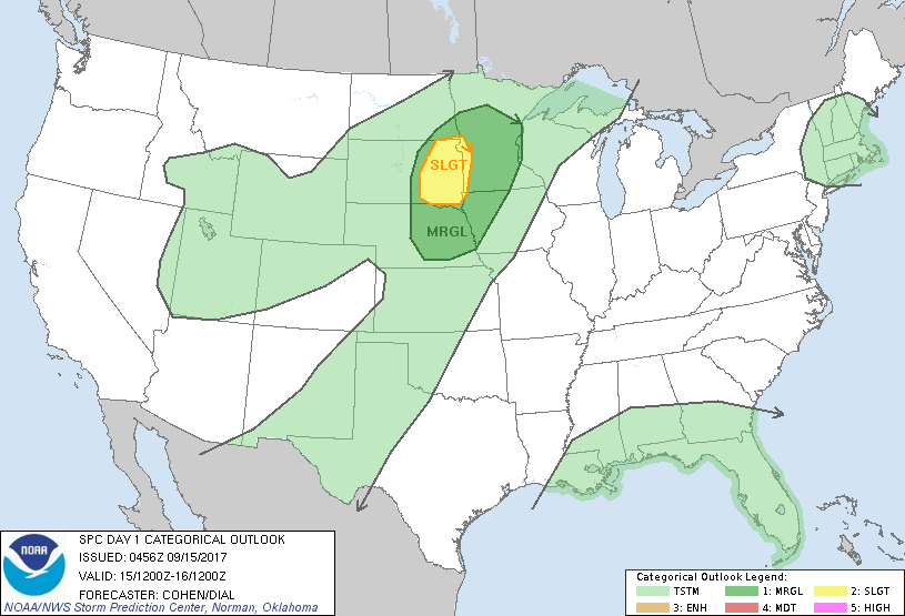
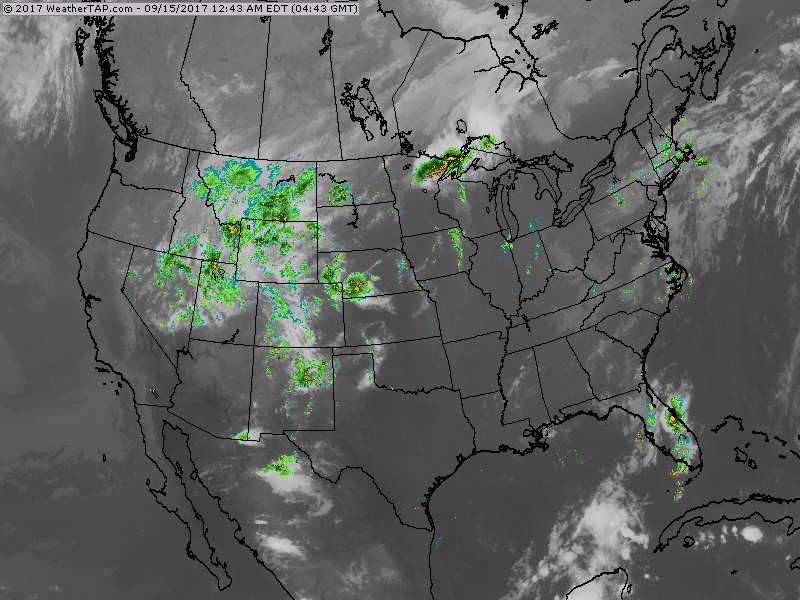
Below  - animated maps for the weekend....followed by threat of severe weather for today and finally - latest satellite - radar.  Be safe.
Picture
Picture
Picture
0 Comments


Leave a Reply.

    Genesis of a Tornado
    We'll have daily weather discussions, talking about major systems on the horizon along with anything noteworthy that pops up on our radar.

    Pat Pagano,
    Mike Merin

    Follow us on Twitter and like us on Facebook to get updates whenever we post a new entry!

    RSS Feed

Powered by Create your own unique website with customizable templates.