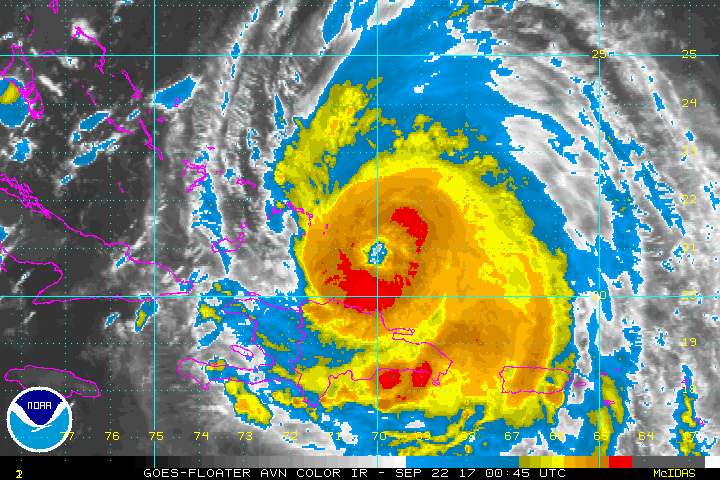
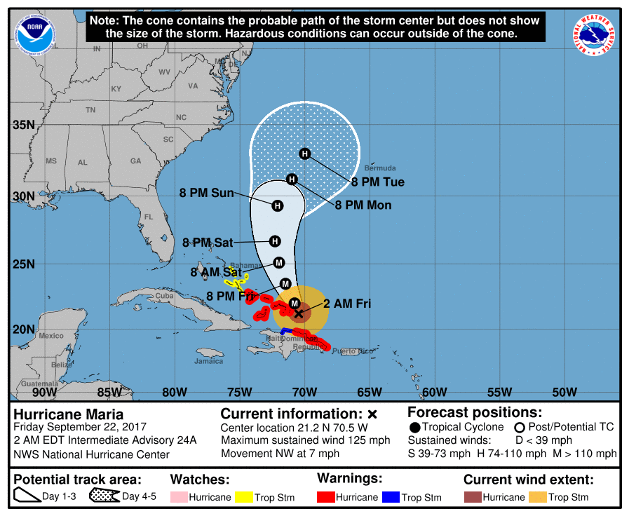
Jose continues to hit Cape Cod with wind and heavy rain. That may not improve until late weekend as Jose is nearly moving. As drier air continue to move into his circulation...he will continue to weaken. Below..Maria....which looks to be weakening on satellite pictures...but still a strong Cat 2 hurricane. Her tracks follow.
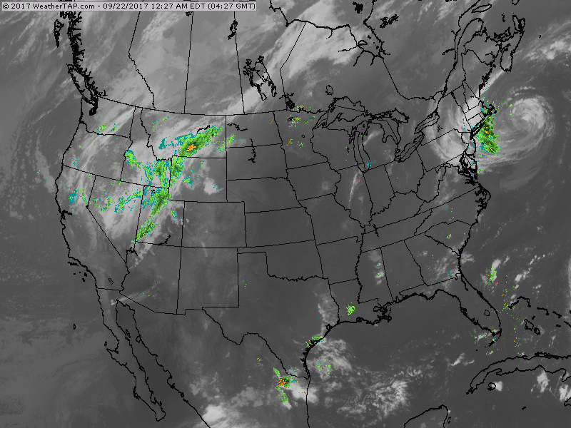
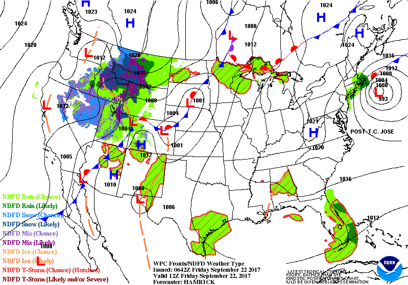
Below...animated maps for the weekend. Heaviest weather will extend across The Plains with a stalled front producing heavy rain and storms.
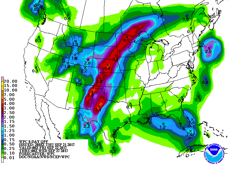
Some places will get over 4" of rain over the next 5 days. Maps will show where the severe risk is today...and rainfall projections next 5 days.
Some places will get over 4" of rain over the next 5 days. Maps will show where the severe risk is today...and rainfall projections next 5 days.

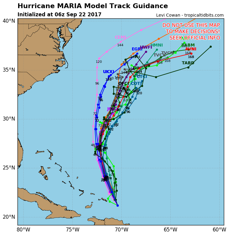
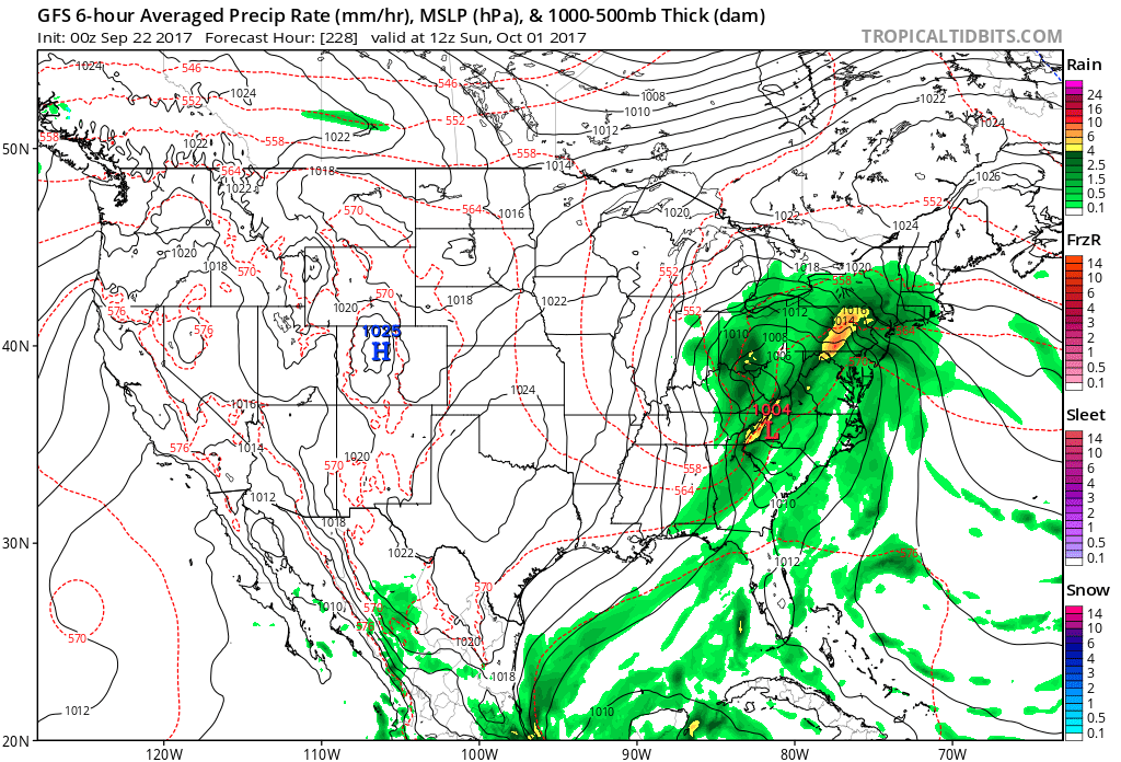
Thought I would diverge a little since the tropics have been "the Weather"...most models showing quite a change by next weekend. Right ow the GFS model leads the pack as being most aggressive. It should quite a storm for The East next weekend along with significantly cooler temperatures. A look at that map below...for now...have a safe weekend and welcome to Fall.

 RSS Feed
